Country:

 City:


Start from the car park next to the Plateau de Beille resort building.
(S/E) Walk round the building to the south to reach the start of the ski runs, fifty metres further south. At the forest track, take the path that runs parallel to its left, sheltered by the hook-needle pines. It never strays far from the track but is much more pleasant than the regular, stony track.
(1) After about 600 m, leave the track by cutting across the forest at a 90° angle. This shortcut cuts across a bend in the track, which you rejoin a little further on, when the slope levels out. Continuing in the open, still running parallel to the track, you’ll reach the Piparlan crossroads.
(2) At the crossroads, take the track leading northwards for about twenty metres, then turn immediately right to follow a track running along the slope of the plateau. The view of the Montagne de Tabe and the Trimouns quarry, on the other side of the Ariège valley, is magnificent. Pass a first, fairly gentle ridge, then an area of springs, before going past a second projection of the plateau. You’ll reach another damp area.
(3) Pass through this area, trying not to get your feet wet, then head due south, keeping your eyes on a clearing in a pine forest a little higher up the slope. The path isn’t particularly visible in this section, and you must take care not to be led towards the lower Jasse de Beille – the next stop on this route, which you can already make out on its ridge some distance away. Once past the copse, the path veers left and heads towards the shepherd’s hut.
(4) At the small pass next to the hut, cross the track and take the one that heads up the southern slope. The path is well marked up to the first stream, but becomes more uncertain thereafter. Cross several areas of springs, staying almost at the same level, and thus traverse the entire cirque above the Sauquet forest. In the less clearly defined sections, simply look out for the fence surrounding the mountain pasture and stay on the upstream side.
(5) Continue along the more or less well-defined path, following the same guidelines as before. When you reach a small stream, do not cross it, as the path comes to a dead end beyond this point.
(6) Then turn right and head straight up the slope, following a newly cleared path through the heather and rhododendrons. After 200 metres of a fairly strenuous climb, you’ll emerge onto a track followed by the GR® 10. Head left to go round the hilltop overlooking the path and rejoin the track leading up to it. Leave the GR® 10 and turn right to complete the ascent.
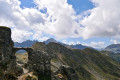
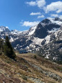
(7) This summit is one of the two highest points on the plateau; it offers a magnificent panorama of the plateau and its surroundings, particularly the Val d’Aston and Lac de Laparan. From the summit, descend via the north-west. You’ll soon rejoin the track and the GR®10, which skirt around it; follow these until the next small pass at an elevation of 1,946 metres.
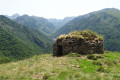
(8) Leave the track and the GR®10 and take the path that winds down the Toudous valley on the left. After a section running along a ledge above the valley, you’ll reach a ridge overlooking the Orri de Toudous, a small, round, overgrown structure – an ancient shepherd’s hut lost in the mountains.
(9) Do not descend to the Orri, but continue to the right and on level ground to keep skirting the edge of the plateau. You will soon be back in the forest. Continue along this path until you reach a recently burnt area, then the mountain pastures surrounding the Cabane de Piparlan.
(10) Join the track leading to the hut and turn left to pass to its right. Continue to the next signpost.
(11) Let the track continue straight ahead and cut left, descending through the mountain pasture and then the woodland below, until you reach another clearly marked forest track. Follow its hairpin bends downwards until you emerge into a more open area, where you’ll find another track coming from the left which forms part of the GR®10.
(12) Turn right onto the GR®10, cross a ravine, then continue straight on along this track until you reach a dog breeding kennel. You won’t go unnoticed here, as its residents have keen hearing and powerful barks.
(13) After the kennels, the track reaches the mountain pastures adjacent to the Plateau de Beille ski resort. Follow the track until you return to the starting point of the walk and the nearby car park (S/E).
 Visorando Member
 Easy

 Difficult
 Very difficult