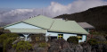
Bélouve Forest – Tamarinaie Trail

Although it is virtually impenetrable, the Bélouve Forest can be explored via a few more or less hidden trails. The Tamarinaie trail is certainly one of the most interesting. This circular route, starting from the Bélouve lodge, allows you to look out over the Salazie cirque and return to the start via the primary forest.

Please note: as of 24 June 2026, this trail is reportedly no longer passable.

Details

42742773
Creation:
Last update:
Last review:
  • Walking
    Activity: Walking
  • ↔
    Distance: 2.36 mi
  • ◔
    Average duration: 1h 25 
  • ▲
    Difficulty: Easy

  • ⚐
    Back to start: Yes
  • ↗
    Ascent: + 374 ft
  • ↘
    Descent: - 374 ft

  • ▲
    Highest point: 5,269 ft
  • ▼
    Lowest point: 4,892 ft

Description of the walk

Start from the car park before the Bélouve lodge, at the end of forest road no. 2, from La Plaine des Palmistes

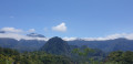
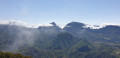
(S/E) Go through the barrier just past the car park and follow the road up to the Bélouve lodge. A flight of steps on the right allows you to cut across the first hairpin bend. You’ll soon reach the crossroads just before the lodge. Head towards the lodge and go down the steps leading to the lower viewing platform to take in the panoramic view of Salazie and Hell Bourg, just below.

(1) Then head back up and return to the crossroads before the lodge. Turn right onto the forest track that seems to lead straight towards the Piton des Neiges. It climbs gently through the forest and, after a few bends, reaches a second viewpoint, right next to a communications mast.

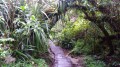
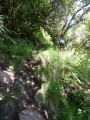
(2) From this plateau, you enter the forest by heading out through the top of this open space. Follow the GR®R1 markings, which you then take to reach the top of the Ravine Bringéllier. This section of the route is typical of Réunion, as it was carved out along the crest of Salazie’s eastern rampart. Amidst dense vegetation, you’ll navigate a series of steps and ravine crossings for about half an hour. The path is very busy and may be muddy in places.

(3) When you reach Ravine Bringéllier, turn left to move away from the ridge, then left again at the signpost for the Tamarinaie trail. You will then enter the dense undergrowth, following the path which remains clearly visible throughout. When you come out onto the Vierge forest track, turn left and follow it downhill to the next bend.

(4) Immediately after this bend, leave the forest track to the left and rejoin the path through the forest. You’ll once again feel as though you’re immersed in an environment that is both hostile and protective. As you descend, you’ll come out onto an avenue of cryptomerias, followed by eucalyptus plantations. As you approach the ravine and the forest track that crosses it, the terrain becomes slightly more rugged.

(5) When you come out onto the forest road again, all you have to do is follow it downhill until you reach the car park where you started. (S/E)

Waypoints

  1. S/E : mi 0 - alt. 4,895 ft - Bélouve car park
  2. 1 : mi 0.27 - alt. 4,898 ft - Viewpoint at the Bélouve lodge
  3. 2 : mi 0.91 - alt. 5,125 ft - Antenna viewpoint
  4. 3 : mi 1.36 - alt. 5,269 ft - Top of the Ravine Bringellier
  5. 4 : mi 1.73 - alt. 5,174 ft - La Vierge forest track
  6. 5 : mi 2.2 - alt. 4,934 ft - Lower Bringellier Ravine
  7. S/E : mi 2.36 - alt. 4,895 ft - Bélouve car park

Notes

The Bélouve lodge offers light meals (by reservation) and a selection of drinks. Please note: it is closed on Wednesdays.

No public transport from La Plaine des Palmistes (approx. 15 km).

To enjoy the view of Salazie and the surrounding mountains, you need to set off before 10 am, as clouds usually start to roll in from that time onwards.

Always be cautious and plan ahead when you're outdoors. Visorando and the author of this route cannot be held responsible for any accidents occurring on this route.

The GR® and PR® markings are the intellectual property of the Fédération Française de Randonnée Pédestre.

Reviews and comments

5 / 5
Based on 1 review

Reliability of the description
Not used
Ease of following the route
5 / 5
Route interest
5 / 5
philrandovilaine
philrandovilaine

Thanks for the info.
I’ll add it to the trail description
Kind regards
PhilRV

Machine-translated

Ti Mars
Ti Mars

The ONF rangers on site advised us against this walk due to the poor condition of the path....

Machine-translated

User 13590345
• Edited:

Overall rating : 5 / 5

Date of your route : Jan 29, 2026
Reliability of the description : Not used / Not applicable
Ease of following the route : ★★★★★ Very good
Route interest : ★★★★★ Very good
Very busy route : No

Part of the walk is very pleasant and well maintained, but another part must have suffered from a storm that caused many trees to fall. It is still passable, but you sometimes have to be a contortionist...

Machine-translated

Other walks in the area

For more walks, use our search engine .

The GPS track and description are the property of this route's author. Please do not copy them without permission.