Circular route starting from Figazzona via the trulli and the Apulian aqueduct

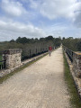
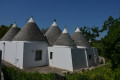
To immerse yourself in the land of the trulli, simply hit the road and let yourself wander from village to village. The low stone walls lining the roads will guide you more reliably than any signposting. But you’ll still need to find your way through the maze of narrow roads criss-crossing the Itria Valley. The suggested circular route first follows the Apulian Aqueduct route, then, after Monte Castel Pagano, branches off to return to Figazzano via charming little roads lined with trulli vying for attention with their beauty.

Details

51393913
Creation:
Last update:
Last review:
  • Walking
    Activity: Walking
  • ↔
    Distance: 6.08 mi
  • ◔
    Average duration: 3h 05 
  • ▲
    Difficulty: Moderate

  • ⚐
    Back to start: Yes
  • ↗
    Ascent: + 302 ft
  • ↘
    Descent: - 322 ft

  • ▲
    Highest point: 1,184 ft
  • ▼
    Lowest point: 1,001 ft

Photos

Description of the walk

Start from the church in the village of Figazzano, between Locorotondo and Cisternino. The church is set back slightly from the road running through the village, just below the highest and oldest part of the village.

(S/E) From the church, return to the main road and turn left to reach the highest point. Continue straight on downhill until you come to a small road.

(1) Cross the road and continue straight on until you come to the path that runs alongside the Apulian aqueduct. Turn left and follow this straight path until you cross the railway line.

(2) Pass under the structure and continue straight on. A few trulli dot this unremarkable path, where you can spot the access structures to the aqueduct here and there. On the left, beneath the canopy of trees, you can make out the low rise of Monte Caste Pagano. At the level of the hill, you’ll come across another road.

(3) Cross the road and continue straight on for about 400 m. At the first small road you come to, turn right to go down towards a junction and take the first turn left then right.

(4) From here, leave the tedious sandy track for small roads lined with trulli. From the heights where the aqueduct stretches out, you can take in the whole of the Valle d’Itria as far as Martina Franca.
Head down the slope following the small road that serves the numerous trulli, passing each cluster as you go. On this route, make a wide circular loop to the right to join, a little further on, the Strada Cisternino which leads to Martina Franca.

(5) At the road, turn left and follow it down for about 120 m. Take care on this road as it is busy but well-lit.
Turn right at the first road you come to, and follow it up towards the old quarry buildings. Walk alongside the quarry until you reach a new underpass beneath the railway line.

(6) Once past this bridge, the narrow road, flanked by two walls, climbs steeply towards Contrada de Sisto. When you reach the church, turn right to cross the village, following the Strada Provinciale 12 for about 400 m.

(7) Leave the SP 12 by turning left onto the road leading to the Giardini di Pomona. You will soon reach this site, which is an international fig conservatory housing over six hundred varieties. Follow the road, passing alongside part of the plantations. Follow the road straight on, passing the first junction, then turn right at the next three-way junction. Continue downhill until you reach a four-way crossroads.

(8) Turn right and head back towards the village of Figazzano, clearly visible a little further on to the right on its hilltop.
In the centre of the village, turn left to find the church. (S/E)

Waypoints

  1. S/E : mi 0 - alt. 1,161 ft - Church of Figazzano
  2. 1 : mi 0.45 - alt. 1,115 ft - Junction with the Cisternino road
  3. 2 : mi 1.23 - alt. 1,096 ft - First railway crossing
  4. 3 : mi 1.8 - alt. 1,125 ft - Crossroads below Monte Castel Pagano
  5. 4 : mi 2.11 - alt. 1,112 ft - Zigzag junction
  6. 5 : mi 2.88 - alt. 1,017 ft - Turn left towards Martina Franca
  7. 6 : mi 3.56 - alt. 1,073 ft - Second passage under the railway line
  8. 7 : mi 4.47 - alt. 1,165 ft - SP 12, left towards Giardini di Pomona
  9. 8 : mi 5.55 - alt. 1,076 ft - Four-way junction
  10. S/E : mi 6.08 - alt. 1,158 ft - Church of Figazzano

Notes

Apart from in Sisto, we did not find any refreshment points. So make sure you plan ahead before setting off.

The description of this route is not very precise due to the lack of map data or route information. It is therefore advisable to keep an eye on the map and the GPX track at first.

The Itria Valley and its trulli are particularly photogenic, and you’ll have plenty of opportunities to practise your craft if you have a flair for photography.

Worth a visit

To round off the day in style, pop over for a drink in Cisternino, which is just a stone’s throw away. Although this town is less well-known than its neighbours, it is full of charm, and there is a magnificent view from the balcony of Piazza Garibaldi.

Just before the (3), you can turn left towards Monte Castel Pagano. This hill would offer a beautiful viewpoint over the Itria Valley, were it not for the trees crowning its summit. The site is better known for its underground treasures, as it is a major caving site.

Reviews and comments

4.6 / 5
Based on 4 reviews

Reliability of the description
4.5 / 5
Ease of following the route
4.8 / 5
Route interest
4.5 / 5
jolo07
jolo07

Overall rating : 4.3 / 5

Date of your route : Jun 11, 2026
Reliability of the description : ★★★★☆ Good
Ease of following the route : ★★★★★ Very good
Route interest : ★★★★☆ Good
Very busy route : No

An interesting route – best not to do it in the middle of the day, but rather in the cool of the morning, and make sure you take plenty of water

Machine-translated

CDavid
CDavid

Overall rating : 5 / 5

Date of your route : May 11, 2026
Reliability of the description : ★★★★★ Very good
Ease of following the route : ★★★★★ Very good
Route interest : ★★★★★ Very good
Very busy route : No

A lovely walk – easy and enjoyable. It’s mostly along roads, but only a short stretch is on a busy road. Easy to park. Beautiful views of the trulli, olive trees and vineyards.

Machine-translated

PatLoc
PatLoc

Overall rating : 4 / 5

Date of your route : May 05, 2025
Reliability of the description : ★★★★☆ Good
Ease of following the route : ★★★★☆ Good
Route interest : ★★★★☆ Good
Very busy route : No

A lovely little walk to explore the trulli. The route follows quiet tarmac roads and some unpaved sections. These unpaved sections, along with the low stone walls and unrestored trulli, lend a rustic charm to this pleasant walk.

Machine-translated

isaraph57
isaraph57

Overall rating : 5 / 5

Date of your route : Oct 23, 2024
Reliability of the description : ★★★★★ Very good
Ease of following the route : ★★★★★ Very good
Route interest : ★★★★★ Very good
Very busy route : No

A lovely path winding through the trulli in the countryside. A very pleasant walk! We highly recommend it!

Machine-translated

For more walks, use our search engine .

The GPS track and description are the property of this route's author. Please do not copy them without permission.