Country:

 City:
City:


Start from the Font d’Alagnon car park, just below the last houses.
(S/E) Leave the car park by crossing the Alagnon, then cut across away from the imperial road to join the forest track. On reaching the track, turn right and follow it for about one and a half kilometres. This section runs at a virtually constant elevation, through a wooded landscape at the bottom of the valley, which forms the northern part of the Lioran area.
(1) After a sharp right-hand bend, where the gradient steepens considerably, you’ll reach a three-way junction. Let the forest track continue to the right, and head left to begin the climb towards the Buron de Meige Costes. The nature and character of the path change completely, as it tackles the slope with gusto, and it remains this way until you reach the refuge. Fortunately, the route is mostly in the shade.
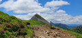
(2) Shortly after emerging from the tree cover, a final bend to the right offers a view of the buron. A refuge has been set up there, allowing hikers on the GR® 400 to stop for a break, but day-trippers cannot stop there for a drink… except from the spring water. Go to the left of the building to round the rocky spur overlooking it, and continue along the path that climbs the south-eastern slope of Puy Bataillouse; as you go, join the GR®400 path, which comes from the Téton de Vénus and the Rocher du Bec de l’Aigle, and reach the Col de Rombière.
(3) At the pass, go through the gate and descend slightly to find the path coming from Puy Griou. Where these two routes meet, turn right towards the Col de Cabre. The walk there is easy and slightly downhill. Take the opportunity to admire the upper reaches of the Mandailles valley and the ridge leading to Puy Mary.
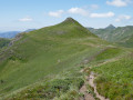
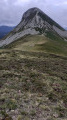
(4) At the Col de Cabre, follow the GR®400 for a few metres, then let it branch off to the left. Continue by turning right onto the ridge that leads up to the summit. A steep climb awaits you; be sure to look back and admire the magnificent landscape, at the far end of which stands the perfect cone of Puy Griou. As you approach the rocks marking the base of the summit, the path veers to the right and levels out. Follow it until you pass a scree slope whose boulders appear to have come down from the mountain very recently.
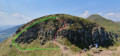
(5) After a spring – which may be the Santoire – overlooking the valley, the path seems to disappear amongst the boulders. One path climbs straight up the slope from the scree to tackle the hundred or so metres of elevation gain leading to a small pass at the foot of the summit. Hold on tight, both literally and figuratively – the climb isn’t the easiest!
(6) At the small pass, head left to complete the ascent, which is much easier than the previous section.
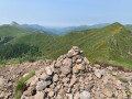
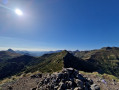
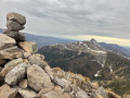
(7) From the summit, the panorama is exceptional, offering a 360° view, interrupted only by the Plomb du Cantal. Then head back down to the small pass.
(6) Head left to pass beneath the summit, before continuing along a rather vertiginous ridge path that follows the watershed between Impradine to the north and Jordanne to the south. When you reach the lowest point of this section, it’s time to leave the ridge and join the GR® 400.
(8) At the pass, take the hairpin bend to the left to join the balcony path that runs below Peyre Arse. Along the way, you’ll pass several springs, including the source of the Jordanne. This path skirts a magnificent cirque before returning to the Col de Cabre, which you’ve already passed on the way out.
(4) Return to the Col de Rombière via the same route as on the way out.
(3) Continue straight on along the ridge path, only leaving it as you approach the top station of the Rombière chairlift. Pass by the foot of the resort and alongside a drinking trough where you can fill up your water bottles as you go.
(9) From the chairlift’s top station, take the path that descends to the left, south-east, running alongside the ski run. This path, which is sometimes steep, passes through woods and mountain pastures, crossing or following the ski runs that criss-cross this part of the slope on numerous occasions. It takes just under half an hour to reach the Col de Font de Cère this way and rejoin the Route Impériale.
(10) Rather than following the Route Impériale, cut across the bends via the footpaths and tracks that criss-cross its hairpin bends to reach the valley floor and the car park (S/E).

 Visorando Member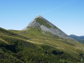

 Difficult