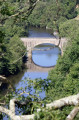
A walk through the vineyards above the Goulaine Marshes

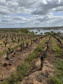
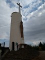
Right in the heart of Muscadet country, the Butte de la Roche juts out between two expanses – the Marais de Goulaine, which are flooded in winter. As you make your way through vineyards and hamlets, you follow the hillside to the Moulin du Pé. Like a landmark, this white column and its pointed neighbour dominate the landscape and mark the direction to follow. The return journey to the Pont de Louen takes you along the ridge of the Butte de la Roche.

Details

47434264
Creation:
Last update:
Last review:
  • Walking
    Activity: Walking
  • ↔
    Distance: 7.77 mi
  • ◔
    Average duration: 3h 55 
  • ▲
    Difficulty: Moderate

  • ⚐
    Back to start: Yes
  • ↗
    Ascent: + 358 ft
  • ↘
    Descent: - 358 ft

  • ▲
    Highest point: 197 ft
  • ▼
    Lowest point: 20 ft

Photos

Description of the walk

The walk starts from the car park opposite the Maison Bleue, on the other side of the Pont de Louen.

(S/E) From the car park, cross the bridge to reach the hamlet of Pont de Louen. Turn right at the three-way junction and walk round the village to reach the Butte de la Roche by taking the path that climbs to the left after the houses.

(1) After a fair climb, you’ll reach the top of the hill and the orientation table at the foot of the imposing cedar tree that marks the summit. After taking in the view, continue straight on for about 100 metres.

(2) Turn left to descend the northern slope of the hill. Then turn right to pass right by a strange stone structure reminiscent of the base of a medieval tower. Carry on straight ahead, then follow the hedge that runs along the slope above the village of La Potardière.

(3) Turn left after an abandoned building to head down towards La Potardière. In the hamlet, head down to the right between the buildings, then cut across to the right again through the vineyards. Walk between the plots until you come to a path leading down from the ridge. Turn left here to go round a vineyard plot and pass between it and the meadow that occupies the damp valley floor above the marsh. Carry on to the copse.

(4) Pass to the right of the copse surrounding a pond and head back up to the right to return to the foot of the vineyard-covered hillside. Reach the woodland marking its base and turn left to pass above the market-garden greenhouses.

(5) Pass all the greenhouses to approach La Giraudière. As you approach this hamlet, turn left then immediately right to walk alongside a rosemary plantation, below the road. You’ll rejoin the road a little further on when the path running alongside the rosemary plants veers off to the left. Continue along the road until you reach the next crossroads.

(6) Cross the D104 with care and carry on straight ahead to join the next road (D7). Follow this road to the left for about 70 metres.

(7) Cross it carefully and turn right onto the first track. You’ll enter a vineyard area once more, before continuing along the edge of a wetland. The further you go, the fewer vineyards you’ll see, as you end up at the bottom of a valley where cows are lounging in lush grass. Cross a stream at the deepest part of the valley, before heading back up through the village of Bas Coudray.

(8) In the centre of the village, turn right to head back towards the stream, then head up towards La Rouaudière after crossing it a second time. Go round the houses in the hamlet on the right, then join the D301.

(9) Cross the road carefully and take the road opposite that climbs up the hill where the two mills are situated. Reach the mills by turning right at the first junction.

(10) From the foot of the mills, there is a superb view over the Goulaine valley, as well as over the Nantes conurbation, where you can see its most iconic landmarks.
After taking in the scenery, carry on past the two mills and walk between the two southernmost buildings in the hamlet. This leads to a small path that winds down the hill until it reaches Bas Pé. When you come out onto the village road, turn right and head straight on to the D301, which you should cross again, taking care at all times

(11) At the crossroads, take the path straight ahead that runs alongside the vineyard, bordering the wet meadows at the bottom of the valley. Head uphill to the right once the path has passed a wooded area, then continue through the vineyards towards the hamlet of La Bronnière. When you reach the road, turn left towards La Faveltière, a village well worth a detour to admire the beautifully restored houses. Cut left between the houses to return to the road

(12) On leaving the village, turn right onto the path that runs behind the last property, then turn left at the next bend to enter a long lane through the vineyards.

(13) When you reach the Élaudière vineyards (private property), turn right to climb the hillside, then turn left onto the first track. At the road, carry on straight ahead and follow the track that turns right to join the D7. Then turn left and follow this road until you pass the hamlet of La Roche and its beautiful mansion, which dominates the landscape.

(14) Leave the D7 via the small road leading to the village of La Hyonnière; follow it all the way down, before turning right onto the track that branches off the road at the last bend.

(15) Pass beneath the last few houses to rejoin a vineyard track leading to the hamlet of La Graholière, which the track skirts, and then on to the hamlet of Guérande.

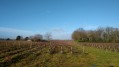
(16) Don’t look for the salt marshes! This is a vineyard. Walk alongside the buildings as you head up towards the hillside. Reach the hillside after the last buildings, following the zigzag of the path. Walk all the way up the hillside until you reach the ridge of the Butte de la Roche.

(17) Turn left when you reach the ridge path, then follow it until you come to the cedar tree sheltering the orientation table at the viewpoint.

(2) Walk down the hill along the same path you took on the way up.

(1) At Pont de Louen, you’ll come out onto the road; follow it carefully to the right to reach the bridge over the Goulaine, then continue to the Maison Bleue car park (S/E). A final glance at the information boards will give you a deeper understanding of the Goulaine marshes and their inhabitants.

Waypoints

  1. S/E : mi 0 - alt. 20 ft - Car park before the - Pont de l'Ouen
  2. 1 : mi 0.17 - alt. 20 ft - Junction
  3. 2 : mi 0.51 - alt. 135 ft - Turn left after the summit of the Butte de la Roche
  4. 3 : mi 0.9 - alt. 128 ft - Turn-off towards La Potardière
  5. 4 : mi 1.44 - alt. 39 ft - Bosquet de la Mare
  6. 5 : mi 1.74 - alt. 89 ft - Above the market garden greenhouses
  7. 6 : mi 2.28 - alt. 89 ft - Junction with the RD104
  8. 7 : mi 2.46 - alt. 85 ft - Crossing the D7
  9. 8 : mi 3.21 - alt. 95 ft - Le Bas Coudray
  10. 9 : mi 3.54 - alt. 102 ft - Junction with the RD 301
  11. 10 : mi 3.85 - alt. 197 ft - Le Moulin du Pé
  12. 11 : mi 4.25 - alt. 62 ft - Second junction with the RD301
  13. 12 : mi 4.64 - alt. 89 ft - La Faveltière
  14. 13 : mi 5.08 - alt. 98 ft - Turn left before Élaudière
  15. 14 : mi 5.71 - alt. 108 ft - La Roche
  16. 15 : mi 5.97 - alt. 49 ft - La Hyonnière
  17. 16 : mi 6.23 - alt. 49 ft - Guérande
  18. 17 : mi 6.56 - alt. 141 ft - Turn left onto the ridge path
  19. S/E : mi 7.77 - alt. 20 ft - Car park before the bridge over the - Goulaine (rivière)

Notes

The suggested route crosses yellow-marked trails on several occasions, including one that circles the Butte de la Roche. The route described here does not follow these markings. So do not be misled into following them.

A hill in wine-growing country is particularly exposed to the wind. The east-west orientation of the circular route encourages walkers to follow the paths in such a way as to make the most of the protection offered by the terrain, depending on the direction of the wind. So do not hesitate to reverse the direction of the route to benefit from the shelter of the hill when walking uphill into the wind.

To fully appreciate the contrast between the rocky, vine-covered hill and the marsh, it’s best to explore this route when the marsh is flooded. This spring of 2024, the high water level in the marsh, combined with the young shoots on the vines, offers particularly photogenic views from the Butte de la Roche.

There are no places to buy refreshments along the walk. Make sure you bring everything you need to complete this circular walk independently. Unless, of course, you stop for a taste of Muscadet at one of the wine cellars you pass along the way!

Worth a visit

A stone’s throw from the Pont de Louen stands the Château de Goulaine, a magnificent Renaissance mansion whose rooftops can be seen from the Butte de la Roche. The château is open to visitors and is well worth a visit.

Reviews and comments

4.4 / 5
Based on 3 reviews

Reliability of the description
5 / 5
Ease of following the route
4.3 / 5
Route interest
4 / 5
User 16442786

Overall rating : 4.3 / 5

Date of your route : Mar 30, 2026
Reliability of the description : ★★★★★ Very good
Ease of following the route : ★★★★☆ Good
Route interest : ★★★★☆ Good
Very busy route : Yes

The circular route leading to the Pès mill, beyond the county road, runs partly across private land. We were stopped by a landowner on our way back so that she could report the issue to Visiorando. The start of the walk at the Butte de la Roche, however, is on public land 😉 and is well worth a detour for its splendid views over the marshes 🤗

Machine-translated

User 17971767

Overall rating : 4.7 / 5

Date of your route : Mar 16, 2026
Reliability of the description : ★★★★★ Very good
Ease of following the route : ★★★★☆ Good
Route interest : ★★★★★ Very good
Very busy route : Yes

A lovely route, though the route marking is sometimes lacking
A lovely viewpoint

Machine-translated

philrandovilaine
philrandovilaine

Once the route had been surveyed, the prohibition on access was only signposted on the ground from point 13 onwards, which explains the change in route at that point. Whilst the land registry does not, in fact, list these paths as public rights of way, there was nothing at the time to prohibit access to them. Is this still the case? If this were to change, the only option would then be to take the road between points 12 and 14.
Thanks for the info.
PhilRV

Machine-translated

User 5517374

Overall rating : 4.3 / 5

Date of your route : May 24, 2025
Reliability of the description : ★★★★★ Very good
Ease of following the route : ★★★★★ Very good
Route interest : ★★★☆☆ Average
Very busy route : No

The walk crosses private land, including the section between points 12 and 14. The landowner was not happy that I had ended up in the middle
his vineyards and asked me to report this to Visorando.

Machine-translated

Other walks in the area

For more walks, use our search engine .

The GPS track and description are the property of this route's author. Please do not copy them without permission.