A green walk around the Erdre stream in Nantes

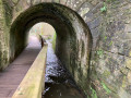
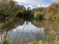
As the Erdre begins to wind its way through the Nantes conurbation, it flows through a green and cool valley overlooked by the tallest towers of the surrounding neighbourhoods. From the wide boulevards that encircle the heart of Nantes right up to the ring road that encircles the city, we are treated to an almost woodland-like walk right by the water’s edge, where the city is reduced to nothing more than the hum of urban life.

Details

40986273
Creation:
Last update:
Last review:
  • Walking
    Activity: Walking
  • ↔
    Distance: 4.00 mi
  • ◔
    Average duration: 1h 55 
  • ▲
    Difficulty: Easy

  • ⚐
    Back to start: Yes
  • ↗
    Ascent: + 56 ft
  • ↘
    Descent: - 52 ft

  • ▲
    Highest point: 72 ft
  • ▼
    Lowest point: 13 ft
  • ⚐ Country: France
  • ⚐ City: Nantes (44200|44300|44000|44)
  • ⚑
    Start/End: N 47.235291° / W 1.549089°
  • ❏
    IGN map(s): Ref. 1223SB
  • Hour-by-hour weather

Description of the walk

The route starts at the Pont de la Tortière, which can be reached by bus (line 10).

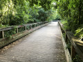
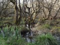
(S/E) Descend from the bridge via the steps leading to the right bank of the Erdre. Walk along the river on your right and take the first footbridge built over a flooded section. Turn right, keeping as close as possible to the Erdre (ignore the cycle path branching off to the left). Pass through a second section built across a wetland area.

(1) Cross a bridge over the Cens just before it joins the Erdre. Pass the Navibus jetty on your right and continue along a long, high stone wall, a remnant of the Château du Tertre park. You can catch a glimpse of the château, which is now obscured by the buildings of the University of Nantes. At the end of the wall, you’ll reach the Ifremer building, a stark structure amidst all this greenery.

(2) Carry on along the river until you reach the first buildings in the Jonelière neighbourhood. When you reach the first houses, follow the quay, where numerous boats are moored.

(3) Cross the Gêvres. Go under the railway bridge, then turn left onto the cycle path (do not go under the road bridge). Follow the cycle path, which passes under the railway bridge twice, winding its way between its piers.

(4) Once at the top of the hill, turn left to cross the railway bridge and cross the Erdre, following the railway line.

(5) On the other bank, take the sharp left-hand bend and head down towards the river. At the water’s edge, turn left and follow the Erdre on your right-hand side until you reach the Nantes lifeguards’ station. Walk past the building, taking a moment to admire the beautiful mural adorning its south-facing side, and continue along the river. Cross the first stream, go round a residential area, then cross a second stream.

(6) As you approach a children’s playground, turn right to follow the riverbank as closely as possible. You’ll soon come out onto the esplanade of the Nantes Rowing Club and cross it from one end to the other to go round the boathouse. Return to the main path and turn right. You will then enter the wetland formed by the confluence of the stream that appears to flow from the high-rise blocks of Port Boyer. Once past this, you’ll come out at the Navibus jetty.

(7) Turn left and walk alongside the maritime college to reach a series of footbridges built over the water. A pretty humpback bridge marks the centre of this stretch: it provides access to the few small private harbours visible beneath the trees sheltered by the footbridge. Continue along the river to reach the Pointe de la Trémissinière.

(8) Once past this final headland, the Tour Bretagne comes into view as the Erdre continues its course through the town, beyond the Pont de la Tortière. Walk to the bridge. Climb the steps leading up to the bridge and cross the Erdre via the bridge. As you cross, note the beautiful building with its white façade right at water level. This will take you to the bus stop (S/E).

Waypoints

  1. S/E : mi 0 - alt. 16 ft - Pont de la Tortière
  2. 1 : mi 0.56 - alt. 16 ft - Bridge over the Cens - Cens (rivière)
  3. 2 : mi 0.93 - alt. 23 ft - Ifremer building
  4. 3 : mi 1.54 - alt. 13 ft - Gesvres (rivière)
  5. 4 : mi 1.74 - alt. 72 ft - Entrance to the - Pont de la Jonelière
  6. 5 : mi 1.96 - alt. 62 ft - Exit the viaduct and head down towards the Erdre
  7. 6 : mi 2.84 - alt. 20 ft - Belle Isle playground
  8. 7 : mi 3.39 - alt. 16 ft - Navibus jetty - Erdre (rivière)
  9. 8 : mi 3.78 - alt. 16 ft - Pointe de la Trémissinière
  10. S/E : mi 4 - alt. 20 ft - Pont de la Tortière

Notes

This urban route sometimes runs right alongside the Erdre, and some sections may be under water when the river is in flood. You can easily tell this when you reach the first footbridge, as the access to it is one of the areas that may be submerged.

You can take a break on the terrace of the Quai de la Jonelière bar-restaurant.

Worth a visit

Once past the Jonelière Bridge, you can choose to extend the route to the Beaujoire Rose Garden, which is also situated on the banks of the Erdre, just a few hundred metres away on the other side of the exhibition centre. This should only be considered when the park is not hosting a trade fair or exhibition that would require the grounds to be closed off. This adds around two kilometres to the route, including a visit to the Parc de la Beaujoire. This circular route starts at the foot of the railway viaduct, heading up the left bank.

Reviews and comments

4.8 / 5
Based on 2 reviews

Reliability of the description
5 / 5
Ease of following the route
5 / 5
Route interest
4.5 / 5
Cocoplom
Cocoplom

Overall rating : 5 / 5

Date of your route : Sep 08, 2025
Reliability of the description : ★★★★★ Very good
Ease of following the route : ★★★★★ Very good
Route interest : ★★★★★ Very good
Very busy route : No

It was a pleasant surprise to discover this corner of nature just a stone's throw from the city. A peaceful, green interlude.

Machine-translated

lamarie444
lamarie444

Overall rating : 4.7 / 5

Date of your route : Feb 05, 2024
Reliability of the description : ★★★★★ Very good
Ease of following the route : ★★★★★ Very good
Route interest : ★★★★☆ Good
Very busy route : Yes

:jap(jap)P

Machine-translated

Other walks in the area

For more walks, use our search engine .

The GPS track and description are the property of this route's author. Please do not copy them without permission.