Country:

 City:


The walk starts from the arcade of the former spa complex at Ussat-les-Bains.
(S/E) Opposite the arcade, head left, then, at the next junction, turn right onto the small road leading up to the village of Ussat, which you’ll reach in about ten minutes.
(1) At the crossroads by the town hall, head up towards the church and, at the foot of the church, take the road branching off to the right. This small road climbs towards Ussat-le-Haut, passing in front of the cemetery.
(2) Continue along the road for about 700 metres, until you have passed the last houses in the village.
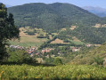
(3) Beyond these, the road becomes a track and the valley opens out. Beautiful meadows line the path on either side of the hedge and the central ditch. Continue along this track until you reach the gate.
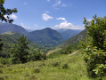
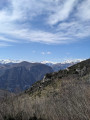
(4) Once past this barrier, the terrain changes. The gradient increases significantly and you climb rapidly. At the third hairpin bend, take a moment to look back: in line with the Ussat valley, the pass in the mountain opposite reveals the massif of the Pic de Montcalm (the highest point in Ariège at 3,077 m), at the far end of the Vicdessos valley. There are still a few dozen metres to go before reaching the Col d’Ussat.
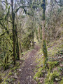
(5) At the pass, ignore the main path heading off to the left and take the narrow track that winds its way into the vegetation on the right. The path, which winds its way through the trees, soon reaches a small pass.
(6) Leave the path on the left, which descends directly to Ornolac, and continue straight on along the ridge. This path alternates between relatively flat sections and steeper ones, climbing gently up to a first hilltop. Descend a few metres before continuing towards the Clot de la Carbonnière, the highest point of this route.
(7) The descent is gentle for the first few metres but becomes much steeper once you’ve passed a hunting blind on your right. The path then literally plunges down the slope, on the edge between scrub and woodland. The unobstructed view over the Ariège valley makes the descent rather dizzying. After about 300 metres, the path curves to the left and the gradient becomes more manageable. Descend the entire slope, following this well-defined little path, until you reach the first houses of Ornolac.
(8) At a place called Embusca, you’ll come out onto the road; follow it to the right to reach Barry d’en Haut. In the village, go round the church and its cemetery on the left, then continue the descent to the En Soussat district, which marks the edge of the old village.
(9) Turn right onto the small lane serving this neighbourhood, which then continues as a footpath. Cross a stream, climb slightly up the opposite slope, then continue the descent along a lovely path that runs along the hillside, parallel to the stream and the road leading to the church. As you approach Barry d’en Bas, go round a large, unfenced plot of land, at the top of which a row of small rental properties has been built, to rejoin the village road. Then turn right to complete the descent to the heart of Barry d’en Bas.
(10) At the small square in the village, let the road continue off to the left and take the narrow track that leads off to the right towards the far end of the village. A cantilevered path above the alluvial plain allows you to go round the last houses in the village, then pass beneath the cliff (a climbing site), before rejoining the road leading to the thermal baths. Caution for those prone to vertigo: the path is narrow and has no guardrail on the side facing the drop.
(11) When you emerge onto the lower road, continue to the right, passing in front of the Chapel of Saint-Martin and then the various buildings of the spa complex. The old gallery at the start is the last of these (S/E).
 Visorando Member

 Easy
 Tourist office