


Refine your search for walks in Coeur du Parc national des Pyrénées
Coeur du Parc national des Pyrénées walks


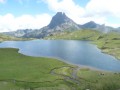
 Lakes of Ayous
 Visorando Member
 9.78 mi
 +2,464 ft
 -2,467 ft
 6h 40
 Moderate
 Departure from Laruns (Pyrénées-Atlantiques)
The not-to-be-missed Lacs d'Ayous, deep in the Ossau valley, with a magnificent view of the Pic du Midi d'Ossau.
The Estaubé Circus
 7.46 mi
+755 ft
-748 ft
4h 05
Moderate
Departure from Gèdre (Hautes-Pyrénées)
This easy hike leads to the foot of the Cirque d'Estaubé. Although less famous than its neighbour Gavarnie, the Cirque d'Estaubé is a magnificent sight, with many waterfalls. Great picnic opportunities in a superb mountain setting.
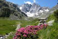
Gaube lake and Oulettes de Gaube refuge
 Tourist office
 9.68 mi
+2,329 ft
-2,326 ft
6h 30
Moderate
Departure from Cauterets (Hautes-Pyrénées)
Departing from Le Pont d'Espagne, this moderately demanding hike will take you into the Pyrenees National Park to discover Lac de Gaube and the Oulettes de Gaube refuge, from where you can admire the Vignemale, the highest peak in the Pyrenees at 3298m. If you're lucky, you might even spot some marmots.
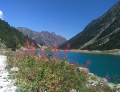
Lac de Gaube via Pont d'Espagne
 3.41 mi
+889 ft
-889 ft
2h 20
Moderate
Departure from Cauterets (Hautes-Pyrénées)
This pretty mid-mountain lake (1,731 m) on the GR®10 is easy to access and overlooked by peaks over 2,500 m high. It makes for a pleasant hike of a few hours. It is also accessible in winter, under the snow, on foot or with snowshoes. The long walk through the magnificent forest along the Gave de Gaube, on the side of the Gaube coast, makes the discovery of the mountains even more beautiful when you arrive at the first Huats lake with the north face of the Vignemale as a backdrop.
The Cirque de Gavarnie via the Bellevue plateau
 7.49 mi
+2,438 ft
-2,434 ft
5h 35
Moderate
Departure from Gavarnie (Hautes-Pyrénées)
(!) (September 2024). Following recent bad weather, the footbridge at point (6) has been swept away by the floodwaters. Fording the Gave de Pau is tricky and strongly advised against.
(!) Updated 25/06/2025, Gavarnie Valleys Tourist Office. => The footbridge at (6) has been repaired and will reopen to the public from 25/06/2025.However, the footbridge located upstream of the Hôtellerie du Cirque (9) is still not in place, and fording the Gave de Pau is tricky depending on the current water level.
The Tourist Office advises: ‘Please note, however, that the footbridge will be dismantled every late autumn and reassembled in late spring as it is situated in an avalanche path.’
A different approach to the Gavarnie Cirque. The plateau offers a panoramic view, allowing you to take it all in at a glance. A little later, you’ll wander through the cirque to fully appreciate its majesty. To quote Victor Hugo, the Colosseum of nature.
Taillon and Breche de Roland from the Col des Tentes
 8.62 mi
+3,442 ft
-3,428 ft
7h 00
 Difficult
Departure from Gavarnie (Hautes-Pyrénées)
Landscapes “rich in nature” on this hike in the area of Gavarnie, accompany your steps towards the peak of Taillon, through the legendary Roland breach. Taillon, a summit that at the top of its 3144 m, offers a stunning panorama and striking views as far as the eye can see.
The Cirque de Troumouse
 7.13 mi
+2,178 ft
-2,162 ft
5h 10
Moderate
Departure from Gèdre (Hautes-Pyrénées)
The Central Pyrenees boast three superb cirques, the best known of which is Gavarnie. However, the other two, Troumouse and Estaubé, are also well worth a visit. Troumouse, situated furthest to the east, features stunning rock faces that mark the border with Spain.Important note: following discussions with the Gavarnie-Gèvre Tourist Office, here is some information about this hike:Road access to Héas and the Maillet plateau has been restored, and the road is considered to be open again. Works will resume in the spring and may occasionally affect traffic.However, the access road to the chapel at Héas is closed every winter and in early spring due to snow and avalanche risks. The road reopens gradually from March–April and then in late May–early June. To find out when the road is open, please visit the website.
Grand Tour of the Pic du Midi d'Ossau
 13.12 mi
+4,856 ft
-4,829 ft
More than 12 hrs
 Very difficult
Departure from Laruns (Pyrénées-Atlantiques)
Why Grand Tour? Because it's a must-see passage through the Ayous Refuge in a setting that is, how can I put it? Sublime...
⚠️ 23/09/2025: The Magnabaigt trail (section of the Tour du Midi d'Ossau) will be closed from 1 September 2025 until further notice from (13) to (S/E) for forestry work. Hike not possible at this time.
The Brèche de Roland
 6.87 mi
+2,103 ft
-2,100 ft
5h 00
Difficult
Departure from Gavarnie (Hautes-Pyrénées)
Hike above the Cirque de Gavarnie to visit a mountain pass made famous by its name.
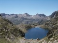
Towards the lakes of Embarrat, Pourtet and Nère
 12.19 mi
+3,274 ft
-3,241 ft
8h 25
Difficult
Departure from Cauterets (Hautes-Pyrénées)
This hike, starting from Pont d'Espagne, will take you to the heart of the Pyrenees National Park. You will follow the Marcadau valley to reach the lakes of Embarrat, Pourtet and Nère at an altitude of over 2,400 metres.
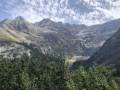
The Cirque de Gavarnie via the ledges
 7.19 mi
+2,313 ft
-2,306 ft
5h 20
Moderate
Departure from Gavarnie (Hautes-Pyrénées)
This trail is much less frequented than the main path and offers more views of the cirque along most of its length.
⚠️From 1 November to 30 April, and as soon as the quiet zone is established, using the route between 4 and 5 constitutes an offence under the National Park regulations: a 4th category offence under: R.331-65 3° — "Deliberate disturbance of the peace in the core area of the National Park" (€750 fine)."
⚠️ DOGS ARE NOT ALLOWED between 2-3-4 and 5.
Please check with the Gavarnie Tourist Office before setting off: +33 (0)5 62 92 49 10.
Lac de Gaube from La Raillère
 9.54 mi
+2,405 ft
-2,395 ft
6h 30
Moderate
Departure from Cauterets (Hautes-Pyrénées)
Discover Lac de Gaube from La Raillère, south of Cauterets, via theGR®10.
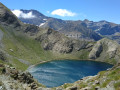
Lac de la Bernatoire
 5.88 mi
+1,923 ft
-1,926 ft
4h 25
Moderate
Departure from Gavarnie (Hautes-Pyrénées)
Pure beauty! A hike that will take your breath away, surrounded by cows, marmots and chamois!
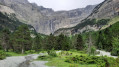
Gavarnie waterfall with return via the Cirque du Pailla
 7.27 mi
+2,156 ft
-2,142 ft
5h 15
Moderate
Departure from Gavarnie (Hautes-Pyrénées)
Hike in the most famous cirque in the Pyrenees. Return via the path leading to the Cirque du Pailla, which allows you to avoid the crowds and gain height to enjoy this magnificent place from a different perspective.
The Estelat Lakes via the Refuge de la Glére
 6.41 mi
+2,402 ft
-2,454 ft
5h 00
Moderate
Departure from Barèges (Hautes-Pyrénées)
This is a hike not to be missed for lovers of mountain lakes and wide open spaces.
Moderator's addition on 23/08/2021: The start of the circuit has changed. It is now at the Chez Louisette restaurant and the hike is therefore longer. See the comments at the bottom of this page
Lake Estaens
 5.26 mi
+1,745 ft
-1,749 ft
3h 55
Moderate
Departure from Urdos (Pyrénées-Atlantiques)
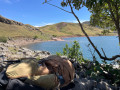
This round trip hike is mostly in Spain and is suitable for all walkers. It is a very easy family walk. The green surroundings are home to marmots and chamois, if you know where to look. From the end of June onwards, numerous flocks of sheep, cows and horses graze here. The lake is splendid and is surrounded by white rock mountains on the left with the Aspe peak and the Visaurin and on the right by red rocks with the Gabedaille peak.
The lakes and ruins of Liantran from Lac d'Estaing
 9.50 mi
+2,369 ft
-2,375 ft
6h 25
Moderate
Departure from Estaing (Hautes-Pyrénées) (Hautes-Pyrénées)
This hike will take you to the bottom of the Estaing Valley to discover the Liantran Lakes and pastoral remains.
You will discover the Lac d'Estaing, then the Lac de Langle (sometimes dry in summer), the Lac du Plaa de Prat, and finally the Lacs de Liantran.
There are no difficulties from May onwards, although in spring there may still be some snow drifts, so caution is advised.
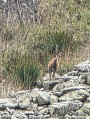
Pyrenean ibex and chamois are often spotted here.
Lac d'Estaens loop via the Chemin des Échelles
 6.65 mi
+2,162 ft
-2,165 ft
4h 55
Moderate
Departure from Urdos (Pyrénées-Atlantiques)
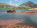
The aim here is to make a loop. You will need to climb down a small chimney and follow a path that runs along the cliff and takes you down a ladder. Magnificent view of the peaks and the valley below.
Houer Lake
 5.84 mi
+1,736 ft
-1,745 ft
4h 10
Moderate
Departure from Laruns (Pyrénées-Atlantiques)
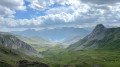
Lac de Houer is very quiet, as hikers prefer to head towards Lac de la Pombie from Cabane d'Araille.
In summer, this walk allows you to admire the equally beautiful landscapes far from the crowds, surrounded by pastures and herds of cattle.
The Gaube, Aratille and Marcadau valleys
 14.84 mi
+4,029 ft
-4,029 ft
10h 20
Difficult
Departure from Cauterets (Hautes-Pyrénées)
A 24 km loop to discover between lakes, mountain streams, peaks, mountain pines and wildlife.
Circular at Lac de Badet
 4.84 mi
+1,129 ft
-1,122 ft
3h 15
Moderate
Departure from Aragnouet (Hautes-Pyrénées)
A short, easy walk for the whole family.
Bucolic landscapes and a beautiful little lake where you can relax and daydream.
The Raillère waterfall trail to the Pont d'Espagne hotel
 5.89 mi
+1,749 ft
-1,732 ft
4h 15
Moderate
Departure from Cauterets (Hautes-Pyrénées)
The path begins in the undergrowth of the Pyrenees National Park. From waterfall to waterfall, we reach Pont d'Espagne and its hotel. The path passes through the forest, which is very pleasant in summer. We walk along the Gave du Marcadau or Cauterets. This hike is a classic in the region.
In the Marcadau valley, from Pont d'Espagne to the Wallon refuge
 9.86 mi
+1,365 ft
-1,342 ft
5h 45
Moderate
Departure from Cauterets (Hautes-Pyrénées)
This hike, which generally follows the valley floor, will take you on a gentle slope to the Wallon-Marcadau refuge. You will alternate between mountain pine forests, peat bogs and meadows until you reach the refuge, where the landscape becomes more rocky. A beautiful variety of landscapes and fairly easy access make this a very enjoyable hike starting from Pont d'Espagne.
Lac d'Aule from Bious-Artigues
 5.08 mi
+2,513 ft
-2,523 ft
4h 30
Moderate
Departure from Laruns (Pyrénées-Atlantiques)
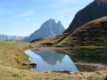
This is a short hike that takes you off the beaten track to a lake that is less frequented but just as beautiful as the more famous Ayous Lakes, perhaps because this walk can only really be done as a round trip. We went there in autumn for the peace and quiet, the beauty of the site and, quite simply, for the colours, the colours!
Lac du Chabarrou starting from Pont d'Espagne
9.86 mi
+2,799 ft
-2,799 ft
7h 00
Difficult
Departure from Cauterets (Hautes-Pyrénées)
I suggest you discover the beautiful and uncrowded Lac du Chabarrou, at an altitude of 2,300 m. An interesting alternative to the very popular hike to the Oulettes de Gaube refuge. Access is challenging. Don't forget to admire the Pont d'Espagne (a very popular tourist site) before or after your hike.
Pombie Refuge
 5.84 mi
+1,581 ft
-1,578 ft
4h 05
Moderate
Departure from Laruns (Pyrénées-Atlantiques)
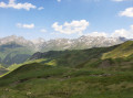
With only 8 km and 470 m of elevation gain, this hike is accessible to almost everyone. The paths are wide and easy to follow. The views are magnificent. A change of scenery without too much difficulty. From the refuge, the more adventurous can climb to the Col de Peyreget or the Col de Suzon. To do so, you will need to be very well equipped.
Lac du Hourat from Cambasque
 7.89 mi
+3,340 ft
-3,346 ft
6h 30
Difficult
Departure from Cauterets (Hautes-Pyrénées)
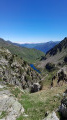
A beautiful lake with an island, difficult to access from Lake Ilhéou.
This hike is classified as difficult because the path is steep from Lac d'Ilhéou and a good sense of direction is necessary at the end of the route. This summer hike can be undertaken from the end of June until the first snowfall (for the Ilhéou - Hourat section).
Beware of Patou, the sheepdog. Do not cross through a flock, but go around it.
Lac de Migouélou circular via Lac des Touest
 6.12 mi
+2,930 ft
-2,930 ft
5h 20
Difficult
Departure from Arrens-Marsous (Hautes-Pyrénées)
Hanging above the Arrens-Marsous Valley are several lakes, the magnificent dam and the Migouélou refuge, surrounded by peaks ranging from 2,500 to 2,700 metres.But this classic route is not enough to tempt you! GPX track essential.After passing by old mining installations, the railway line, a metal footbridge and Lac de Lassiédouat, the route offers a return via the Vallon de Massey, home to two other adorable little lakes, the Touest.
 From Pont d'Espagne to the Marcadau or Wallon refuge on snowshoes
 9.62 mi
+1,440 ft
-1,417 ft
6 hrs
Moderate
Departure from Cauterets (Hautes-Pyrénées)
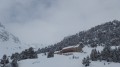
A very pretty, fairly long and enjoyable hike. If you set off early and it has snowed, you can look forward to a very pleasant climb to the refuge.
Cirque Gavarnie par le Plateau de Bellevue et Bosquet Long
 7.53 mi
+2,228 ft
-2,231 ft
5h 25
Moderate
Departure from Gavarnie (Hautes-Pyrénées)
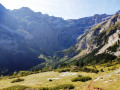
The Cirque de Gavarnie needs no introduction, it's a monument! The passage through the Plateau de Bellevue offers a wonderful viewpoint. Without snow, the path running along the side of the Bosquet Long heights adds an extra element of excitement, allowing you to appreciate it in all its splendour and tranquillity, which is not possible on the more well-known variants. The more classic return route allows you to cross the very pleasant La Prade plateau, as well as meeting other people.
⚠️ Hiking is prohibited from 1 November to 30 April. Once the quiet zone is in place, using this route between (4) and (5) constitutes a violation of National Park regulations. This is a category 4 offence under: R.331-65 3° — "Deliberate disturbance of the peace in the core area of the National Park" (€750 fine).
⚠️ DOGS PROHIBITED
See other prohibitions in the practical information section.
Please check with the Gavarnie Tourist Office before setting off: +33 (0)5 62 92 49 10.
Refuge des Espuguettes, Plateau des Cardous and Plateau d'Alans
 4.68 mi
+2,362 ft
-2,352 ft
4h 10
Moderate
Departure from Gavarnie (Hautes-Pyrénées)
Starting from Gavarnie, enjoy a change of scenery by escaping to the wild plateaus at the foot of the Grand and Petit Piméné (2,801m and 2,667m).
The Refuge des Espuguettes is a beautiful stop along the way. If you push on a little further to the Plateau des Cardous, you can admire the entire border range, the peaks of the Cirque, just for you, from the Tour du Marboré (3009m) to the Mailh Arrouy (2965m), passing by the majestic Vignemale (3,298 m).
A change of scenery and tranquillity guaranteed!
Cirque de Gavarnie via the Corniche des Espugues
 7.05 mi
+2,480 ft
-2,484 ft
5h 25
Moderate
Departure from Gavarnie (Hautes-Pyrénées)
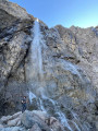
This magnificent hike takes you off the beaten track for more than half of the route, passing through splendid, varied and uncrowded landscapes. Forests, small waterfalls, passages under cornices and breathtaking panoramas, before arriving at the highlight of the show, the foot of the Grande Cascade de Gavarnie.
Refuge du Pailha circular
 5.94 mi
+1,388 ft
-1,385 ft
3h 55
Moderate
Departure from Gavarnie (Hautes-Pyrénées)
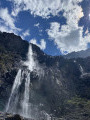
A magnificent circular hike that allows you to climb to a high altitude without too much difficulty and arrive at a refuge guarded by very friendly people. The return journey takes you along a path carved into the rock, offering splendid views.
From Cauterets to the Ceriset Waterfall
 6.20 mi
+1,765 ft
-1,788 ft
4h 25
Moderate
Departure from Cauterets (Hautes-Pyrénées)
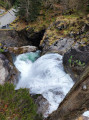
An accessible hike where you will walk around Cauterets on the heights with, for those who wish, a detour to the Waterfall Trail to the Ceriset Waterfall.
La Glère mountain refuge and Lac det Mail
 8.13 mi
+2,772 ft
-2,772 ft
6h 10
Difficult
Departure from Barèges (Hautes-Pyrénées)
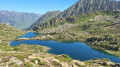
From the Ayré Forest, the hike begins by climbing up the Glère Valley. A trough-shaped profile, winter avalanche slides, a torrent at the bottom of the valley and groves of pines and rhododendrons; a classic approach to the high mountains. Nothing suggests that at the top of the main ridge, the Refuge de la Glère opens the door to the crystalline empire of Néouvielle, a universe where a constellation of lakes, large and small, sparkle, each more charming than the last.
Le Casque du Marboré via the normal route
 8.37 mi
+3,340 ft
-3,323 ft
6h 45
Difficult
Departure from Gavarnie (Hautes-Pyrénées)
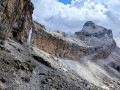
Want to climb one of the legendary "3000" peaks of the Cirque de Gavarnie with breathtaking views? The Casque du Marboré could be your next goal! The entire route offers magnificent views of the surrounding mountains: Vignemale, Néouvielle, Mont Perdu, Canyon d'Ordesa. However, it is important to bear in mind that part of this hike takes place in a high mountain environment, with sometimes unstable scree and passages where you will need to use your hands.
3 days in the Central Pyrenees Park from Cauterets
 30.88 mi
+10,197 ft
-10,226 ft
3 days
Difficult
Departure from Cauterets (Hautes-Pyrénées)
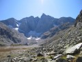
Explore the Pyrenees National Park (central section) with a trip to Spain, lakes and mountain passes at an altitude of 2,600 metres.
With an average elevation gain of ± 1,230 m and a distance of 17 km per day, this trip is, all in all, quite strenuous.
Please take into account the cumulative elevation gain and the distance to be covered.
The trip takes place between 1000 m and 2655 m altitude.
The start of this route is accessible by public transport (coaches and shuttle bus from Cauterets in summer).
Pics d'Ayous and Pic de Larry circular via the Vallon d'Aas de Bielle
 9.36 mi
+4,085 ft
-4,088 ft
7h 50
Difficult
Departure from Laruns (Pyrénées-Atlantiques)
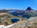
This route in the upper Ossau Valley allows you to explore the ridges overlooking the Ayous lakes, without having to contend with the crowds that flock there.The Vallon d’Aas de Bielle is a wonderful, peaceful, pastoral spot.From the summits of the Pics d’Ayous and Larry, the view is magnificent towards the Pic du Midi d’Ossau (2,884 m), which rises imposingly, as well as over all the Ayous lakes – a sight you won’t regret seeing from such a height!
From Ansabère to Acherito
 8.98 mi
+3,629 ft
-3,625 ft
7h 15
Difficult
Departure from Lescun (Pyrénées-Atlantiques)
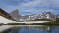
A cross-border circular to discover a little-known area (Ibón de Acherito) from a very popular location (Cabanes d'Ansabère from Lescun). Magnificent landscapes, a varied route.
Hike published in Pyrénées Magazine in 1995 (without a map and with little detail on the descent).
Update: According to several hikers' reviews (see the associated forum), it would be preferable to do this route in reverse.
A winter loop in the Cirque de Gavarnie
 4.67 mi
+830 ft
-843 ft
4 hrs
Moderate
Departure from Gavarnie (Hautes-Pyrénées)
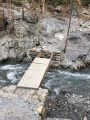
A beautiful site in summer, with its majestic waterfall. Please note that it is very busy in summer.In winter, you will appreciate the magnificent, peaceful landscape with the ice waterfalls at the bottom of the cirque.This circuit can be done very easily at any time of year:- in 3 hours in summer, including breaks and lunch.- but in 3 to 4 hours in winter.
Circular in the Cirque d'Anéou
 4.30 mi
+965 ft
-951 ft
2h 50
Moderate
Departure from Laruns (Pyrénées-Atlantiques)
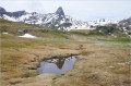
What better season than spring to discover (or rediscover) the mountains? Snow still adorns the landscape, streams flow merrily down the slopes, and a profusion of flowers carpets the already thick grass of the mountain pastures. The Cirque d'Anéou, in the upper Ossau valley, offers us the added bonus of its magnificent setting and geological curiosities.
Pic Labigouer from Lhers
 9.84 mi
+3,973 ft
-3,983 ft
8h 00
Difficult
Departure from Accous (Pyrénées-Atlantiques)
The main attraction of this hike is the easy ridge walk, when there is no snow, from the Col de Souperet to the Col de la Nabe. The 360° view stretches from Bedous to the Cirque de Lescun, Ossau, Balaïtous and beyond.
In summer, there are numerous herds of sheep, and shepherds make the famous sheep's cheese in their huts. Keep your eyes peeled, as chamois are not uncommon.
Set off early to enjoy the shade on the way up.
See practical information.
Barroude Lakes circular via Port de Barroude and Port Vieux
12.98 mi
+4,616 ft
-4,623 ft
10h 00
Difficult
Departure from Aragnouet (Hautes-Pyrénées)
The climb to the Cirque de Barroude is after a passage through the forest along the Neste de la Géla in magnificent summer pastures. The arrival at the lakes via a bucolic path offers a splendid view of the cliffs that tower 500 metres above. The return via the Port de Barroude and then the ridges allows us to see the Spanish side and its Aragonese sierras.
Arremoulit refuge
 8.92 mi
+4,127 ft
-4,108 ft
7h 40
Difficult
Departure from Laruns (Pyrénées-Atlantiques)
This round trip hike requires a fairly good level of fitness. Long distance and steep gradient.
Returning via Lake Artouste greatly reduces the difficulty.
This hike is magnificent. Throughout the climb, you will have the high peaks in your sights.
The trails are varied: you will cross forests, summer pastures with herds of cattle, streams and, early in the morning, you may even see some izards (a type of wild goat).
The circuit around Pic de Peyreget near Pic du Midi d'Ossau
 7.28 mi
+2,539 ft
-2,543 ft
5h 35
Difficult
Departure from Laruns (Pyrénées-Atlantiques)
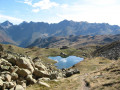
A circular walk starting from the Anéou basin, to pay a visit to Jean-Pierre, the giant of Béarn, and enjoy the beauty of a few small mountain lakes. A walk we have done several times in late summer or autumn, always with the same pleasure.
Circular route of the Cirque de Troumouse from the Chapelle de Héas
7.71 mi
+2,169 ft
-2,169 ft
5h 25
Moderate
Departure from Gèdre (Hautes-Pyrénées)
Circular trail starting from the Chapelle de Héas to explore the magnificent Cirque de Troumouse. The trail offers panoramic views of the entire cirque, passing by the Lac des Aires, before continuing towards La Vierge and the Cabane de la Vierge.A varied hike with superb scenery, which returns gently to the Chapelle de Héas to complete a circular route.
⚠️ Following a discussion with the Gavarnie-Gèvre Tourist Office, here is some information about this hike:Road access to Héas and the Maillet plateau has been restored, and the road is considered to be open again. Works will resume in the spring and may occasionally affect traffic.However, the access road to the Chapelle de Héas is closed every winter and early spring due to snow and avalanche risks. The road reopens gradually from March–April and then in late May–early June.To find out when the road is open , pleasevisit the website.
Lake Bassia from Gèdre-Dessus
 7.96 mi
+3,625 ft
-3,655 ft
6h 50
Difficult
Departure from Gèdre (Hautes-Pyrénées)
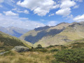
A beautiful, long hike through large areas of summer pastures, starting from a small village.A sense of direction is necessary. The return journey described here is for when there is no snow, bad weather or fog.Old yellow markings are still visible in places.Part of the climb via the Campbieil barns is in the Pyrenees National Park. Special regulations apply.To get to the start of the hike, see the directions in the practical information section.
Please note: the Gavarnie Valleys Tourist Office reports that on 8 May 2025
> that access restrictions for hiking in the Campbieilh valley may be lifted.> Thank you very much.
Cirque de Gavarnie via the Plateau de Bellevue
 6.95 mi
+1,450 ft
-1,470 ft
4h 25
Moderate
Departure from Gavarnie (Hautes-Pyrénées)
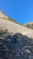
Walk to the Cirque de Gavarnie, staying above the Plateau de Bellevue, aptly named.
⚠️ Hiking is prohibited from 1 November to 30 April. Once the quiet zone is in place, using this route between (4) and (7) constitutes a violation of National Park regulations. This is a category 4 offence under: R.331-65 3° — "Deliberate disturbance of the peace in the core area of the National Park" (€750 fine).
⚠️ DOGS PROHIBITED
See other prohibitions in the practical information section.
Please check with the Gavarnie Tourist Office before setting off: +33 (0)5 62 92 49 10.
From the Refuge Wallon to Cauterets via the Col d'Arratille and the Col des Mulets
13.24 mi
+2,789 ft
-5,502 ft
8h 30
Difficult
Departure from Cauterets (Hautes-Pyrénées)
This circular is best done from mid-June until the first cold spells.
This isthe third and fairly longday of a three-day route in the Central Pyrenees National Park.
In case of bad weather or unforeseen circumstances, it is possible to shorten the route by descending directly from the (1) to the (8).
Hourquette de Héas
 7.62 mi
+2,779 ft
-2,785 ft
5h 55
Difficult
Departure from Aragnouet (Hautes-Pyrénées)
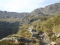
Hike starting from the Piau Engaly resort. The only difficult section is the climb up to the pass, a 30-minute scramble over scree. Superb views of the Cirque de Troumouse and the peaks of the Cirque de Gavarnie. During this hike you’ll come across marmots and, with a bit of luck, chamois or vultures.