Lake Estaens

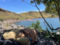
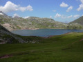
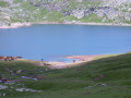
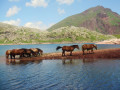
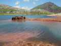
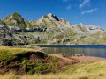
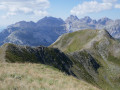
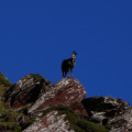
This round trip hike is mostly in Spain and is suitable for all walkers. It is a very easy family walk. The green surroundings are home to marmots and chamois, if you know where to look. From the end of June onwards, numerous flocks of sheep, cows and horses graze here. The lake is splendid and is surrounded by white rock mountains on the left with the Aspe peak and the Visaurin and on the right by red rocks with the Gabedaille peak.

Details

3189591
Creation:
Last update:
Last review:
  • Walking
    Activity: Walking
  • ↔
    Distance: 5.26 mi
  • ◔
    Average duration: 3h 55 
  • ▲
    Difficulty: Moderate

  • ⚐
    Back to start: Yes
  • ↗
    Ascent: + 1,745 ft
  • ↘
    Descent: - 1,749 ft

  • ▲
    Highest point: 5,909 ft
  • ▼
    Lowest point: 4,298 ft

Photos

Description of the walk

Access: In Oloron-Sainte-Marie, head towards Somport on the N134. Pass Urdos and just before the tunnel, head towards the pass. Follow this road for 3.5 km, then take a right turn at the junction marked 1329 on the map. The car park is in poor condition. This is a very popular hike, so don't arrive too late in the summer.

(S/E) Take the path below the car park. This path leads to the Gave d'Aspe, which you cross. Follow the track to a fork with a sign.

(1) Leave the track and turn right. Cross a small footbridge and you will come to a second signpost. Continue straight ahead and after two hairpin bends in the forest, rejoin the track you left at the start.

(2) Turn right onto the track that leads to a sheepfold, the Cabane d'Escouret (cheese shop). Follow it to a fork.

(3) Leave the sheepfold on your right and climb to the left (north-west), then follow the hairpin bends to the west. At the edge of the woods, you will reach the Spanish border next to border marker 292 (altitude 1,645 m).

(4) The trail heads due west and arrives at a flat area with a small stream at theGR®11junction.

(5) Ford the stream, looking for the most suitable place, and continue along the trail, which is generally westbound. You will reach a mostly dry ravine and then a flat area (altitude 1,800 m).

(6) Descend 40 m to reach the lake shore.

(7) Enjoy the peace and quiet and the magnificent panorama, then return by the same route to the car park where you started (S/E).


Waypoints

  1. S/E : mi 0 - alt. 4,327 ft - Car park. Cross the - Gave d'Asp (cours d'eau) - Espagne - Affluent du Gave d'Oloron
  2. 1 : mi 0.13 - alt. 4,314 ft - Junction - sign
  3. 2 : mi 0.47 - alt. 4,633 ft - Track
  4. 3 : mi 0.54 - alt. 4,652 ft - Sheepfold junction
  5. 4 : mi 1.34 - alt. 5,308 ft - Spanish border
  6. 5 : mi 1.61 - alt. 5,489 ft - Stream - junction °°GR®°°11
  7. 6 : mi 2.17 - alt. 5,846 ft - Gully
  8. 7 : mi 2.63 - alt. 5,761 ft - Lac d'Estaens (1754 m)
  9. S/E : mi 5.26 - alt. 4,327 ft - Car park

This route passes through a protected area, which may be subject to special regulations:

Always be cautious and plan ahead when you're outdoors. Visorando and the author of this route cannot be held responsible for any accidents occurring on this route.

The GR® and PR® markings are the intellectual property of the Fédération Française de Randonnée Pédestre.

Reviews and comments

4.7 / 5
Based on 23 reviews

Reliability of the description
4.6 / 5
Ease of following the route
4.7 / 5
Route interest
4.7 / 5
taboulechat
taboulechat

Hello.
I’ve also posted the circular route around Lake Estaens via the Chemin des Échelles.
Kind regards

Machine-translated

User 26479763

Overall rating : 4 / 5

Date of your route : Jul 21, 2026
Reliability of the description : ★★★★☆ Good
Ease of following the route : ★★★★☆ Good
Route interest : ★★★★☆ Good
Very busy route : No

It’s a shame that the outward and return journeys follow the same route. A circular route would have been ideal.

Machine-translated

User 13317411

Overall rating : 5 / 5

Date of your route : Aug 17, 2026
Reliability of the description : ★★★★★ Very good
Ease of following the route : ★★★★★ Very good
Route interest : ★★★★★ Very good
Very busy route : Yes

A lovely walk, but very busy in August! The car park was full, but we arrived around 2 pm and some spaces became available.
We’re weekend hikers (adults only) and the route is still accessible. Stunning scenery and the lake as a reward at the end (the water level of which is particularly low due to the heatwave…)
We saw cows and sheep along the way, but no marmots and certainly no chamois.

Machine-translated

Sardine3472
Sardine3472

Overall rating : 5 / 5

Date of your route : Aug 08, 2026
Reliability of the description : ★★★★★ Very good
Ease of following the route : ★★★★★ Very good
Route interest : ★★★★★ Very good
Very busy route : No

A lovely walk, not very difficult. There’s no risk of getting lost – the path is clearly signposted. The view when you reach the lake is stunning.

Machine-translated

User 27056717

Overall rating : 4 / 5

Date of your route : Jul 28, 2026
Reliability of the description : ★★★★☆ Good
Ease of following the route : ★★★★☆ Good
Route interest : ★★★★☆ Good
Very busy route : No

A lovely walk that begins by passing through a forest – so it’s very shady – before emerging onto the grassy plateaus amongst herds of cows and sheep.
However, the difficulty level is significantly underestimated: the first 2 km are very steep, and the following 2.5 km across the meadows alternate between steep sections and deceptively flat stretches. That’s not what I’d call an easy walk!!
The return journey is, of course, a leisurely one along the same route.

Machine-translated

User 16693850

Overall rating : 5 / 5

Date of your route : Jul 28, 2026
Reliability of the description : ★★★★★ Very good
Ease of following the route : ★★★★★ Very good
Route interest : ★★★★★ Very good
Very busy route : Yes

Very beautiful, very good.
The problem is that walkers aren’t respecting the area. There’s lots of toilet paper and rubbish lying about, and dogs are present even though they’re banned in the national park. Tourists are going for a swim...
Hikers, please take your rubbish away with you – even your toilet paper. There are so many of us passing through these areas; if we want them to stay as they are, we need to treat them with respect. Thank you for reading.

Machine-translated

User 30132929

Overall rating : 4.7 / 5

Date of your route : Jul 24, 2026
Reliability of the description : ★★★★★ Very good
Ease of following the route : ★★★★★ Very good
Route interest : ★★★★☆ Good
Very busy route : Yes

A walk with no technical difficulties but with a fair bit of elevation gain. As novice walkers, we found it quite challenging, especially as we set off a bit late and were heading back around 1 pm. Do feel free to walk round the lake to reach the viewpoint (be careful – the cliff edge is unsecured).

Machine-translated

LOS ESCAPATS
LOS ESCAPATS

Overall rating : 5 / 5

Date of your route : Oct 20, 2025
Reliability of the description : ★★★★★ Very good
Ease of following the route : ★★★★★ Very good
Route interest : ★★★★★ Very good
Very busy route : Yes

A very beautiful hike, especially in good weather

Machine-translated

User 9438379

Overall rating : 4.7 / 5

Date of your route : Sep 06, 2025
Reliability of the description : ★★★★★ Very good
Ease of following the route : ★★★★☆ Good
Route interest : ★★★★★ Very good
Very busy route : Yes

The magnificent Lake Estaens under the sun. Beautiful images captured (photos and videos)
Most of the hikers were chatty Spaniards!
Fairly easy route.

Machine-translated

User 27283967

Overall rating : 4.7 / 5

Date of your route : Aug 17, 2025
Reliability of the description : ★★★★★ Very good
Ease of following the route : ★★★★★ Very good
Route interest : ★★★★☆ Good
Very busy route : Yes

Machine-translated

Gaël_Brest
Gaël_Brest

Overall rating : 5 / 5

Date of your route : Aug 06, 2025
Reliability of the description : ★★★★★ Very good
Ease of following the route : ★★★★★ Very good
Route interest : ★★★★★ Very good
Very busy route : Yes

A very beautiful walk. Particularly busy in summer, we started the walk around 3pm (with no risk of storms) and it was really very pleasant: very few people, a really varied climb and a beautiful lake.

Machine-translated

Murielle Biez
Murielle Biez

Overall rating : 5 / 5

Date of your route : Aug 14, 2025
Reliability of the description : ★★★★★ Very good
Ease of following the route : ★★★★★ Very good
Route interest : ★★★★★ Very good
Very busy route : Yes

Beautiful hike, very busy! Lots of children and families.
Magnificent scenery. It's spectacular.

Machine-translated

Murielle Biez
Murielle Biez

Overall rating : 3.7 / 5

Date of your route : Jul 28, 2025
Reliability of the description : ★★★☆☆ Average
Ease of following the route : ★★★★☆ Good
Route interest : ★★★★☆ Good
Very busy route : Yes

Following the damage caused by the weather in February and March 2025, the route has been modified. The signposting is well done. A beautiful hike

Machine-translated

taboulechat
taboulechat

Go to your account, then profile information, and you can change your email address. Of course, remember to save the changes.
Happy hiking!

Machine-translated

muntot
muntot

Overall rating : 4.3 / 5

Date of your route : Feb 10, 2025
Reliability of the description : ★★★★☆ Good
Ease of following the route : ★★★★☆ Good
Route interest : ★★★★★ Very good
Very busy route : Yes

On snowshoes

Machine-translated

Other walks in the area

For more walks, use our search engine .

The GPS track and description are the property of this route's author. Please do not copy them without permission.