Hourquette de Héas

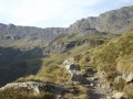
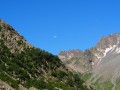
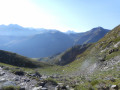
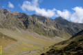
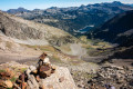
Hike starting from the Piau Engaly resort. The only difficult section is the climb up to the pass, a 30-minute scramble over scree. Superb views of the Cirque de Troumouse and the peaks of the Cirque de Gavarnie. During this hike you’ll come across marmots and, with a bit of luck, chamois or vultures.

Details

631029
Creation:
Last update:
Last review:
  • Walking
    Activity: Walking
  • ↔
    Distance: 7.62 mi
  • ◔
    Average duration: 5h 55 
  • ▲
    Difficulty: Difficult

  • ⚐
    Back to start: Yes
  • ↗
    Ascent: + 2,779 ft
  • ↘
    Descent: - 2,785 ft

  • ▲
    Highest point: 8,501 ft
  • ▼
    Lowest point: 5,971 ft
  • ⚐ Country: France
  • ⚐
    Area: Pyrenees
  • ⚐ City: Aragnouet (65170)
  • ⚑
    Start/End: N 42.785821° / E 0.156364°
  • ❏
    IGN map(s): Ref. 1748ET, 1748ETR, 1748OT, 1748OTR
  • Hour-by-hour weather

Photos

Description of the walk

Start from the upper car park at Piau Engaly.

(S/E) Take the tarmac road heading towards the Mouscadès chairlift. Pass through an electric fence (don’t forget to close it behind you).

(1) After the chairlift departure station, leave the ski run and take the path on the right. Cross the stream and follow it at a distance, roughly parallel to it, for about 500m. Continue westwards and move away from the stream. The path climbs gradually and heads south-south-west.

(2) At this junction, take the path to the right towards the Port de Campbieil (the one on the left leads to Lac de Badet) until the next junction.

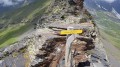
(3) Continue left (south) towards the Hourquette de Héas (the other path leads to the Port de Campbieil). The path climbs gradually to the next junction, marked by a sign.

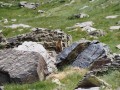
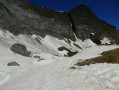
(4) At the bottom of a large scree slope, take the path on the right leading to the Hourquette de Héas. A fairly difficult 30-minute climb over scree. After passing the eternal snows, there is a large boulder with a small path branching off to the left: I recommend climbing over the boulder to avoid a tricky section.

(5) Return along the same path to the bottom of the scree slope.

(4) Then turn right (east) to return via Lac de Badet. Descend and then traverse along the hillside.

(6) At the junction marked by a sign, take the path on the left (north) which descends towards Lac de Badet (the one on the right leads to the Hourquette de Chermentas).

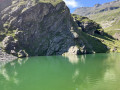
(7) At the lake, continue along the path northwards. After passing the shelter, carry on straight ahead until you reach the ski run; you cannot go wrong.

(8) Head back down the ski run to the Mouscadès chairlift, then follow the tarmac road back up to the upper car park (S/E).

Waypoints

  1. S/E : mi 0 - alt. 6,142 ft - Car park
  2. 1 : mi 0.34 - alt. 5,978 ft - Chairlift departure station – Junction
  3. 2 : mi 2.15 - alt. 7,034 ft - Junction
  4. 3 : mi 2.45 - alt. 7,306 ft - Junction
  5. 4 : mi 3.65 - alt. 8,120 ft - At the bottom of a large scree slope
  6. 5 : mi 3.91 - alt. 8,501 ft - Hourquette de Heas (2608m)
  7. 6 : mi 4.84 - alt. 7,723 ft - Junction
  8. 7 : mi 5.45 - alt. 6,837 ft - Lac de Badet
  9. 8 : mi 6.62 - alt. 6,316 ft - Ski slope. Passage near the source of the - Neste (rivière)
  10. S/E : mi 7.62 - alt. 6,142 ft - Car park

Notes

Make sure you wear good hiking boots, preferably high-top ones, especially for the climb up to the pass.

This route passes through a protected area, which may be subject to special regulations:

Worth a visit

Marmots are very common throughout this hike. With a bit of luck, you might spot vultures, chamois or even Egyptian vultures.

A beautiful panorama awaits you from the Hourquette de Héas (5): breathtaking views of the Cirque de Troumouse and the peaks of the Cirque de Gavarnie.

Reviews and comments

4.5 / 5
Based on 5 reviews

Reliability of the description
4.6 / 5
Ease of following the route
4.6 / 5
Route interest
4.4 / 5
PierreJou
PierreJou

Overall rating : 4 / 5

Date of your route : Jun 21, 2021
Reliability of the description : ★★★★☆ Good
Ease of following the route : ★★★★☆ Good
Route interest : ★★★★☆ Good
Very busy route : No

A lovely hike, but make sure you bring crampons early in the season for the pass itself (on 21 June, we couldn’t cross the final snowfield with just our hiking boots and poles)

Machine-translated

Arktos
Arktos
• Edited:

Overall rating : 5 / 5

Date of your route : Aug 05, 2020
Reliability of the description : ★★★★★ Very good
Ease of following the route : ★★★★★ Very good
Route interest : ★★★★★ Very good
Very busy route : No

The scree slope isn’t particularly technical; there’s a fairly well-trodden path that lets you avoid walking on the rocks. However, the slope is very steep, so you need to be in good shape for the climb up and then the descent down the scree slope.
Reaching the top of the pass is fabulous; the view of the peaks of Gavarnie, the Vignemale and Mont Perdu is a great reward. We were also greeted at the summit by vultures.
Thank you for this accurate and reliable description

Machine-translated

lm0
lm0

Overall rating : 4 / 5

Date of your route : Jun 08, 2019
Reliability of the description : ★★★★☆ Good
Ease of following the route : ★★★★☆ Good
Route interest : ★★★★☆ Good

A lovely hike.
We did it in early June 2019, and there was still plenty of snow: it was almost impossible to follow the path hidden beneath the snow.
Deep snow in places and we were wearing crampons, so we sank in easily!!

It must be more accessible in summer

Machine-translated

adarme47
adarme47

Hello,

Is this route suitable for snowshoes?
Thanks in advance
Kind regards

Machine-translated

JC Mont
JC Mont

Overall rating : 4.7 / 5

Date of your route : Oct 28, 2017
Reliability of the description : ★★★★★ Very good
Ease of following the route : ★★★★★ Very good
Route interest : ★★★★☆ Good

If there is a layer of icy snow below the saddle, crampons are required to reach it.

Machine-translated

25MENAI
25MENAI

Overall rating : 5 / 5

Date of your route : Jul 08, 2017
Reliability of the description : ★★★★★ Very good
Ease of following the route : ★★★★★ Very good
Route interest : ★★★★★ Very good

I did this hike about ten years ago and this description matches my experience perfectly. It’s a route best tackled towards the end of your holiday if you’re fit. Hiking boots are ESSENTIAL, and a walking stick is well worth taking.
In my opinion, the difficulty lies in the length of the route. Admittedly, the scree slope is not to be taken lightly.
Happy hiking to all

Machine-translated

Other walks in the area

For more walks, use our search engine .

The GPS track and description are the property of this route's author. Please do not copy them without permission.