Refine your search for walks in Schattenhalb
Schattenhalb walks


 Dossenhütte from Rosenlaui
 Visorando Member
 5.74 mi
 +4,373 ft
 -4,364 ft
 6h 25
6h 25
 Very difficult
 Departure from Schattenhalb (Canton of Bern)
A return walk along the access route to the CAS Dossenhütte hut. Please note that, although this is a signposted path, - this route requires a minimum level of experience in navigating rough or exposed terrain, and you must not be afraid of heights. - Whilst a number of tricky or exposed sections are equipped with cables, ladders or crampons, this is not always the case, and some sections leave no room for a misstep.
- To be avoided at all costs in wet weather...
Melchsee-Frutt
 6.88 mi
+1,335 ft
-1,345 ft
4h 20
6.88 mi
+1,335 ft
-1,345 ft
4h 20
 Moderate
Departure from Kerns (Obwalden)
Moderate
Departure from Kerns (Obwalden)
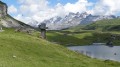
A lovely walk in Switzerland with views of the Titlis.
The Sidelhorn from the Grimsel Pass, on the shores of Lake Totensee
 5.13 mi
+1,978 ft
-1,962 ft
5 hrs
Very difficult
Departure from Oberwald (Valais)
5.13 mi
+1,978 ft
-1,962 ft
5 hrs
Very difficult
Departure from Oberwald (Valais)
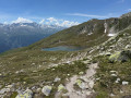
Starting from the Grimsel Pass in the Bernese Alps, this mountain hike ascends to the summit of the Sidelhorn before descending through the valley of the high-altitude lakes. The route first climbs above the Totensee and its mountain-pass hotel, along a stony path that soon overlooks the Rhône Valley and the surrounding glacial peaks. The final ascent involves scrambling up a rocky ridge to a wide viewpoint overlooking the High Bernese Alps and their glaciers. The return route runs alongside the Jostsee, a small mountain lake, before following a balcony-like path back towards the pass. A true alpine ascent, to be attempted only in the height of summer, in fine, dry weather, and reserved for seasoned walkers wishing to experience the Swiss high mountains.
Circular Lauberhorn from Kleine Scheidegg
 2.80 mi
+1,283 ft
-1,283 ft
2h 25
Moderate
Departure from Lauterbrunnen (Canton of Bern)
2.80 mi
+1,283 ft
-1,283 ft
2h 25
Moderate
Departure from Lauterbrunnen (Canton of Bern)
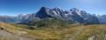
The Lauberhorn is a modest peak, yet legendary amongst downhill skiers, situated above Kleine Scheidegg. It offers a superb panorama of the Grindelwald and Lauterbrunnen valleys, but above all of the majestic trio formed by the Eiger, the Mönch and the Jungfrau.
From Schynige Platte to First via Faulhorn
10.94 mi
+3,553 ft
-2,956 ft
8h 05
 Difficult
Departure from Gsteigwiler (Canton of Bern)
Difficult
Departure from Gsteigwiler (Canton of Bern)
The Faulhorn rises to an altitude of 2,680 metres. It offers a 360-degree view of the Alps, with some peaks over 4,000 metres high, such as the Grosses-Fiescherhorn. The two main access points to the Folhorn are via the Schynige Platte or First. However, with good logistics (see practical information), it is also possible to make a one-way trip and return by public transport. The hike is a gradual climb, but offers splendid views of the first Alpine glaciers and other peaks in the surrounding area. There are restaurants where you can eat and take a break in pleasant surroundings.
Short tour of the Augstmatthorn
 3.92 mi
+1,831 ft
-1,837 ft
3h 25
Moderate
Departure from Habkern (Canton of Bern)
3.92 mi
+1,831 ft
-1,837 ft
3h 25
Moderate
Departure from Habkern (Canton of Bern)
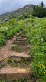
Park at the starting point of this circuit and begin the ascent to the Augstmatthorn immediately, following the signs.
The terrain can be very slippery, even impassable, after or during rain.
Tour of the Göscheneralpsee - Descent via the Panorama trail
3.98 mi
+512 ft
-2,657 ft
2h 15
Moderate
Departure from Göschenen (Canton of Uri)
The second stage of this circuit starts at the Dammahütte and follows a "Panorama" trail through a glacial cirque, then continues along the northern shore of the lake.
Obergesteln – Belvedere Furka
 11.02 mi
+4,150 ft
-1,178 ft
8h 40
Very difficult
Departure from Obergestein (Valais)
11.02 mi
+4,150 ft
-1,178 ft
8h 40
Very difficult
Departure from Obergestein (Valais)
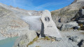
This fifth stage of the Vier Quellen Weg will take you from Obergesteln to the source of the Rhône. This magnificent route will have the Rhône as your constant companion. Right from the start, it will be by your side; you’ll follow it upstream to its source via the Furka Pass, then descend towards the historic Hotel Belvédère at the foot of the glacier. As with the other sources, you’ll find an engraved marker indicating the Rhône.
Aaschlucht from Engelberg
 5.50 mi
+148 ft
-1,562 ft
2h 40
5.50 mi
+148 ft
-1,562 ft
2h 40
 Easy
Departure from Engelberg (Obwalden)
Easy
Departure from Engelberg (Obwalden)
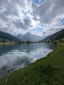
A hike along the adventure trail through the beautiful Aa Gorge from Engelberg to Grafenort railway station. As the gorge is very shady, the route is perfect for hot summer days.
Please note: One bridge on the route is currently destroyed (noted on 27 May 2026). A well-signposted diversion is in place, but this makes the hike around 100 m steeper and 2 km longer.
The Brienzersee viewpoints between Harderkulm and Rothorn
 13.56 mi
+6,942 ft
-3,986 ft
8 hrs
Very difficult
Departure from Unterseen (Canton of Bern)
13.56 mi
+6,942 ft
-3,986 ft
8 hrs
Very difficult
Departure from Unterseen (Canton of Bern)
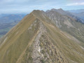
This hike follows the ridge path along the northern shore of Lake Brienz for its entire length, from Harderkulm hill to the summit of the Brienzer Rothorn. The route offers panoramic views almost throughout, and is relatively quiet except at the start and finish (accessible by funicular). There are several slightly vertiginous sections, but no real technical difficulty. The main challenge is the cumulative elevation gain, which ends up being considerable, as the jagged ridge involves many successive ascents and descents, often steep.
Panorama Rundweg Thunersee
 40.03 mi
+7,106 ft
-7,159 ft
4 days
Moderate
Departure from Unterseen (Canton of Bern)
40.03 mi
+7,106 ft
-7,159 ft
4 days
Moderate
Departure from Unterseen (Canton of Bern)
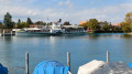
Four-day panoramic tour around Lake Thun. This route offers numerous views of the lake and the peaks of the Bernese Oberland. In good weather, you can see the Eiger, Mönch and Jungfrau mountains, as well as the Schreckhorn. You will also discover the charm of the towns along the way. Interlaken, at the eastern end of Lake Thun, is the starting point for this itinerary.
Interlaken - Sigriswil via the Panorama Rundweg Thunersee
 10.66 mi
+3,028 ft
-2,257 ft
7h 30
Difficult
Departure from Unterseen (Canton of Bern)
10.66 mi
+3,028 ft
-2,257 ft
7h 30
Difficult
Departure from Unterseen (Canton of Bern)
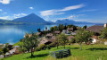
Interlaken, a cosmopolitan town, is the starting point for this tour around Lake Thun. You’ll be able to admire the three famous peaks of the Bernese Oberland: the Eiger, the Mönch and the Jungfrau. This beautiful route follows the northern shore of the lake. You’ll look out over the lake near the Saint Béat Caves, then pass through the pretty village of Merligen. You’ll enjoy stunning views of both the lake and the peaks, such as the Niederhorn and the Rothorn in Sigriswil.
Tour of the Göscheneralpsee via Damahütte
 7.23 mi
+3,199 ft
-3,215 ft
2 days
Difficult
Departure from Göschenen (Canton of Uri)
7.23 mi
+3,199 ft
-3,215 ft
2 days
Difficult
Departure from Göschenen (Canton of Uri)
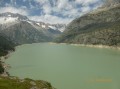
If you’re looking to hike in the high mountains and discover a beautiful Swiss glacial lake, here’s what you need: a walk around the Göscheneralpsee (a lake with a dam) and an overnight stay at the “Dammahütte”, a small, friendly mountain hut with 20 beds at an altitude of 2,440 metres..
Tour of the Göscheneralpsee - Ascent to the Dammahütte
 3.25 mi
+2,687 ft
-584 ft
3h 50
Difficult
Departure from Göschenen (Canton of Uri)
3.25 mi
+2,687 ft
-584 ft
3h 50
Difficult
Departure from Göschenen (Canton of Uri)
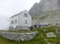
The first stage of this two-day circuit involves climbing up to the Damahütte via a path on the southern shore of the lake.
Mürren – Lauterbrunnen
5.15 mi
+528 ft
-3,291 ft
2h 50
Difficult
Departure from Lauterbrunnen (Canton of Bern)
Depart from the Mürren campsite to visit Lauterbrunnen. You can take a stroll around the town and its surroundings before heading to Lauterbrunnen station to return to Geneva. It’s a quiet day to relax.
Märjelenseestube - Bellwad via the Aletsch Panoramaweg
 5.76 mi
+1,004 ft
-3,652 ft
3h 30
Difficult
Departure from Fieschertal (Valais)
5.76 mi
+1,004 ft
-3,652 ft
3h 30
Difficult
Departure from Fieschertal (Valais)
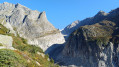
This third stage will take you to the Fieschergletcher, which runs parallel to the Aletschgletcher. On the Aspi Titter suspension bridge, you will be impressed by the depth of the Weisswasser river gorges. This fairly technical end of the route ends in the beautiful village of Bellwad, which has preserved its traditional chalets.
Hundshubel – Mürren
4.71 mi
+256 ft
-2,333 ft
2h 25
Moderate
Departure from Lauterbrunnen (Canton of Bern)
This hike takes you back to the town, which is well worth a visit. There are several campsites to choose from. Much of the route is downhill. Water is available along the way if needed. If the descent is too steep, you can take public transport for part of the way.
Alpnachstad – Bürgenstock
 9.79 mi
+3,159 ft
-1,729 ft
7h 15
Difficult
Departure from Alpnach (Obwalden)
9.79 mi
+3,159 ft
-1,729 ft
7h 15
Difficult
Departure from Alpnach (Obwalden)
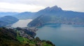
This fourth stage will take you from Alpnachstad (OW) to Bürgenstock (NW). The start of the stage passes through the meadows of the Alpnachstader Ried before descending to Stansstad via the Rotzlochschlucht gorge. After a visit to the town of Stansstad, taking in the Schnitzturm, the path runs alongside the lake to Harissen Bay. From there, the steep climb to the former resort of Fürigen begins. The gradient eases off towards Ober Schilt before the ascent to Bürgenstock begins.
The Eggishorn circular walk from Fiescheralp
 8.53 mi
+3,497 ft
-3,524 ft
7h 00
Difficult
Departure from Fiesch (Valais)
8.53 mi
+3,497 ft
-3,524 ft
7h 00
Difficult
Departure from Fiesch (Valais)
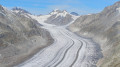
A superb alpine hike taking you from the village of Fiescheralp to the summit of the Eggishorn. You’ll go through the Tälli Tunnel and walk along the north face of the Tälligrat. At the summit of the Eggishorn, you’ll enjoy a breathtaking view of the Aletsch Glacier.
As the route takes you through a tunnel beneath the Tälligrat rather than climbing to the summit and then descending, the elevation gain is overestimated: allow for around 250 m less for the actual elevation gain, both ways.
Capanna Piansecco – Obergesteln
 11.78 mi
+2,028 ft
-4,055 ft
7h 10
Difficult
Departure from Bedretto (Ticino)
11.78 mi
+2,028 ft
-4,055 ft
7h 10
Difficult
Departure from Bedretto (Ticino)
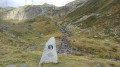
This fourth stage of the Vier Quellen Weg will take you from Cappana Piansecco to Obergesteln. During the day, you’ll discover the source of the Ticino (Tessin). An engraved marker indicates this source. You’ll cross the Nufenen Pass, which will take you to Obergesteln, a charming little village on the banks of the Rhône.
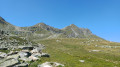
The Eggishorn from the Bettmerhorn top station
 8.50 mi
+2,110 ft
-4,462 ft
5h 45
Difficult
Departure from Betten (Valais)
8.50 mi
+2,110 ft
-4,462 ft
5h 45
Difficult
Departure from Betten (Valais)
A very beautiful route starting from the upper Bettmerhorn station. After a panoramic viewpoint right at the start of the hike, you’ll make your way to the second summit, which offers the widest panorama of the Aletsch Glacier.
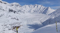
 Moosfluh – Riederfurka – Bettmeralp
 4.82 mi
+312 ft
-1,634 ft
3 hrs
Moderate
Departure from Riederalp (Valais)
4.82 mi
+312 ft
-1,634 ft
3 hrs
Moderate
Departure from Riederalp (Valais)
A superb panoramic hike, with a remarkable view of the Aletsch Glacier. On arriving at Riederfurka, you will notice Villa Cassel.
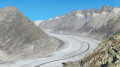
Route around Fiescheralp to see the Aletsch Glacier
 13.28 mi
+5,810 ft
-5,007 ft
2 days
Difficult
Departure from Betten (Valais)
13.28 mi
+5,810 ft
-5,007 ft
2 days
Difficult
Departure from Betten (Valais)
A stunning alpine hike taking you to the two most beautiful viewpoints over the Aletsch Glacier. In the evening, you’ll enjoy the tranquillity of these two villages, which also offer superb views of the Valais’ 4,000-metre peaks: the Dom, the Matterhorn and the Weisshorn
From Bettmeralp to Fiecheralp via the Bettmerhorn Bergstation
4.75 mi
+2,313 ft
-1,483 ft
4h 10
Difficult
Departure from Betten (Valais)
A very beautiful alpine hike that will take you from the village of Bettmeralp to the Bettmerhorn viewpoint. You’ll enjoy a magnificent view of the Aletsch Glacier. The rest of the route, which is downhill, will take you to Fiescheralp.
Renggpass - From Stansstad to Hergiswill
4.82 mi
+1,772 ft
-1,709 ft
3h 45
Moderate
Departure from Hergiswil (Nidwalden)
Starting from Stansstad railway station, you go straight up above the motorway, thus tackling the steepest part.
Then, along the ridge overview of the Alpnachersee lake for a good third of the way, glimpses of views and appreciating the 400-500m ascent: Probably a good time to rest for a lunch break before the Renggpass.
The final part is downhill all the way to the village and train station of Hergiswil, passing through fields of cows, farms & green pasture.
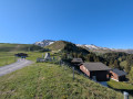
The Klewenstock circuit
 1.85 mi
+846 ft
-997 ft
1h 35
Easy
Departure from Beckenried (Nidwalden)
1.85 mi
+846 ft
-997 ft
1h 35
Easy
Departure from Beckenried (Nidwalden)
A very simple hike that takes you around the Klewenstock mountain. This walk allows you to admire the scenery and the flowers, with lovely little signs to help you learn to identify them!
Beckenried – Seelisberg
8.09 mi
+2,799 ft
-1,693 ft
6h 10
Moderate
Departure from Beckenried (Nidwalden)
This sixth stage will take you from Beckenried (NW) to Seelisberg (UR). The route follows the road along the lake to Risleten. The path continues with a fairly steep climb through the Risletenschlucht gorge, where the Choltalbach rushes down to the lake, creating spectacular waterfalls. The route then crosses the Stützberg and passes through Volligen. The final stretch to Seelisberg involves one last climb across meadows.