


 Country:

 City:
City:


The start and finish of this hike are at the Betten–Bettmeralp–Bergstation cable car station.
The route described starts at the Bettmerhorn top station.
From the Bettmeralp top station, follow the main road (Hauptstrasse) north-eastwards to the junction with Seestrasse. At the end of the village, just before the tennis courts, head back to the Bettmerhorn cable car lower station – a walk of about 1 km. At the Bettmerhorn station, buy a single ticket.
(S) From the Bettmerhorn top station, head towards the ‘Point of View’ viewing platform on the Bettmerhorn Glacier.
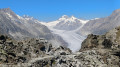
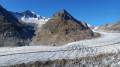
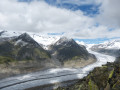
(1) Enjoy the panoramic view of the Aletsch Glacier. Head back towards the station until you reach the signposts for the descent. Turn right towards Moosfluh. Facing west, begin the descent until you reach a flat area.
(2) Turn left and follow a path that winds around boulders. You’ll reach a junction.
(3) Keep to the left and begin a bend towards the east, staying close to the foothills of the Bettmerhorn. You’ll soon rejoin a track leading down towards Bättmer-Hitta.
(4) Take the path on the right and continue the descent to a fork marked by two menhir-shaped rocks.
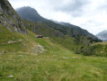
(5) Take the north-facing path and begin a steep climb through the mountain pastures to reach the top of the “Fiesch” chairlift.
(6) Continue the ascent across scree to reach the Elselicka Pass.
(7) From the pass, follow the path along the Fiescherhorli ridge to the platform housing the antennas.
(8) Descend slightly towards the Eggishorn cable car terminus.
(9) Continue to the Horli-Hitta restaurant.
(10) Just past the restaurant, the ascent to the summit begins. Take a well-maintained path, which is fairly wide at first and then winds its way up to the summit of the Eggishorn.
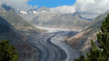
(11) Enjoy the panoramic view of the Aletsch Glacier and the surrounding peaks. Descend via the same route and, just before the restaurant, turn off towards the ‘Point of View’ viewing platform on the Eggishorn Glacier.
(12) Enjoy the panoramic view of the Aletsch Glacier one last time.
(9) Head back towards the cable car station and walk down to the junction marked by two menhir-shaped rocks.
Take the southern branch to join a track suitable for jeeps.
Turn right and join the path that runs alongside Lake Schönbodensee.
(14) Walk along the lake until you reach the second sign for Bättmer-Hitta.
(15) Head down towards Bättmer-Hitta.
(16) Heading south-west, take the track to the entrance to the village of Bettmeralp, walk through the whole village and reach the Bettmeralp Bergstation. (E)
 Visorando Member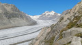
 Average
