


Mürren – Lauterbrunnen


Depart from the Mürren campsite to visit Lauterbrunnen. You can take a stroll around the town and its surroundings before heading to Lauterbrunnen station to return to Geneva. It’s a quiet day to relax.
This walk is part of a multi-day hike: Treck : 4 jours/ 3nuits en Suisse dans l'Oberland Bernois
Details
Creation:
Last update:
Last review:
–
–
-
 Activity: Walking
 -
 Distance: 5.15 mi
 -
 Average duration: 2h 50
 -
 Difficulty: Difficult
 -
-
 Back to start: No
 -
 Ascent: + 528 ft
 -
 Descent: - 3,291 ft
 -
-
 Highest point: 5,446 ft
 -
 Lowest point: 2,602 ft
-
 Country:
Switzerland
Country:
Switzerland
-
 Area: Alps
 -
 City:
Lauterbrunnen
City:
Lauterbrunnen -
 Start: N 46.558016° / E 7.890841°
 -
 End: N 46.596841° / E 7.908291°
 -


 Hour-by-hour weather


Waypoints
- S : mi 0 - alt. 5,397 ft - Schilthornbahn
- 1 : mi 0.14 - alt. 5,384 ft - Mürren
- 2 : mi 1.34 - alt. 5,344 ft - Fork in the road
- 3 : mi 2.61 - alt. 4,190 ft - Staubbach
- 4 : mi 3.43 - alt. 3,051 ft - Fork in the road
- 5 : mi 3.73 - alt. 2,680 ft - Lauterbrunnen
- 6 : mi 4.32 - alt. 2,605 ft - Campsite
- E : mi 5.15 - alt. 2,621 ft - Railway
Other walks in the area
Hundshubel – Mürren
 Visorando Member4.71 mi
+256 ft
-2,333 ft
2h 25
Visorando Member4.71 mi
+256 ft
-2,333 ft
2h 25
 Moderate
Departure from Lauterbrunnen (Canton of Bern)
Moderate
Departure from Lauterbrunnen (Canton of Bern)
This hike takes you back to the town, which is well worth a visit. There are several campsites to choose from. Much of the route is downhill. Water is available along the way if needed. If the descent is too steep, you can take public transport for part of the way.
Circular Lauberhorn from Kleine Scheidegg
 2.80 mi
+1,283 ft
-1,283 ft
2h 25
Moderate
Departure from Lauterbrunnen (Canton of Bern)
2.80 mi
+1,283 ft
-1,283 ft
2h 25
Moderate
Departure from Lauterbrunnen (Canton of Bern)
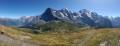
The Lauberhorn is a modest peak, yet legendary amongst downhill skiers, situated above Kleine Scheidegg. It offers a superb panorama of the Grindelwald and Lauterbrunnen valleys, but above all of the majestic trio formed by the Eiger, the Mönch and the Jungfrau.
Griesalp – Hundshubel
5.09 mi
+4,052 ft
-1,250 ft
5h 50
Difficult
Departure from Reichenbach im Kandertal (Canton of Bern)
Hike with 1,300 metres of elevation gain: be warned, it’s going to be tough. It’s a challenging day, all uphill from the hotel to the campsite. We’ll arrive in the heart of the countryside. We’ll need to set up camp before having a nap and getting out the card games (not forgetting the food).
From Schynige Platte to First via Faulhorn
10.94 mi
+3,553 ft
-2,956 ft
8h 05
Difficult
Departure from Gsteigwiler (Canton of Bern)
The Faulhorn rises to an altitude of 2,680 metres. It offers a 360-degree view of the Alps, with some peaks over 4,000 metres high, such as the Grosses-Fiescherhorn. The two main access points to the Folhorn are via the Schynige Platte or First. However, with good logistics (see practical information), it is also possible to make a one-way trip and return by public transport. The hike is a gradual climb, but offers splendid views of the first Alpine glaciers and other peaks in the surrounding area. There are restaurants where you can eat and take a break in pleasant surroundings.
Kiental - Kandersteg
 12.21 mi
+4,098 ft
-3,360 ft
9h 10
12.21 mi
+4,098 ft
-3,360 ft
9h 10
 Very difficult
Departure from Reichenbach im Kandertal (Canton of Bern)
Very difficult
Departure from Reichenbach im Kandertal (Canton of Bern)
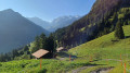
This second stage will take you from Kiental to Kandersteg. After a fairly challenging climb to Ramslauenen, you will cross the beautiful Horewald forest and then overlook the Kander valley. You will enjoy more views of Lake Thun and the Niesen. You will also have a bird's eye view of the trains on the Lötschberg line. Kandersteg is the station where vehicles board the shuttle trains before the Lötschberg railway tunnel.
Interlaken - Sigriswil via the Panorama Rundweg Thunersee
 10.66 mi
+3,028 ft
-2,257 ft
7h 30
Difficult
Departure from Unterseen (Canton of Bern)
10.66 mi
+3,028 ft
-2,257 ft
7h 30
Difficult
Departure from Unterseen (Canton of Bern)
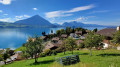
Interlaken, a cosmopolitan town, is the starting point for this tour around Lake Thun. You’ll be able to admire the three famous peaks of the Bernese Oberland: the Eiger, the Mönch and the Jungfrau. This beautiful route follows the northern shore of the lake. You’ll look out over the lake near the Saint Béat Caves, then pass through the pretty village of Merligen. You’ll enjoy stunning views of both the lake and the peaks, such as the Niederhorn and the Rothorn in Sigriswil.
Panorama Rundweg Thunersee
 40.03 mi
+7,106 ft
-7,159 ft
4 days
Moderate
Departure from Unterseen (Canton of Bern)
40.03 mi
+7,106 ft
-7,159 ft
4 days
Moderate
Departure from Unterseen (Canton of Bern)
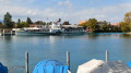
Four-day panoramic tour around Lake Thun. This route offers numerous views of the lake and the peaks of the Bernese Oberland. In good weather, you can see the Eiger, Mönch and Jungfrau mountains, as well as the Schreckhorn. You will also discover the charm of the towns along the way. Interlaken, at the eastern end of Lake Thun, is the starting point for this itinerary.
The Brienzersee viewpoints between Harderkulm and Rothorn
 13.56 mi
+6,942 ft
-3,986 ft
8 hrs
Very difficult
Departure from Unterseen (Canton of Bern)
13.56 mi
+6,942 ft
-3,986 ft
8 hrs
Very difficult
Departure from Unterseen (Canton of Bern)
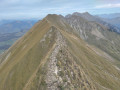
This hike follows the ridge path along the northern shore of Lake Brienz for its entire length, from Harderkulm hill to the summit of the Brienzer Rothorn. The route offers panoramic views almost throughout, and is relatively quiet except at the start and finish (accessible by funicular). There are several slightly vertiginous sections, but no real technical difficulty. The main challenge is the cumulative elevation gain, which ends up being considerable, as the jagged ridge involves many successive ascents and descents, often steep.
For more walks, use our search engine .
The GPS track and description are the property of this route's author. Please do not copy them without permission.

