Country:

 City:
City:


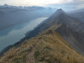
Start at Harderkulm station, the upper station of the Harder funicular. See the ‘Practical Information’ section for details on how to reach the start and finish points.
(S) Head west-south-west towards a restaurant. In front of it, take a sharp right-hand bend. Pass several benches and children’s play areas and continue straight on along the path which climbs into the forest, heading north-east (marked with red and white signs).
(1) At a fork in the road, keep left towards the Augstmatthorn.
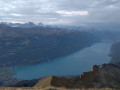
(2) At the next junction, if you wish, turn sharply left and you’ll soon reach Wannichnubel. It is neither the highest nor the most spectacular peak on this walk, but it is the only one from which you can still see Lake Thun.
(3) Retrace your steps back to the previous junction.
(2) Resume the north-easterly path. Carry straight on, ignoring a few paths leading down on either side.
(4) At a fork in the road directly below the summit of Roteflue, keep left and continue north-east. The path emerges from the forest onto a mountain pasture and then joins the ridge.
(5) At another junction, carry on straight ahead along the ridge path. Go round the summit of Schönbüel on the left. Continue along the ridge. Go round an unnamed peak (elevation 1849) on the left and you’ll soon reach another junction.
(6) Continue straight on along the ridge and, at the Fork in the road that appears shortly afterwards, keep to the right to climb the Suggiture, which is clearly visible from the mountain pasture.
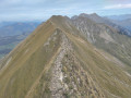
(7) Continue north-east along the ridge to the summit of the Augstmatthorn.
(8) Descend slightly on the other side (blue and white markings) and climb back up to reach the summit of Wytlouwihoren quickly.
(9) Continue north-east, still along the ridge (the markings fade out but the path remains perfectly visible and passable). Make several short descents and ascents to reach the summit of Gummhoren.
(10) Descend eastwards, then head north-east again to reach the summit of Schnierenhireli.
(11) Continue north-east along the ridge and descend. At a junction (elevation 1918), carry straight on and climb to the summit of Ällgäuwhoren.
(12) Descend and continue along the ridge to the summit of Tannhorn.
(13) Continue along the ridge, first north-east then east-north-east, with a further series of ascents and descents and a few exposed sections. This leads to the Chruterepass.
(14) Carry on straight ahead and you’ll come across red and white markings again. The path veers away from the ridge at times, first to the north and then to the south.
(15) At a fork in the road, just before the funicular station visible below, take the path that climbs to the left.
(16) At the junction that you’ll soon come to, turn sharply left and head for the summit of the Schongütsch, which offers a close-up view of the Brienzer Rothorn.
(17) Head back down the same path to the previous junction.
(16) Continue straight downhill to the funicular station (Brienz Rothorn Bahn).
(E) Walk past the station and the inn and continue eastwards. Climb the Brienzer Rothorn, the highest point in the canton of Lucerne, which offers magnificent views. N.B. The area is naturally very busy, given the direct access via the funicular or a cable car.
(18) Retrace your steps back to the funicular station (E).
 Visorando Member
 Difficult
 Moderate