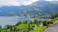
Along Lake Lucerne

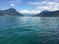
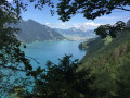
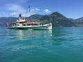
A 10 km walk (one-way) along the lake and through the forest, returning by boat.

Details

n°11476696
Creation:
Last update:
Last review:
  • Walking
    Activity: Walking
  • ↔
    Distance: 6.32 mi
  • ◔
    Average duration: 4h 20 
  • ▲
    Difficulty: Moderate

  • ⚐
    Back to start: No
  • ↗
    Ascent: + 1,644 ft
  • ↘
    Descent: - 1,696 ft

  • ▲
    Highest point: 2,398 ft
  • ▼
    Lowest point: 1,424 ft

Photos

Description of the walk

Park in the Beckenried car park (flat rate of 5 CHF per day).

(S) Head down to the lakeside.

(1) Continue to the right, along the road that runs alongside the lake. Take care.

(2) Turn left at the junction onto the quiet road by the lake.

(3) Take the steps leading down to the left.

(4) Start the climb up another flight of steps.

(5) Take the new, wide path on the right, which turns into a road.

(6) Turn left onto the path through the fields.

(7) Join the road and follow it down to the left to reach the boat station.

(E) Take the boat running between Treib, Gersau and Beckenried (cost: 20 CHF per person). Make sure you check the boat timetables before setting off on your walk.

Waypoints

  1. S : mi 0 - alt. 1,483 ft - Beckenried car park
  2. 1 : mi 0.14 - alt. 1,434 ft - Crossroads. Lakeside
  3. 2 : mi 0.46 - alt. 1,430 ft - Stairs
  4. 3 : mi 2.35 - alt. 1,631 ft - Stairs
  5. 4 : mi 2.81 - alt. 1,480 ft - Path
  6. 5 : mi 3.89 - alt. 2,054 ft - Route
  7. 6 : mi 4.7 - alt. 2,159 ft - Path through the fields
  8. 7 : mi 5.74 - alt. 1,677 ft - Route
  9. E : mi 6.32 - alt. 1,434 ft - Treib boat station

Notes

No particular difficulty. The climb is a bit steep but manageable. The shade provided by the trees, on a sunny day, is pleasant for just over half the route.
Sturdy footwear is recommended.

Worth a visit

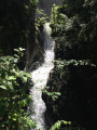
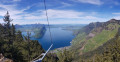
Stunning views from the lake and also from higher up. There are also a few waterfalls to see up close along the way.

Reviews and comments

4.2 / 5
Based on 2 reviews

Reliability of the description
3.5 / 5
Ease of following the route
4 / 5
Route interest
5 / 5
Marduel
Marduel

Overall rating : 4.3 / 5

Date of your route : Apr 12, 2025
Reliability of the description : ★★★★☆ Good
Ease of following the route : ★★★★☆ Good
Route interest : ★★★★★ Very good
Very busy route : No

This hike was magnificent, but we did it the other way round: we went to Treib by boat from Beckenried and then hiked from Treib to Beckenried. I found it more interesting in terms of the scenery and there was none of the stress of missing the return boat.

Machine-translated

MASSONNEAU
MASSONNEAU

Overall rating : 4 / 5

Date of your route : Aug 13, 2023
Reliability of the description : ★★★☆☆ Average
Ease of following the route : ★★★★☆ Good
Route interest : ★★★★★ Very good
Very busy route : Yes

Magnificent walk in a sumptuous landscape and a very pleasant boat trip back: Thank you.
Some inaccuracies in the description made it a bit difficult to get started:
- Parking: which one? Just say "cable car parking" and you'd have found it straight away.
- The GPS coordinates were all wrong. Our 4 smartphones gave coordinates that were quite different from those in the guidebook (sorry, I didn't think to write down the right ones).
- Right from the start, you can see that the route is signposted in red and white + yellow arrows, but when we followed the signposting we had the impression that we were following a different route to the one described from the top of the 2nd staircase, climbing higher than described (734m) and only rejoining the road further east after a long descent along a path that was fortunately very easy. Should we have gone straight on at the waterfall, leaving the red and white markings and arrows?
Alain Massonneau

Machine-translated

Other walks in the area

For more walks, use our search engine .

The GPS track and description are the property of this route's author. Please do not copy them without permission.