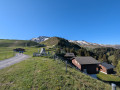
Melchsee-Frutt

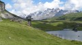
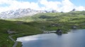
A lovely walk in Switzerland with views of the Titlis.

Details

n°350285
Creation:
Last update:
Last review:
  • Walking
    Activity: Walking
  • ↔
    Distance: 6.88 mi
  • ◔
    Average duration: 4h 20 
  • ▲
    Difficulty: Moderate

  • ⚐
    Back to start: Yes
  • ↗
    Ascent: + 1,335 ft
  • ↘
    Descent: - 1,345 ft

  • ▲
    Highest point: 7,316 ft
  • ▼
    Lowest point: 6,198 ft

Photos

Description of the walk

Start from the Stöckalp cable car top station.

(S/E) On exiting the cable car, take the path leading off to the right to go round Melchsee (the lake) on the right-hand side. Cross a track and head for a crossroads at the north-western tip of the lake.

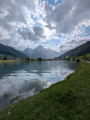
(1) Walk along the left-hand side of Lake Melchsee on a clearly marked path.

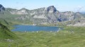
(2) When you reach the base of the ski lift, turn right (south) towards Balmeregghorn and Erzeg. The path winds its way beneath the ski lift cables. Continue up this steep ascent to the summit of Balmeregghorn (magnificent views of the Swiss glaciers and the entire Melchsee-Frutt plateau).

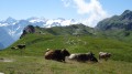
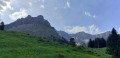
(3) From the summit, head north-east towards Tannensee, following the ridge path which is clearly visible along its entire length. The path descends gently. To your right, views of the glaciers; to your left, views across the entire Melchsee-Frutt plateau. Pass through pastures.

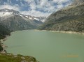
(4) Once you reach the heights above Tannensee, take the path on the left which leads to the southern shore of the lake. Follow this shore with the lake on your right, heading towards Melchsee.

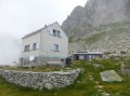
(5) At the south-western tip of the lake, by the dam, carry on straight ahead down the gentle slope towards Melchsee-Frutt (west). From here, you may come across the Früttli Zug (a small train, subject to a fare, which allows non-walkers to enjoy the alpine lakes). Pass the start of the cable car to Bonistock on your right, follow the eastern shore of Melchsee and walk past the chapel.

(6) Then cross the River Tannenbach and continue along the lake on your left-hand side.

(7) Take the ‘Panoramalift’ (free), which offers a view of the entire walk (those who do not wish to take the lift can continue along the path that runs alongside the lake; both routes eventually meet). Upon exiting the Panoramalift, continue to the left then turn right to return to the starting point (S/E).

Waypoints

  1. S/E : mi 0 - alt. 6,319 ft - Stöckalp cable car top station
  2. 1 : mi 0.39 - alt. 6,217 ft - Crossroads
  3. 2 : mi 1.26 - alt. 6,234 ft - Balmeregg cable car
  4. 3 : mi 2.59 - alt. 7,316 ft - Balmeregghorn
  5. 4 : mi 4.53 - alt. 6,601 ft - Junction towards Tannensee
  6. 5 : mi 5.15 - alt. 6,486 ft - Tannensee
  7. 6 : mi 6.33 - alt. 6,211 ft - The chapel
  8. 7 : mi 6.6 - alt. 6,263 ft - Panoramalift
  9. S/E : mi 6.88 - alt. 6,322 ft - Stöckalp cable car top station

Notes

A hike where the route is clearly visible from start to finish, no matter where you are. Climb up to a ridge to walk around the plateau.
A mid-mountain walk; ensure you have suitable equipment for all weather conditions. Best undertaken in fine weather to enjoy magnificent views.

Price for the pedestrian crossing via the cable car: 25 CHF.

Worth a visit

Views of the Alpine glaciers and the Titlis.
For geocaching enthusiasts, there are a few caches to find around Melchsee.

Reviews and comments

4.2 / 5
Based on 2 reviews

Reliability of the description
3 / 5
Ease of following the route
4.5 / 5
Route interest
5 / 5
User 5889130

Overall rating : 4 / 5

Date of your route : Sep 12, 2026
Reliability of the description : ★★★☆☆ Average
Ease of following the route : ★★★★☆ Good
Route interest : ★★★★★ Very good
Very busy route : No

It is not always possible to drive up to the resort. There are specific times for this – please check their website for details.
We paid thirty-nine Swiss francs for a return journey on the cable car.
Bear in mind that the climb up to the Balmerreghorn is quite challenging, especially if you’re not used to hiking at high altitudes.
Apart from that, the views are magnificent and the trails are lovely.

Machine-translated

Kindbeiter
Kindbeiter

Overall rating : 5 / 5

Date of your route : Oct 01, 2021
Reliability of the description : Not used / Not applicable
Ease of following the route : ★★★★★ Very good
Route interest : ★★★★★ Very good
Very busy route : No

Superb walk with a refreshment break about 2/3 of the way through.
Well signposted route

Machine-translated

Other walks in the area

For more walks, use our search engine .

The GPS track and description are the property of this route's author. Please do not copy them without permission.