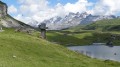
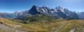
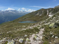
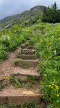
Dossenhütte from Rosenlaui

A return walk along the access route to the CAS Dossenhütte hut. Please note that, although this is a signposted path,
- this route requires a minimum level of experience in navigating rough or exposed terrain, and you must not be afraid of heights.
- Whilst a number of tricky or exposed sections are equipped with cables, ladders or crampons, this is not always the case, and some sections leave no room for a misstep.

- To be avoided at all costs in wet weather...

Details

105796676
Creation:
Last update:
Last review:
  • Walking
    Activity: Walking
  • ↔
    Distance: 5.74 mi
  • ◔
    Average duration: 6h 25 
  • ▲
    Difficulty: Very difficult

  • ⚐
    Back to start: Yes
  • ↗
    Ascent: + 4,373 ft
  • ↘
    Descent: - 4,364 ft

  • ▲
    Highest point: 8,661 ft
  • ▼
    Lowest point: 4,439 ft

Description of the walk

(S/E) From the Rosenlaui car park, follow the route to the CAS Dossenhutte mountain hut. The path is marked in red and white as far as the junction.

(1) Continue to the right and follow the blue and white markings to the hut.

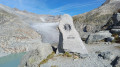
(2) Further up, the path appears to disappear, but in fact climbs straight up the slope to reach a weak point in the lateral moraine. The markings may disappear or seem inconsistent in this unstable area, but they reappear once you reach the weak point in the moraine.

(3) This is where the first real difficulties begin: exposed sections, cables and other ladders.

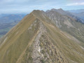
(4) You finally reach the ridge line, which you must follow to the mountain hut visible further up. It is on this final stretch that the most vertiginous sections are found.

(5) Return to the starting point via the same route. The descent should not be underestimated; like the ascent, it requires vigilance and concentration (S/E).

Waypoints

  1. S/E : mi 0 - alt. 4,442 ft - Rosenlaui car park
  2. 1 : mi 0.79 - alt. 5,486 ft - Engelhornhütte junction
  3. 2 : mi 1.69 - alt. 6,145 ft - Foot of the moraine
  4. 3 : mi 2.06 - alt. 6,808 ft - Start of the cables
  5. 4 : mi 2.64 - alt. 8,061 ft - North Face
  6. 5 : mi 2.87 - alt. 8,648 ft - Dossenhütte mountain hut
  7. S/E : mi 5.74 - alt. 4,439 ft - Rosenlaui car park

Notes

Official CAS rating: T4.

Access by car is only possible from Meiringen.
Parking in this valley is subject to a charge; payment is made at a machine – a sort of toll booth – at the bottom of the valley.

The starting point is also accessible by bus.

Description in German on the CAS website:

Worth a visit

You can take the opportunity to visit the Rosenlaui Glacier Gorge, or even start the ascent by passing through the gorge.
It’s beautiful (especially when the water levels are high), well-maintained, somewhat touristy and, of course, subject to a charge.

Other walks in the area

For more walks, use our search engine .

The GPS track and description are the property of this route's author. Please do not copy them without permission.