Refine your search for walks in Sarcelles
Sarcelles walks
 The Forts of Écouen and Domont loop trail
 Visorando Member
 11.05 mi
 +1,053 ft
 -1,043 ft
 6h 00
6h 00
 Moderate
 Departure from Écouen (Val-d'Oise)
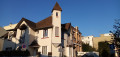
A walk starting from Écouen, passing through Piscop and skirting Sarcelles-Saint-Brice and Villiers-le-Bel, between the two forts of Écouen and Domont, the Écouen Regional Forest and the Montmorency State Forest, two churches, castles, urban areas, some farmland and deciduous woodland.
Ecouen Ezanville
7.00 mi
+233 ft
-256 ft
3h 25
Moderate
Departure from Écouen (Val-d'Oise)
Country walk through woods, town and plains, starting from Ecouen Castle.
The Montmorency Forest in Écouen Ézanville
6.97 mi
+584 ft
-587 ft
3h 45
Moderate
Departure from Ézanville (Val-d'Oise)
From the Montmorency Forest via Saint-Brice-sous-Forêt, a walk through the woodland, with a river and fields: it feels like being in the countryside just half an hour from Paris.
From Notre-Dame Church in Deuil to Dino Park in Montmorency
 1.66 mi
+125 ft
-128 ft
0h 50
1.66 mi
+125 ft
-128 ft
0h 50
 Easy
Departure from Deuil-la-Barre (Val-d'Oise)
Easy
Departure from Deuil-la-Barre (Val-d'Oise)
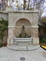
This circular takes walkers along the paths of the Deuil coastline through areas that are sometimes wooded, sometimes more open, with beautiful views of the capital.Starting from Notre-Dame Church (Place des Victimes du V2), halfway through the walk, you will cross Dino Park in Montmorency, a place steeped in history that was redeveloped and inaugurated in July 2025.This route is offered by the association Les Sentiers de la Côte de Deuil.
On the paths of the Côte de Deuil
 1.88 mi
+144 ft
-144 ft
1h 00
Easy
Departure from Deuil-la-Barre (Val-d'Oise)
1.88 mi
+144 ft
-144 ft
1h 00
Easy
Departure from Deuil-la-Barre (Val-d'Oise)
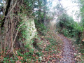
This walk allows you to explore the Côte de Deuil, a vast natural area located just 300 m from the town centre. Formerly an agricultural area, this green space is criss-crossed by numerous paths, the oldest of which date back to Gallic times. The walk is fully signposted in the same style as classicGR® trails but in purple.
You can also view a 3D tour of the walking route on YouTube or on the Côte des Sentiers website
From the Galatea Statue to the Church of Notre-Dame de Deuil
 1.34 mi
+49 ft
-0 ft
0h 40
Easy
Departure from Deuil-la-Barre (Val-d'Oise)
1.34 mi
+49 ft
-0 ft
0h 40
Easy
Departure from Deuil-la-Barre (Val-d'Oise)
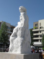
This route across Deuil-la-Barre from south to north connects Place de la Nation in the renovated Galathée district to Place de l'Église in the historic town centre. It takes about 40 minutes at a leisurely pace.This pleasant walk through numerous public gardens takes you to Place de l'Église (or Place de Victimes du V2), which is also the starting point for several hikes on the Côte de Deuil trails.This route is recommended by the association Les Sentiers de la Côte de Deuil.
Along the water’s edge through various parks north of Paris
10.99 mi
+180 ft
-141 ft
5h 15
Moderate
Departure from Épinay-sur-Seine (Seine-Saint-Denis)
A walk that follows the water’s edge, starting from Épinay-sur-Seine station, with a view of Fort de la Briche from the Île Saint-Denis Departmental Park. The route passes by the Basilica of Saint-Denis, then through Madeleine Riffaud Park, before heading into the Coulée Verte green corridor alongside the ponds of the Georges Valbon Departmental Park.
In the footsteps of the Refoulons
 1.97 mi
+246 ft
-3 ft
1h 05
Easy
Departure from Enghien-les-Bains (Val-d'Oise)
1.97 mi
+246 ft
-3 ft
1h 05
Easy
Departure from Enghien-les-Bains (Val-d'Oise)
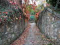
For nearly 90 years, the Refoulons railway line shaped the lives of the people of Enghien and Montmorency. This route invites you to take a trip back in time. The main appeal of this route lies in its historical significance: following the route of this old railway line, where a few remnants still remain here and there. Those who love railway relics will truly enjoy this walk.
Circular from station to station through the Montmorency Forest and the Château de la Chasse.
4.42 mi
+407 ft
-407 ft
2h 30
Easy
Departure from Bouffémont (Val-d'Oise)
A circular loop from station to station accessible via line H. Starting from the town of Bouffémont, it takes you into the Montmorency Forest and on to the Château de la Chasse and its pond. Before and after the château, the route follows various forest trails in the shade of century-old trees.
From Bouffémont to Taverny via the Montmorency Forest
 13.25 mi
+971 ft
-1,020 ft
6h 55
13.25 mi
+971 ft
-1,020 ft
6h 55
 Difficult
Departure from Bouffémont (Val-d'Oise)
Difficult
Departure from Bouffémont (Val-d'Oise)
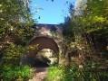
A very beautiful route from station to station in the Montmorency Forest, based in part on four themed trails: “Le Sentier des Lisières”, “Le Sentier de la Reine Hortense” and “Le Chemin des Philosophes” described on the Saint-Leu-la-Forêt tourist information website, plus “Taverny par les Sentes”. Thanks to a number of information boards, the route allows you to trace the region’s ancient and more recent history, admire many of its most interesting sites, and even engage in a bit of philosophy.
It can easily be shortened to 18 km by avoiding the return trip to the Statue of Notre-Dame de France at the start of the walk.
The Forêt de Montmorency and its Southwest border
 9.50 mi
+778 ft
-768 ft
5h 05
Moderate
Departure from Montlignon (Val-d'Oise)
9.50 mi
+778 ft
-768 ft
5h 05
Moderate
Departure from Montlignon (Val-d'Oise)
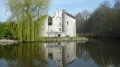
A walk in the larger Val d'Oise forest, located only 20 kilometres north of Paris. Chestnut trees are plentiful in this hilly area with ponds and historical sites. A walk to the southwest border will let you discover some interesting features of the local heritage.
The Château de la Chasse
 6.27 mi
+446 ft
-443 ft
3h 15
Moderate
Departure from Montlignon (Val-d'Oise)
6.27 mi
+446 ft
-443 ft
3h 15
Moderate
Departure from Montlignon (Val-d'Oise)
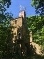
Half-day hike of moderate difficulty from Château de la Chasse to Montlignon.
Château de la Chasse
 4.43 mi
+315 ft
-315 ft
2h 20
Easy
Departure from Montlignon (Val-d'Oise)
4.43 mi
+315 ft
-315 ft
2h 20
Easy
Departure from Montlignon (Val-d'Oise)
Short hike with a relatively low elevation gain over 7 km in the Montlignon Forest.
Moderator's addition on 08/03/2021: the description does not seem to be sufficient to follow this route. A GPS or the Visorando app may be useful
A stroll through the Courneuve Departmental Park
 8.78 mi
+302 ft
-315 ft
4h 20
Moderate
Departure from La Courneuve (Seine-Saint-Denis)
8.78 mi
+302 ft
-315 ft
4h 20
Moderate
Departure from La Courneuve (Seine-Saint-Denis)
The Courneuve Departmental Park (Parc Georges Valbon) offers a wide range of leisure facilities, but it is also an area renowned for its ecological riches. This suggested stroll allows you to discover its many facets and appreciate the beauty of its landscapes.
Historical route through Saint-Denis and walk along the canal
 3.91 mi
+62 ft
-13 ft
1h 50
Easy
Departure from Saint-Denis (Seine-Saint-Denis) (Seine-Saint-Denis)
3.91 mi
+62 ft
-13 ft
1h 50
Easy
Departure from Saint-Denis (Seine-Saint-Denis) (Seine-Saint-Denis)
The first stage of this urban journey consists of two distinct sections. The first section, the historical trail, invites us to trace the passage of time from the legend of Saint-Denis and the city’s origins right up to the 21st century, with the help of some twenty richly documented information points. Next, we follow the Canal Saint-Denis along its pedestrian quay back to Paris.
From the Basilica of Saint-Denis to Notre-Dame de Paris
 17.04 mi
+554 ft
-528 ft
5 days
Easy
Departure from Saint-Denis (Seine-Saint-Denis) (Seine-Saint-Denis)
17.04 mi
+554 ft
-528 ft
5 days
Easy
Departure from Saint-Denis (Seine-Saint-Denis) (Seine-Saint-Denis)
This urban itinerary, comprising five short stages, links two masterpieces of Gothic art in the Île-de-France region. It offers an opportunity to discover a rich and diverse heritage: medieval remains, 17th-century mansions, industrial and modern architecture, street art, and more. The purely urban sections are interspersed with a walk along the Canal Saint-Denis and a stroll through several parks and gardens, including those of La Villette and the Buttes Chaumont.
From Saint-Denis to Le Bourget via Georges Valbon Park
 5.93 mi
+66 ft
-33 ft
2h 45
Easy
Departure from Saint-Denis (Seine-Saint-Denis) (Seine-Saint-Denis)
5.93 mi
+66 ft
-33 ft
2h 45
Easy
Departure from Saint-Denis (Seine-Saint-Denis) (Seine-Saint-Denis)
Starting from one of the masterpieces of Gothic art in Île-de-France, the Basilica of Saint-Denis, this urban route crosses a vast park where lawns alternate with flowerbeds, woodland and lakes. There is a commemorative aspect to the commune of Le Bourget, which was the scene of fierce fighting in 1870–1871.
From Épinay to the Pont de Bezons via Argenteuil and Parc Lagravère
 5.92 mi
+105 ft
-131 ft
2h 50
Easy
Departure from Épinay-sur-Seine (Seine-Saint-Denis)
5.92 mi
+105 ft
-131 ft
2h 50
Easy
Departure from Épinay-sur-Seine (Seine-Saint-Denis)
An urban route that starts on the towpath along the banks of the Seine and then climbs higher into Argenteuil. After crossing to the other bank, the route follows the river through Parc Lagravère.
Île Saint-Denis
 3.73 mi
+26 ft
-52 ft
1h 45
Easy
Departure from Épinay-sur-Seine (Seine-Saint-Denis)
3.73 mi
+26 ft
-52 ft
1h 45
Easy
Departure from Épinay-sur-Seine (Seine-Saint-Denis)
In the footsteps of the Impressionists, an urban route mostly along the banks of the Seine, through the Parc Départemental de l'Île Saint-Denis. At the end of the route, the Basilica of Saint-Denis adds a superb touch of heritage to this short walk.
From Saint-Denis to Asnières-sur-Seine
8.75 mi
+30 ft
-30 ft
4h 05
Moderate
Departure from Saint-Denis (Seine-Saint-Denis) (Seine-Saint-Denis)
A walk from station to station around Villeneuve-la-Garenne, along the Seine and then to Île Saint-Denis via the park’s water sports centre, passing by the Chantereine Farm (visiting hours are in the afternoon only); a walk without too much distance or elevation gain.
On the Argenteuil plateau, where the mills meet
9.24 mi
+889 ft
-784 ft
5h 00
Difficult
Departure from Épinay-sur-Seine (Seine-Saint-Denis)
A route with a slight elevation gain, starting at the banks of the Seine and the railway line, then climbing towards Parc de la Butte d'Orgemont. Pass by Moulin d'Orgemont and Moulin de Sannois, through the Buttes du Parisis regional forest and Fort de Cormeilles.
⚠️ Please note! This hike is not marked, so be sure to follow the description, map and compass.
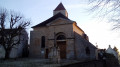
A corner of the L'Isle-Adam Forest via the churches of Montsoult and Maffliers
 8.24 mi
+551 ft
-535 ft
4h 15
Moderate
Departure from Montsoult (Val-d'Oise)
8.24 mi
+551 ft
-535 ft
4h 15
Moderate
Departure from Montsoult (Val-d'Oise)
A hike through the south-western part of the L'Isle-Adam Forest, where you will encounter some remarkable trees and beautiful heritage sites in Montsoult and Maffliers.
Route north of Montsoult Maffliers
6.39 mi
+515 ft
-492 ft
3h 25
Easy
Departure from Montsoult (Val-d'Oise)
A walk through the Isle-Adam State Forest and the Bois Carreau. Passing through Maffliers and Montsoult, two beautiful churches: Saint-Sulpice and Notre-Dame des Champs. A walk suitable for all ages with minimal elevation gain.
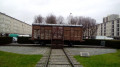
Urban planning and remembrance trail in Drancy
 4.78 mi
+26 ft
-13 ft
2h 15
Easy
Departure from Le Bourget (Seine-Saint-Denis)
4.78 mi
+26 ft
-13 ft
2h 15
Easy
Departure from Le Bourget (Seine-Saint-Denis)
Between Le Bourget and Bobigny, this route offers a glimpse of a variety of housing types in the inner suburbs, ranging from detached houses to blocks of flats. It also provides an opportunity to stop at a number of memorial sites, including the Drancy internment camp.
The Parc des Chanteraines and the Promenade Bleue
 3.77 mi
+79 ft
-36 ft
1h 50
Easy
Departure from Gennevilliers (Hauts-de-Seine)
3.77 mi
+79 ft
-36 ft
1h 50
Easy
Departure from Gennevilliers (Hauts-de-Seine)
An itinerary almost entirely surrounded by greenery in a densely urbanised area! The circular paths within the park are complemented by a walk along the banks of the Seine. The charming Jardin Ombre et Lumière (Shadow and Light Garden) and the reed beds of the lake are sure to delight enthusiasts.
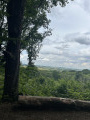
Loop in the Montmorency Forest
 Association / Club / Walk leader
 6.12 mi
+354 ft
-354 ft
3h 05
Moderate
Departure from Chauvry (Val-d'Oise)
6.12 mi
+354 ft
-354 ft
3h 05
Moderate
Departure from Chauvry (Val-d'Oise)
Starting from the Route du Faîte, this is a very hilly hike in the Montmorency Forest, passing by the Château de la Chasse.
The Isle-Adam National Forest and its southern edge
 13.77 mi
+860 ft
-850 ft
7h 05
Moderate
Departure from Maffliers (Val-d'Oise)
13.77 mi
+860 ft
-850 ft
7h 05
Moderate
Departure from Maffliers (Val-d'Oise)
Discover the Isle-Adam National Forest and the agricultural landscapes of the Val d'Oise on its southern edge. The route alternates between forest paths and wide, rolling hills amid cultivated fields and meadows.
Tours and detours in Saint-Ouen
 4.31 mi
+36 ft
-36 ft
2h 00
Easy
Departure from Saint-Ouen (Seine-Saint-Denis) (Seine-Saint-Denis)
4.31 mi
+36 ft
-36 ft
2h 00
Easy
Departure from Saint-Ouen (Seine-Saint-Denis) (Seine-Saint-Denis)
This urban route offers a taste of what can be found in the inner suburbs of Paris: lively streets; markets; old townhouses; state schools; post-war buildings in varying states of repair; more recent tower blocks; old workshops and a few factories still in place; green spaces; rapidly changing neighbourhoods. Add to that a stroll through the famous flea market, a lovely view of the Seine, and a brief glimpse of the legendary Stade Bauer.
A stroll through Pantin along the Canal de l'Ourcq
 6.23 mi
+279 ft
-279 ft
3h 05
Moderate
Departure from Pantin (Seine-Saint-Denis)
6.23 mi
+279 ft
-279 ft
3h 05
Moderate
Departure from Pantin (Seine-Saint-Denis)
From the Porte de la Villette to the outskirts of Lilas and Romainville, this itinerary follows the southern half of the city and reveals the many faces of Pantin: from the cosmopolitan Quatre-Chemins neighbourhood to the revitalised Canal de l'Ourcq, passing by the houses at the foot of the TDF tower and the craft and industrial areas.
From Bobigny to Le Raincy via the Canal de l’Ourcq
 4.71 mi
+164 ft
-108 ft
2h 20
Easy
Departure from Bobigny (Seine-Saint-Denis)
4.71 mi
+164 ft
-108 ft
2h 20
Easy
Departure from Bobigny (Seine-Saint-Denis)
An urban route that runs alongside the Canal de l’Ourcq for the first half. The route then moves through a residential area, culminating in the Church of Notre-Dame de l’Assomption du Raincy, which was decidedly modern when it was built in the aftermath of the First World War.
A stroll through Clichy-la-Garenne
 3.76 mi
+23 ft
-23 ft
1h 45
Easy
Departure from Clichy (Hauts-de-Seine)
3.76 mi
+23 ft
-23 ft
1h 45
Easy
Departure from Clichy (Hauts-de-Seine)
Still an industrial town today, with architecture characterised by Art Nouveau, Clichy offers a variety of facets that this urban walk allows you to discover. A diverse heritage awaits.
Coulée Verte and urban trail from Colombes to Asnières
 3.59 mi
+36 ft
-33 ft
1h 40
Easy
Departure from Colombes (Hauts-de-Seine)
3.59 mi
+36 ft
-33 ft
1h 40
Easy
Departure from Colombes (Hauts-de-Seine)
A short hike, from station to station, in two stages. First, follow the Coulée Verte along the route of an old disused railway line, then a green walkway, both of which have been converted for pedestrians. Next, explore the streets and alleys to discover a diverse range of residential architecture.
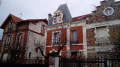
Strolling through the villas and avenues of Bois-Colombes
 3.98 mi
+23 ft
-23 ft
1h 50
Easy
Departure from Bois-Colombes (Hauts-de-Seine)
3.98 mi
+23 ft
-23 ft
1h 50
Easy
Departure from Bois-Colombes (Hauts-de-Seine)
The commune of Bois-Colombes is home to many townhouses nestled in narrow streets, lanes and cul-de-sacs known as "villas" or "avenues". This urban route takes you along a number of these streets, allowing you to discover the charms of spacious housing and diverse architecture.
Short tour of the Isle Adam Forest from Nerville-la-Forêt
9.17 mi
+856 ft
-830 ft
5h 00
Moderate
Departure from Nerville-la-Forêt (Val-d'Oise)
From Nerville-la-Forêt, take a short hike in the Forêt de l'Isles Adam with visits to three villages and three churches. This hike is popular in summer when it is hot thanks to the cool shade of the trees in this forest, and also in winter as the ground is not too muddy.
Old Asnières and the Genevilliers greenway
 4.98 mi
+33 ft
-36 ft
2h 20
Easy
Departure from Asnières-sur-Seine (Hauts-de-Seine)
4.98 mi
+33 ft
-36 ft
2h 20
Easy
Departure from Asnières-sur-Seine (Hauts-de-Seine)
A hike from station to station in two stages. First, we zigzag through old Asnières, passing through squares and discovering a rich heritage. Then, we walk along the paths of the Gennevilliers green corridor, which winds its way through a highly urbanised setting.