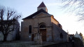
The Montmorency Forest in Écouen Ézanville

From the Montmorency Forest via Saint-Brice-sous-Forêt, a walk through the woodland, with a river and fields: it feels like being in the countryside just half an hour from Paris.

Details

n°45995854
Creation:
Last update:
Last review:
  • Walking
    Activity: Walking
  • ↔
    Distance: 6.97 mi
  • ◔
    Average duration: 3h 45 
  • ▲
    Difficulty: Moderate

  • ⚐
    Back to start: Yes
  • ↗
    Ascent: + 584 ft
  • ↘
    Descent: - 587 ft

  • ▲
    Highest point: 489 ft
  • ▼
    Lowest point: 226 ft
  • ⚐ Country: France
  • ⚐ City: Ézanville (95460|95440)
  • ⚑
    Start/End: N 49.022941° / E 2.36372°
  • ❏
    IGN map(s): Ref. 2313OT
  • Hour-by-hour weather

Description of the walk

Starting point: Écouen Ézanville station.

(S/E) Take Rue de la Gare, then turn right onto Allée du Bois.

(1) Turn right onto Chemin des Bimes and continue in the same direction along Route du Lavoir d’Ézanville. Then take a path on the right as you leave the forest; this will lead you to Rue du Luat. Follow this street to the end, cross the railway line and you’ll soon reach a three-way junction.

(2) Go straight on along Chemin de la Baronne and keep right at the next junction to go round the Château du Luat and the secondary school of the same name.

(3) At the end of the street, turn left onto Route de la Tête Richard, cross over the four-lane road and reach the roundabout.

(4) Go round the roundabout on the left using the pedestrian crossing and continue straight on along Rue de la Belle Vue for 250 m.

(5) Turn left onto a small path which leads you to the hamlet of Les Prés à l’Eau, then onto Chemin de la Fontaine aux Loups. Follow this path to the left until you reach the crossroads.

(6) Turn right onto Rue de la Libération.

(7) At the junction, continue straight ahead along Rue de l’Église. At the sharp bend to the left, take the path straight ahead, pass in front of a chapel and enter the Montmorency Forest. Immediately afterwards, at the crossroads, turn left, cross the tarmac road a little further on and continue straight ahead (small pond on the left). Follow the edge of the forest and then head back into the woods.

(8) Cross the stream, turn left to follow it, then turn right onto the path called the Ruelle aux Loups. Cross a junction of paths and continue straight ahead. When you reach a road, go straight on; a little further on, at the Chemin de Saint-Prix, turn left between the fields until you reach the four-way junction.

(9) Turn left onto Chemin de Montmorency towards Luzarches, then right onto Chemin du Regard. Return to the tarmac road and continue to the junction. Turn left onto Rue de la Planchette, pass the Jardin de la Fontaine on your left and continue to the end. Turn right onto Rue de la Forêt.

(10) Turn left to follow this straight road. Continue along Rue des Poiriers, keep to the right at the cemetery and rejoin Rue de la Libération and the junction you passed on the way out.

(7) Turn right, heading in the opposite direction to the outward journey, until you reach another junction, which you also passed on the outward journey.

(6) Continue straight on along Rue du Petit Saint-Brice, then turn left onto Chemin du Bériot, which leads to Rue de Paris (D11). Follow this road in the same direction until you reach the roundabout you passed on the way there.

(4) Carry on to the right and follow the outward route in the opposite direction to return to the station (S/E).


Waypoints

  1. S/E : mi 0 - alt. 246 ft - Gare d'Ecouen-Ezanville
  2. 1 : mi 0.1 - alt. 233 ft - Chemin des Bimes
  3. 2 : mi 0.45 - alt. 243 ft - Chemin de la Baronne
  4. 3 : mi 1.02 - alt. 325 ft - Route de la Tête Richard
  5. 4 : mi 1.22 - alt. 354 ft - Roundabout at the end of the circular loop – town
  6. 5 : mi 1.4 - alt. 417 ft - Path on the left
  7. 6 : mi 1.96 - alt. 299 ft - Rue de la Libération
  8. 7 : mi 2.14 - alt. 341 ft - Junction of the Saint-Brice circular loop
  9. 8 : mi 2.78 - alt. 308 ft - Stream
  10. 9 : mi 3.56 - alt. 397 ft - The road from Montmorency to Luzarches
  11. 10 : mi 4.39 - alt. 240 ft - Rue de la Forêt
  12. S/E : mi 6.97 - alt. 243 ft - Écouen Ezanville railway station - Petit Rosne (rivière)

Notes

Water point in the village of Piscop, and picnic table in the Montmorency Forest.

Worth a visit

Reviews and comments

3.4 / 5
Based on 3 reviews

Reliability of the description
3.7 / 5
Ease of following the route
3.3 / 5
Route interest
3.3 / 5
francoise SALLES 81
francoise SALLES 81

Overall rating : 3 / 5

Date of your route : Oct 17, 2025
Reliability of the description : ★★★☆☆ Average
Ease of following the route : ★★★☆☆ Average
Route interest : ★★★☆☆ Average
Very busy route : No

Lack of signage on the ground, somewhat dangerous crossing above the D301, and climb towards Blémur.

Machine-translated

Dorothez
Dorothez

Overall rating : 3.3 / 5

Date of your route : Apr 21, 2025
Reliability of the description : ★★★★☆ Good
Ease of following the route : ★★★☆☆ Average
Route interest : ★★★☆☆ Average
Very busy route : Yes

My opinion should be taken with a pinch of salt, as it was only the section of road running between fields that wasn’t great, along with two short, slightly risky stretches where you have to cross two roads.
Otherwise, I’d recommend this walk as a solo venture or with one other person at most for these non-pedestrian sections, and I can assure you they’re not particularly safe.
It’s well worth doing, and the little church is lovely to see, as are other little spots which aren’t exceptional but are very pleasant.🌿

Machine-translated

libertysurf
libertysurf

Overall rating : 4 / 5

Date of your route : Sep 25, 2024
Reliability of the description : ★★★★☆ Good
Ease of following the route : ★★★★☆ Good
Route interest : ★★★★☆ Good
Very busy route : No

A countryside getaway just half an hour from Paris, where you can get some exercise amidst the countryside and greenery.
Best enjoyed on your own, as there are narrow passages between two rows of barbed wire and the ground is uneven in places.

Machine-translated

Other walks in the area

For more walks, use our search engine .

The GPS track and description are the property of this route's author. Please do not copy them without permission.