Country:
 City:
City:


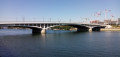
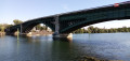
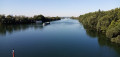
Starting point and access: Épinay-sur-Seine station.
- RER – Line C, on the section between Paris and Pontoise. Take the “Place de la Nouvelle Gare” exit.
- Tram – Line 11 (terminus).
Yellow signposting (sparse)
(S) With your back to the main station building, turn right, pass a chemist’s on your left and follow Rue des Alliés. Turn left onto this street and continue straight ahead. At the end, follow a wide avenue (Avenue du 18 juin 1940 on the map) to the right for about twenty metres.
No signposting
Then turn right down Rue du Port (do not take the bridge over the Seine).
(1) Continue along the tarmac-surfaced towpath and pass under the railway bridge. Carry on straight ahead, keeping the Seine on your left. At the end of the tarmac, go round a metal gate on the right and take a shaded, gravel path. Carry on straight ahead for about 600 m.
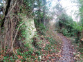
(2) About 250 m before the clearly visible motorway bridge and just before a rubbish bin on the left-hand side, leave the towpath and climb up a steep path on the right, interspersed with wooden steps (take care to spot this turn-off). First turn right then left and go through a narrow tunnel under a railway line. Climb the stone steps and you’ll come out onto a street in a residential neighbourhood.
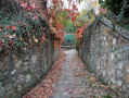
(3) Follow the street to the right and then take thefirst left, Rue des Gascons (signposted further on). At the junction, turn left into Rue des Provençaux. At the next junction, continue straight ahead and you’ll soon reach the Allée couverte des Déserts (unfortunately behind a closed gate).
(4) Continue along the gently sloping street and pass under the A15 motorway bridge. At the junction, turn left, cross Rue des Grands Saules and enter a street closed to vehicles over 4.8 metres long (Rue d’Épinay). Go straight on along this street, lined with detached houses, and pass three streets on the right-hand side.
(5) Then take thefirst left, down the hill, onto Rue de Montfaucon. At the bottom, turn right and, at the Stop sign, head straight across towards Argentueil. Follow Rue Claude Monet straight on, running alongside a railway line on your left.
(6) When you reach No. 9bis, take the bridge over the railway line. As you come off the bridge, turn right. Walk gently downhill between the buildings of a large company. Cross Rue des Charretiers and pass under the railway bridge (access to Argenteuil station on the right).
(7) Cross Boulevard Karl Marx, continue straight ahead, ignoring the streets on the right. Go round a roundabout on the left, follow the boulevard straight ahead and walk alongside a fenced-off public park on your left. At the traffic lights, cross the D909 in several stages, then follow it to the left. Cross the Seine via the Pont d’Argenteuil.
(8) As you come off the bridge, turn right onto Quai du Petit Gennevilliers (preferably take the cycle path on the right-hand side). Ride alongside industrial buildings on your left and the River Seine on your right. At the end of the tarmac, carry on straight ahead, pass a chicane and follow a gravel path.
(9) Pass under a metal bridge and leave a reservoir on your left. Continue straight ahead along a tree-lined path, shared by pedestrians and cyclists, with a surface that alternates between tarmac and concrete. It is also possible to take a parallel footpath.
(10) At the foot of the Pont de Bezons, climb a flight of steps on the left. At the top, take the bridge to cross the Seine a second time. Cross a slip road and continue straight ahead. At the traffic lights, cross a perpendicular street, then turn left to cross a boulevard and the tram tracks, arriving immediately at Pont de Bezons station (E).
To get back home:
- Tram – Line T2, towards La Défense and Porte de Versailles.

 Visorando Member
 Difficult
 Moderate