


Refine your search for walks in Gare de Sarcelles-Saint-Brice
Gare de Sarcelles-Saint-Brice walks


 The Montmorency Forest from west to east
 Visorando Member
 12.62 mi
 +997 ft
 -1,033 ft
 6h 40
6h 40
 Difficult
 Departure from Frépillon (Val-d'Oise)
Close to Paris, the Montmorency Forest offers a pleasant breath of fresh air without straying too far from the city. Being quite large, it’s ideal for day-long walks of varying distances. This route takes you right through the forest. It’s best to do this walk in summer to make the most of the natural surroundings. There are plenty of points of interest, such as the Château de la Chasse, the Étang Godard and the Fort de Domont.
Walks near Gare de Sarcelles-Saint-Brice
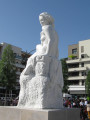
From the Galatea Statue to the Church of Notre-Dame de Deuil
 1.34 mi
+49 ft
-0 ft
0h 40
1.34 mi
+49 ft
-0 ft
0h 40
 Easy
Departure from Deuil-la-Barre (Val-d'Oise)
Easy
Departure from Deuil-la-Barre (Val-d'Oise)
This route across Deuil-la-Barre from south to north connects Place de la Nation in the renovated Galathée district to Place de l'Église in the historic town centre. It takes about 40 minutes at a leisurely pace.This pleasant walk through numerous public gardens takes you to Place de l'Église (or Place de Victimes du V2), which is also the starting point for several hikes on the Côte de Deuil trails.This route is recommended by the association Les Sentiers de la Côte de Deuil.
Along the water’s edge through various parks north of Paris
10.99 mi
+180 ft
-141 ft
5h 15
 Moderate
Departure from Épinay-sur-Seine (Seine-Saint-Denis)
Moderate
Departure from Épinay-sur-Seine (Seine-Saint-Denis)
A walk that follows the water’s edge, starting from Épinay-sur-Seine station, with a view of Fort de la Briche from the Île Saint-Denis Departmental Park. The route passes by the Basilica of Saint-Denis, then through Madeleine Riffaud Park, before heading into the Coulée Verte green corridor alongside the ponds of the Georges Valbon Departmental Park.
In the footsteps of the Refoulons
 1.97 mi
+246 ft
-3 ft
1h 05
Easy
Departure from Enghien-les-Bains (Val-d'Oise)
1.97 mi
+246 ft
-3 ft
1h 05
Easy
Departure from Enghien-les-Bains (Val-d'Oise)
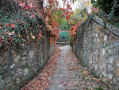
For nearly 90 years, the Refoulons railway line shaped the lives of the people of Enghien and Montmorency. This route invites you to take a trip back in time. The main appeal of this route lies in its historical significance: following the route of this old railway line, where a few remnants still remain here and there. Those who love railway relics will truly enjoy this walk.
Circular from station to station through the Montmorency Forest and the Château de la Chasse.
4.42 mi
+407 ft
-407 ft
2h 30
Easy
Departure from Bouffémont (Val-d'Oise)
A circular loop from station to station accessible via line H. Starting from the town of Bouffémont, it takes you into the Montmorency Forest and on to the Château de la Chasse and its pond. Before and after the château, the route follows various forest trails in the shade of century-old trees.
From Bouffémont to Taverny via the Montmorency Forest
 13.25 mi
+971 ft
-1,020 ft
6h 55
Difficult
Departure from Bouffémont (Val-d'Oise)
13.25 mi
+971 ft
-1,020 ft
6h 55
Difficult
Departure from Bouffémont (Val-d'Oise)
A very beautiful route from station to station in the Montmorency Forest, based in part on four themed trails: “Le Sentier des Lisières”, “Le Sentier de la Reine Hortense” and “Le Chemin des Philosophes” described on the Saint-Leu-la-Forêt tourist information website, plus “Taverny par les Sentes”. Thanks to a number of information boards, the route allows you to trace the region’s ancient and more recent history, admire many of its most interesting sites, and even engage in a bit of philosophy.
It can easily be shortened to 18 km by avoiding the return trip to the Statue of Notre-Dame de France at the start of the walk.
From the Basilica of Saint-Denis to Notre-Dame de Paris
 17.04 mi
+554 ft
-528 ft
5 days
Easy
Departure from Saint-Denis (Seine-Saint-Denis) (Seine-Saint-Denis)
17.04 mi
+554 ft
-528 ft
5 days
Easy
Departure from Saint-Denis (Seine-Saint-Denis) (Seine-Saint-Denis)
This urban itinerary, comprising five short stages, links two masterpieces of Gothic art in the Île-de-France region. It offers an opportunity to discover a rich and diverse heritage: medieval remains, 17th-century mansions, industrial and modern architecture, street art, and more. The purely urban sections are interspersed with a walk along the Canal Saint-Denis and a stroll through several parks and gardens, including those of La Villette and the Buttes Chaumont.
Historical route through Saint-Denis and walk along the canal
 3.91 mi
+62 ft
-13 ft
1h 50
Easy
Departure from Saint-Denis (Seine-Saint-Denis) (Seine-Saint-Denis)
3.91 mi
+62 ft
-13 ft
1h 50
Easy
Departure from Saint-Denis (Seine-Saint-Denis) (Seine-Saint-Denis)
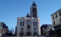
The first stage of this urban journey consists of two distinct sections. The first section, the historical trail, invites us to trace the passage of time from the legend of Saint-Denis and the city’s origins right up to the 21st century, with the help of some twenty richly documented information points. Next, we follow the Canal Saint-Denis along its pedestrian quay back to Paris.
From Saint-Denis to Le Bourget via Georges Valbon Park
 5.93 mi
+66 ft
-33 ft
2h 45
Easy
Departure from Saint-Denis (Seine-Saint-Denis) (Seine-Saint-Denis)
5.93 mi
+66 ft
-33 ft
2h 45
Easy
Departure from Saint-Denis (Seine-Saint-Denis) (Seine-Saint-Denis)
Starting from one of the masterpieces of Gothic art in Île-de-France, the Basilica of Saint-Denis, this urban route crosses a vast park where lawns alternate with flowerbeds, woodland and lakes. There is a commemorative aspect to the commune of Le Bourget, which was the scene of fierce fighting in 1870–1871.
From Épinay to the Pont de Bezons via Argenteuil and Parc Lagravère
 5.92 mi
+105 ft
-131 ft
2h 50
Easy
Departure from Épinay-sur-Seine (Seine-Saint-Denis)
5.92 mi
+105 ft
-131 ft
2h 50
Easy
Departure from Épinay-sur-Seine (Seine-Saint-Denis)
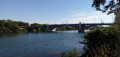
An urban route that starts on the towpath along the banks of the Seine and then climbs higher into Argenteuil. After crossing to the other bank, the route follows the river through Parc Lagravère.
Île Saint-Denis
 3.73 mi
+26 ft
-52 ft
1h 45
Easy
Departure from Épinay-sur-Seine (Seine-Saint-Denis)
3.73 mi
+26 ft
-52 ft
1h 45
Easy
Departure from Épinay-sur-Seine (Seine-Saint-Denis)
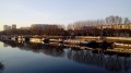
In the footsteps of the Impressionists, an urban route mostly along the banks of the Seine, through the Parc Départemental de l'Île Saint-Denis. At the end of the route, the Basilica of Saint-Denis adds a superb touch of heritage to this short walk.