Country:
 City:
City:


The walk starts from Épinay-Villetaneuse station, coming from Paris Gare du Nord on Train H, bound for Persan-Beaumont.
(S) From Épinay-Villetaneuse station, head along Avenue Jean Jaurès, cross Avenue de la République and continue along Rue de Paris. At Place René Clair, turn left, passing Saint-Médard Church via Rue de l’Église. At the end of this street, take Avenue du 18 Juin 1940 on the left and cross the Seine via the Pont d’Épinay.
(1) After the bridge, head left down Quai de la Marine, then turn right onto the path leading into the Île Saint-Denis Departmental Park. Pass the bandstand, a playground and a football pitch, then take the Promenade des Impressionnistes.
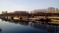
(2) Walk alongside the boats at Quai Saule Fleuri, then head back up to the bridge.
(3) Turn left and walk alongside the tram line. Further on, cross the Île Saint-Denis Bridge, then pass under the railway bridge. Walk past Saint-Denis station and cross the Canal Saint-Denis bridge.
(4) After the bridge, first turn left then right onto Rue Auguste Delaune. Continue alongside the railway line and the shops, heading towards the Église Saint-Denis-de-l’Estrée, then turn right. Cross Boulevard Jules Guesde and continue opposite onto Rue de la République, which is a pedestrianised street at weekends and on public holidays. Walk past the Saint-Denis post office. Cross Rue Gabriel Péri. Cross Place Victor Hugo, where Saint-Denis Town Hall is on the left.
(5) At the end of this square, walk round the Basilica of Saint-Pierre on your left and go through the Jardin Pierre de Montreuil via the black gate. On leaving the park, take the Allée des 6 Chapelles, then turn left onto Rue de Strasbourg and follow it to the roundabout (petrol station on your right).
(6) Turn left onto Avenue Lénine and walk alongside the cemetery, which is hidden by the buildings on your left. You’ll come to a large junction.
(7) Cross it to enter the Parc de Madeleine Riffaud / Marcel Cachin, cut across Rue Henri Barbusse and continue straight ahead.
(8) Exit via the Promenade de la Vieille Mer, go straight on, cross Rue de la Vieille Mer and carry on a little further.
(9) Turn right onto Rue Jacques Vaché. At the Stop sign, turn left onto Avenue Romain Rolland, following the Parc Interdépartemental des Sports de Marville, then the Courtille football ground.
(10) Cross Avenue Roger Salengro (take care) and head straight ahead to enter the Parc Départemental Georges-Valbon.
(11) Keep to the left as you continue through the park until you reach the pond.
(12) Walk round the pond on the left and carry on to the second pond.
(13) Follow the path on the left alongside the cycle path.
(14) Cross the railway line via the Iris Bridge.
(15) Turn left, head towards Lake Supérieur and continue to the waterfall.
(16) After the waterfall, take the path on the left.
(17) On the track, turn left at the sharp left-hand bend. A little further on, leave the track and continue straight ahead to exit the park.
(18) Take Avenue de Stalingrad (D29) on the left and cross over the railway lines via the road bridge, leading to a roundabout.
(19) Take the hairpin bend to the right, then immediately turn left onto Rue Albert Einstein. Continue along Avenue Louis Bordes, passing the Stains post office, until you reach a junction.
(20) Turn left, then after about 50 metres turn right onto Place Henri Barbusse. Pass the town hall, then the Joliot Curie nursery school. Cross Rue Pelletier.
(21) At Place Marcel Pointet, take the sharp right-hand bend onto Avenue Paty. Cross Rue Raoul Duchêne, then Rue Pierre de Geyter.
(22) Turn left onto Rue Jean Durand, running alongside the Romain Rolland School Complex, then the Résidence des Charmilles. Pass the Maurice Utrillo Sixth Form College.
(23) Turn right, passing a recycling centre and the stadium. After the Clinique de l’Estrée at the three-way junction, turn right onto Rue Rosa Luxembourg and arrive at Stains station (E).
 Visorando Member
 Easy
Easy 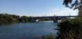
 Difficult