Country:
 City:
City:


Starting point and access: Mairie de Clichy station.
- Metro – Line 13. Take Exit 1, Rue Martre.
- Bus – Lines 54, 174, 274, 341.
(S/E) As you exit the metro station, turn left and walk alongside the Jardin Jean Moulin on your right. At the junction, turn right into Rue Villeneuve. When you reach No. 18, turn left onto a pedestrian lane (Allée Albert Dhalenne on the map). Atthe first junction, turn right onto Rue Charles Paradinas. At the next junction, first turn left then right to follow Rue Alfred Couillard. The street curves to the left and leads to a crossroads.
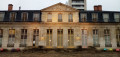
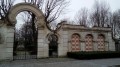
Then take thesecond right, Rue René Véziel, and walk past a brick-built school complex. The street bends to the right and becomes Rue d’Alsace. Atthe first junction, continue straight ahead. Atthe second junction, rejoin Rue Villeneuve and follow it to the left (note the decorated façade at No. 40 bis). At the traffic lights, cross Boulevard du Général Leclerc and follow it to the right, passing Parc Roger Salengro on your left. Continue until you reach an entrance to the park (not shown on the map), opposite the monumental entrance to the Printemps department store’s warehouses.
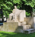
(1) Enter the park, turn immediately right and walk alongside a pond on your left. After a few dozen metres, turn sharply left into the park. Opposite a memorial to war widows and orphans, turn right, passing some toilets on your left. Stay on the main path, which curves widely to the right. At a junction (bench, litter bin), go straight on. Walk along Boulevard du Général Leclerc, then turn right to leave the park through a small gate to the left of a large gate.
Turn left, go round the roundabout on the left, pass by the foot of the war memorial to the 1939–1945 war and cross Rue du Général Roguet in two stages. Then turn left onto Rue Madame de Sanzillon.
(2) Take thefirst right into Rue Madame de Staël. Continue straight on and, at the end of the street, turn left onto Rue Marie et Pierre Curie. At the end, turn right, then right again into Rue Klock. Take thefirst left into Rue Achille Adam, then thefirst right into Rue Martissot. Cross Boulevard du Général Leclerc again and walk past the Maison du Peuple (a massive metal and glass building) on your right. At the corner, turn right into Rue Morillon and you’ll come to the modern (and unassuming) church of Notre-Dame Auxiliatrice.
(3) Then turn left and take thefirst right onto Rue d’Alsace. Continue straight ahead, crossing Rue Morice and Rue Henri Barbusse in turn. Then turn left into the Allées Léon Gambetta, preferably taking the central, tree-lined section. Cross several streets and pass the Théâtre Rutebeuf on your left.
At the end, cross Rue Martre at the pedestrian crossing, enter a square and head towards a bandstand. Walk round the bandstand and join Boulevard Jean Jaurès on the other side.
(4) Follow the boulevard to the right and cross it at thefirst pedestrian crossing. Continue along the boulevard and immediately take thefirst left, into Rue Victor Méric. At the end, turn right and, after a few dozen metres, turn left into Rue Huntziger. At the end, turn right. You’ll come out onto Rue de Neuilly; follow it to the left. Keep going straight on until you reach the railway bridge, ignoring all the streets on the right.
(5) At the foot of the bridge (access to Clichy-Levallois station), turn right into the Passage du Puits Bertin and walk alongside a large industrial building on your right. After about 150 metres, turn left through the gate into the Parc des Impressionnistes. Walk along a concrete path, skirting a lawn below on your right. At the end of the lawn, continue straight on and cross a gravel path. Shortly afterwards, at the next junction, turn right and walk between two reed beds along a concrete path. At the end, turn left and then continue straight on.
When you reach an information sign marked ‘Les bois naturels’, turn right. At the junction that comes up immediately (bench), follow the path on the left which winds through the woodland between two fences. You’ll come to a playground; leave it on your left and turn immediately right towards the park exit. Go down a flight of steps and, at the bottom, turn left. Pass a chicane and you’ll come out onto Rue Gustave Eiffel.
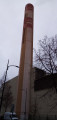
(6) Follow the street to the right. The road winds slightly; keep the council’s warehouses on your right and pass the base of an industrial chimney in shades of ochre and pink. At the T-junction, turn right. At the traffic lights, turn left onto Rue Pierre Bérégovoy (the former name, Rue des Chasses, is still visible). Carry straight on, cross Rue Médéric and then cross Rue Leroy on the right-hand side. At the traffic lights, cross Boulevard Jean Jaurès and follow it to the right for a few dozen metres. Take thefirst left into Rue du Guichet.
At the end, at the corner by the tourist office, turn left and cross the courtyard of the Pavillon Vendôme. Exit on the other side and turn right twice to join Rue du Landy. At the junction, follow Rue Dagobert to the left. Take thefirst right, Rue Marcelin Berthelot, and walk past the Church of Saint-Vincent de Paul on your right. At the end, turn right, walk past the church entrance and head towards the adjoining Saint-Médard Church.
(7) Cross Boulevard Jean Jaurès at the pedestrian crossing and turn left. Immediately turn right into Rue de l’Ancienne Mairie. At the junction, turn left into Rue Médéric. After the street bends to the left, cross a small square. Cross Boulevard Jean Jaurès again and follow it to the right for about thirty metres.
Then turn left into the town hall square. At the foot of the building, turn right. Leave the square and turn left onto Rue Charles et René Auffray. Continue straight ahead and, at the traffic lights, you’ll find the Mairie de Clichy metro station (S/E) immediately on your right.



 Visorando Member

 Moderate