Historical route through Saint-Denis and walk along the canal

The first stage of this urban journey consists of two distinct sections. The first section, the historical trail, invites us to trace the passage of time from the legend of Saint-Denis and the city’s origins right up to the 21st century, with the help of some twenty richly documented information points. Next, we follow the Canal Saint-Denis along its pedestrian quay back to Paris.

This walk is part of a multi-day hike: De la Basilique de Saint-Denis à Notre-Dame de Paris

Details

433630
Creation:
Last update:
Last review:
  • Walking
    Activity: Walking
  • ↔
    Distance: 6.29 km
  • ◔
    Average duration: 1h 50 
  • ▲
    Difficulty: Easy

  • ⚐
    Back to start: No
  • ↗
    Ascent: + 19 m
  • ↘
    Descent: - 4 m

  • ▲
    Highest point: 51 m
  • ▼
    Lowest point: 30 m

Photos

Description of the walk

Starting point and access: Basilica of Saint-Denis.
- Metro - Line 13, Saint-Denis Basilique station. Take Exit 2 to Place du Caquet (marked on the map).
- Tram - Line T1, Basilique de Saint-Denis station. Follow Chemin des Poulies southwards and emerge at Place du Caquet at the metro exit.

Historical route of Saint-Denis

No signposting
The route is marked by 20 numbered themed information points. On the map, these points, as well as other information points, are indicated by the letter i.

(S/E) Head towards the junction with Rue Jean Jaurès: upon exiting the metro station, turn around on the square; if arriving by tram, continue straight ahead. Turn left into Rue Jean Jaurès (ignore the sign opposite reading “Historical Trail Marker 1”). Ignore the side streets on the right and you’ll come to an ancient ruin on the left-hand side of the street (three pillars and a stone lintel). Then turn sharply right into Rue de Strasbourg and walk along the right-hand side of the former premises of the newspaper L’Humanité. You’ll reach the apse of the basilica.

(1) Marker 1 is supposed to be at the entrance to the Pierre de Montreuil Garden but... impossible to find (despite going round and round in circles). As this marker is dedicated to the legend of Saint Denis, enter the Pierre de Montreuil Garden and go to the foot of the North Gate dedicated to this legend. Retrace your steps.

(1) On leaving the garden, turn left onto the Allée des 6 Chapelles and find Marker 2. Continue in the same direction, take the covered passageway known as the 2 Pichets and find Marker 3 opposite on the Place du Caquet. Turn left, pass under a very high footbridge connecting two buildings and emerge onto Place Victor Hugo (Marker 4). Turn immediately left towards the basilica (Marker 5). Then turn right and walk along the front of the basilica.

You will find Marker 6 at the start of a small square situated between Rue de la Boulangerie and Rue de la Légion d’Honneur (straight ahead if coming directly from Marker 5, on the left if emerging from a visit to the basilica). Cross the small square to reach the other side (Marker 7). Then turn right and you will immediately find Marker 8 at No. 2 Rue du Cygne. Continue along Rue de la Boulangerie, passing Rue des Boucheries (Marker 9), Rue du Jambon (Marker 10) and Rue Lanne (Marker 11) in turn. Then continue south along Rue Gabriel Péri. You will emerge onto Place de la Résistance (Marker 12).

(2) Walk along the square with the Memorial to the Deportation on your right. Pass Marker 13 and continue along Rue Gabriel Péri (Museum of Art and History on the left). Cross Rue des Carmélites (Marker 14) and join Rue de la Légion d'Honneur (Marker 15). Continue towards the Stade de France, clearly visible to the south (Marker 16 on the right), and cross Rue de la Barbacane (Metro).

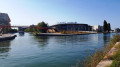
(3) Cross the tram tracks (take care) then a wide avenue (traffic lights). Follow the pedestrian sign for “Stade de France” and walk over the motorway slip roads. On the esplanade (Marker 17), turn left, go under the A1 motorway bridge and arrive at the foot of a wide staircase (Marker 18). Climb the stairs and cross the Canal de Saint-Denis via the footbridge (on the right, a lock and a motorway bridge). Walk to the end of the footbridge to reach the foot of the Stade de France (Marker 19). Then turn left, walk along the north bend of the stadium on your right (view of the basilica on the left), pass gates L and K, and reach Marker 20.

Continue in the same direction, ignoring Rue Jules Rimet on the right (which runs alongside the stadium) and continuing along Rue Henri Delaunay, which descends and curves to the right after a bus stop. At the roundabout at the bottom, turn left. At the traffic lights, turn right and cross a street, then turn left and cross Avenue du Général de Gaulle. Then take the footbridge over the canal.

Walk along the Canal Saint-Denis

Red and white + yellow markings
The markings are intermittent but, as the route follows the canal’s pedestrian and cycle path continuously (the latter being on the right-hand side), this poses no difficulty.

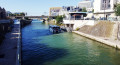
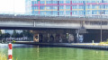
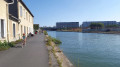
(4) At the end of the footbridge, turn right and follow the pedestrian walkway running alongside the canal. Pass under a small road bridge at the boundary between the municipalities of Saint-Denis and Aubervilliers (sign for the opposite bank), then under the A86 motorway bridge. Next, pass under a railway bridge, going round the pier on the left. Continue along Quai Jean-Marie Tjibaou (which starts earlier than shown on the map) and walk alongside the gates of Lock No. 4. After a cobbled path, return to the canal bank and pass under a footbridge.

(5) Continue along the quay, which narrows, to pass under a road bridge. Walk past workshops/warehouses on your left. Then go round the base of a footbridge on the left and turn right onto the cobbled quay. At lock no. 3, first turn left then right and continue along a cobbled path. Return to the canal bank and walk alongside Square Aimé Césaire on your left. Pass under a road bridge again (Line 12 metro works in December 2016) and continue along the quay with warehouses on your left.

(6) Walk past Lock No. 2 and enter Paris (sign for the opposite bank). Pass under the Boulevard Périphérique bridge and then under the Boulevard MacDonald bridge. Before the railway bridge, turn left, go up a ramp and pass under the bridge. Continue along the quay overlooking the canal. Cross Avenue Corentin Cariou (traffic lights), follow it to the left and you will find Porte de la Villette station on your right (E).

To get back home:
- Metro - Line 7.
- Tram - Line T3b.

Waypoints

  1. S : km 0 - alt. 32 m - Metro and Tram - Basilique Saint-Denis
  2. 1 : km 0.37 - alt. 33 m - Pierre de Montreuil Garden - Basilique Saint-Denis
  3. 2 : km 1.03 - alt. 31 m - Place de la Résistance
  4. 3 : km 1.38 - alt. 33 m - Saint-Denis Porte de Paris metro station
  5. 4 : km 2.46 - alt. 36 m - Footbridge - Canal Saint-Denis
  6. 5 : km 3.48 - alt. 38 m - Footbridge
  7. 6 : km 5.16 - alt. 43 m - Lock No. 2
  8. E : km 6.29 - alt. 47 m - Metro and Tram - Porte de la Vilette

Notes

Trainers are sufficient for this route, which is entirely on tarmac, concrete or paved surfaces. Bars and restaurants are available near the start and finish points.

A map is required (at the very least the one accompanying this description). The time given is walking time and does not include stops at information points or a visit to the basilica.

Visit to the Basilica of Saint-Denis:
- Self-guided tour, except for the necropolis of the kings of France (€9.00 per person in January 2019).
- See detailed opening hours.

Walkers should be aware that this urban route takes place in an environment characterised by the presence of numerous transport routes (roads, motorways, railway lines) and various workshops or warehouses along the canal.

Alternative route:
If you wish to stick to the historical route, at Marker 20, at the foot of the Stade de France, turn back, cross the canal again and head to the Saint-Denis Porte de Paris metro station (line 13).

This walk has been completed twice by the author, the first time on 28 December 2016 and the second on 6 January 2017.

Worth a visit

Historical route of Saint-Denis:

The route was designed and developed by Nicole Rodrigues and Michael Wyss (Archaeology Unit of the City of Saint-Denis), Luc Fochois (historian) and Jean Kiras (visual artist). The themed markers feature text illustrated with maps, photos, reproductions of archaeological objects, etc.

The Basilica of Saint-Denis is, of course, a major site on this trail, but it is not the only point of interest. Of particular note are the moving Memorial to the Deportation of the Dionysiens (the name given to the town’s inhabitants) and the Stade de France.

For further information:
- The Seine-Saint-Denis Tourism page dedicated to the historical trail.
- The page on the Patrimoine et Histoire website dedicated to the Basilica of Saint-Denis.
- An extract fromthe Historical Atlas of Saint-Denis (1999).
- Archaeological studies in the town of Saint-Denis (2014).

A stroll along the Canal Saint-Denis:

The Canal Saint-Denis is ideal for a leisurely stroll, particularly in the afternoon, when the pedestrian and cycle path is bathed in sunshine.

Reviews and comments

4 / 5
Based on 7 reviews

Reliability of the description
3.8 / 5
Ease of following the route
4.4 / 5
Route interest
3.9 / 5
bribrimoum52
bribrimoum52
• Edited:

Overall rating : 4.7 / 5

Date of your route : Apr 23, 2026
Reliability of the description : ★★★★★ Very good
Ease of following the route : ★★★★★ Very good
Route interest : ★★★★☆ Good
Very busy route : No

A lovely walk for three-quarters of the route, but much less interesting towards the end!
(Graffiti on the walls and lots of grime and concrete!!)

Machine-translated

krystel56
krystel56

Overall rating : 4.5 / 5

Date of your route : Sep 13, 2024
Reliability of the description : Not used / Not applicable
Ease of following the route : ★★★★★ Very good
Route interest : ★★★★☆ Good
Very busy route : No

All previous comments regarding the building works are now out of date, as they were completed in time for the Olympics. I reached the Canal de Saint-Denis further upstream by taking Rue de la République opposite the basilica and walking around the left-hand side of the Church of Saint-Denis-de-l’Estrée. I stayed on the left bank of the canal, which is immaculate all the way to Parc de la Villette. Lots of street art in all styles, incredible little houses along the canal, the lock houses, and the Stade de France on the opposite bank make this a very pleasant walk.

Machine-translated

biscotte1
biscotte1

Overall rating : 3.3 / 5

Date of your route : Mar 16, 2024
Reliability of the description : ★★☆☆☆ Disappointing
Ease of following the route : ★★★★★ Very good
Route interest : ★★★☆☆ Average
Very busy route : No

The section of the Saint-Denis Canal from the bend is currently under construction and is occasionally closed for works.
The surroundings aren’t the most pleasant.
Fortunately, there’s some street art to brighten up the walk.

Machine-translated

Viso69006
Viso69006

Overall rating : 3.7 / 5

Date of your route : Nov 08, 2022
Reliability of the description : ★★★★☆ Good
Ease of following the route : ★★★☆☆ Average
Route interest : ★★★★☆ Good
Very busy route : No

Disappointing route:
The first section around the basilica would benefit from a detailed map to make things easier
the walk around the large stadium is to be avoided as the ongoing construction work makes it very unpleasant and uninteresting.
You should walk along the left bank of the canal before crossing it
The path along the canal is cut off several times, forcing long, uninteresting detours
All in all, a route to avoid whilst the construction work and interruptions remain.

Machine-translated

Skocoleuro
Skocoleuro
• Edited:

Overall rating : 4 / 5

Date of your route : Sep 02, 2018
Reliability of the description : ★★★★☆ Good
Ease of following the route : ★★★★☆ Good
Route interest : ★★★★☆ Good

On the first part of the route, the information boards aren’t always easy to spot, but it’s worth looking for them as they offer a fascinating insight into the history of Saint-Denis, from the Middle Ages to the industrial 19th century.
The second part of the route along the canal, peaceful and picturesque, alternates between residential and industrial areas. As you approach Paris, you can admire the work of the many graffiti artists in this area.
At point 6, it is no longer possible to pass under Boulevard McDonald due to roadworks. A staircase at the foot of the bridge allows you to climb up and cross the boulevard, after which you rejoin the route by taking the Quai de la Charente opposite.

Machine-translated

Patral
Patral

Overall rating : 4.7 / 5

Date of your route : Feb 08, 2018
Reliability of the description : ★★★★☆ Good
Ease of following the route : ★★★★★ Very good
Route interest : ★★★★★ Very good

Thanks to Netra for suggesting this walk.

Lovers of bucolic landscapes will probably be disappointed.
But those interested in the tensions and upheavals shaking the Paris metropolitan area will find a real distillation of them here.
What a contrast between the Basilica of Saint-Denis and the former headquarters of the United Nations designed by Niemeyer, between the migrants’ igloo-like tents beneath the ring road and the Millénaire shopping centre, between the magnificent works of street artists and the concrete plants.

A must-see before this neighbourhood is irrevocably ‘gentrified’.

Machine-translated

Claire D
Claire D

Overall rating : 3.7 / 5

Date of your route : Oct 31, 2017
Reliability of the description : ★★★★☆ Good
Ease of following the route : ★★★★☆ Good
Route interest : ★★★☆☆ Average

I did the walk in the opposite direction, so we couldn’t see the signposts very well and were a bit confused by the route descriptions, which we had to read backwards.
I started the route at Pantin RER station, walked down towards the Town Hall and crossed the Ourcq Canal bridge (towpath) to take the left bank – a pleasant stroll to the Cité des Sciences et de l’Industrie, crossing the canal bridge between Pantin and La Villette, I walked along the Quai de l’Ourcq, which I’d immediately advise against as it’s a bit dodgy, then crossed over Avenue Corentin Cariou via the Parc de la Villette, which was much more pleasant.
You can tell you’re in an industrial, neglected area – a bit grubby.
The murals, on the other hand, are magnificent; they make the walk more enjoyable. I didn’t want to go past the Stade de France and continued along the canal quay; the large motorway interchanges aren’t very pleasant, but then again, this is the eastern suburbs. At Quai du Square, I took some narrow side streets to reach the Maison de la Légion d’Honneur.
The town of Saint-Denis is a radical, exotic change; when you arrive at the Place de la Basilique, the view is sublime.
I returned by skirting the Parc de la Légion d’Honneur and took a shortcut to quickly reach the Quai du Canal again via Rue du Canal.
On the way back, the signs were clearly visible.
I wanted to do it, so I did it—that’s all there is to it. I prefer the second part, which starts from La Villette or the Pantin RER station and runs along the Canal de l’Ourcq to Notre-Dame; it’s magnificent.

Machine-translated

Biscotte78
Biscotte78

not yet done

Machine-translated

Other walks in the area

For more walks, use our search engine .

The GPS track and description are the property of this route's author. Please do not copy them without permission.