Country:
 City:
City:


(S) Start the walk at Enghien SNCF station. In front of the station, follow Rue du Départ north-westwards. At the far end of the station, there is a covered area serving as a shelter: this is where the Refoulons line used to terminate. Stay on the street for about 80 metres until you reach the first set of traffic lights on the right (Avenue Carlier). This is where level crossing PN1 used to be, crossing Rue du Départ. Turn right onto Avenue Carlier. Continue straight on at the next junction.
(1) Cross Avenue du Général Leclerc and continue straight on along Rue Jean Mermoz. This is where level crossing PN2 was situated, as well as the Pointe Raquet halt. It no longer exists today, and only an engraved stone serves as a reminder of that era. The Refoulons line ran alongside what is now the pavement on the right-hand side of the street.
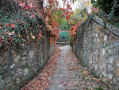
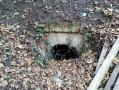
At the next junction, carry straight on along a path which is a remnant of the railway line. The embankment is, in fact, clearly visible. Cross the Ru des Basserons at some rather weathered concrete guardrails: the culvert is still visible but partly buried. To see it, at the guardrails, head down to the right and you’ll come out onto Rue de la Fosse aux Moines.
(2) There used to be an information panel here. The bridge that spanned Rue de la Fosse aux Moines at this point no longer exists, and only the railway embankment serves as a reminder of this crossing. At this point, carry on straight ahead along a cul-de-sac.
At the end of the cul-de-sac, continue along a footpath. Turn onto the first path on the left (Grand Sentier), which becomes a lane before leading to Rue des Carrières. Follow this road to the left and cross a barely visible bridge just before the next bend, near a ‘no parking’ sign. Beneath this bridge – which has been rebuilt and is largely obscured from view on the road by vegetation – ran a branch line leading to the Trou du Loup quarries. This line joined the main line a few metres further south
Join the Refoulons route at the bend just after the bridge. A few metres further on, pass the former Soisy halt, which is easy to recognise by its ‘Soisy’ sign and is currently occupied. Kilometre marker 2 bis was situated right by this station. Continue straight on along Rue des Molléons at the junction just after the bend, then straight on again at the ‘Stop’ sign where it meets Chemin du Grand Chat. Kilometre marker 3 was located here, along with a gatekeeper’s cottage, which no longer exists. After this junction, don’t miss a short section of track and the railway embankment to the right of the road.
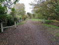
(3) At the end of Rue des Molléons, head straight on along the Sentier du Refoulons. PN4 used to be located here, along with a gatekeeper’s house. The path leads to the Sentier de la Fontaine Saint-Paul at a former PI, of which only ruins remain. At this information point, turn left and then right when you reach the main road (Rue de Margency).
(4) At the four-way junction, take the first right onto Rue de Jagny. Where the ‘no right turn’ sign is located, there used to be railway signal box PN5, along with a signalman’s cottage which still stands by that same sign.
At the next junction, turn left onto Rue Émile Level until you reach the site of the former Montmorency station, marked by signs by a flight of steps on the left at the next bend (E).

 Visorando Member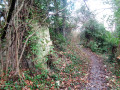
 Difficult
 Moderate