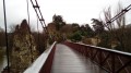
From Bobigny to Le Raincy via the Canal de l’Ourcq

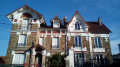
An urban route that runs alongside the Canal de l’Ourcq for the first half. The route then moves through a residential area, culminating in the Church of Notre-Dame de l’Assomption du Raincy, which was decidedly modern when it was built in the aftermath of the First World War.

This walk is part of a multi-day hike: La Petite Couronne de Paris

Details

1678223
Creation:
Last update:
Last review:
  • Walking
    Activity: Walking
  • ↔
    Distance: 4.71 mi
  • ◔
    Average duration: 2h 20 
  • ▲
    Difficulty: Easy

  • ⚐
    Back to start: No
  • ↗
    Ascent: + 164 ft
  • ↘
    Descent: - 108 ft

  • ▲
    Highest point: 292 ft
  • ▼
    Lowest point: 157 ft
  • ⚐ Country: France
  • ⚐ City: Bobigny (93000)
  • ⚑
    Start: N 48.906652° / E 2.449651°
  • ⚑
    End: N 48.88932° / E 2.512257°
  • ❏
    IGN map(s): Ref. 2314OT
  • Hour-by-hour weather

Photos

Description of the walk

Starting point and access: Bobigny Pablo Picasso station.
- Metro – Line 5. Take Exit 3 onto Rue Carnot.
- Tram – Line T1. The stop is on Rue Carnot.

Yellow signposting

(S) At the top of the escalator at the metro exit, turn right and cross (with care) Rue Carnot and the tram tracks. Turn right, then immediately left to come out onto the Esplanade Jean Moulin.

Head south along the right-hand path, the one that remains at ground level, and pass under the shopping centre bridge. Follow thePR® 11 and 13 routes, walking on the left-hand side past the Hôtel du Département de Seine-Saint-Denis, then a lawn with sculptures, and finally a school on your right. Pass under a railway bridge.

(1) As you emerge from under the bridge, turn left onto thePR®13. Walk alongside a tram track on your right and do not cross it at thefirst crossing. Ignore a path branching off to the left and stay on a gravel path running parallel to the tram track.

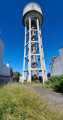
At a dog park and just before a large reservoir, turn right to cross the tram track and walk briefly up a steep tarmac path.

Markings: Yellow + Red and Yellow

At the top (signpost on the right-hand side), leave the tarmac, climb three steps on the left and follow a gravel path towards the park’s visitor centre. Further on, climb a large flight of steps.

No markings

(2) At the top, at a fork in the road, veer to the right (ignore the markings heading left). Cross a path, walk alongside a lawn on your left and pass the base of fitness trail apparatus no. 16. After thesecond bench on the right-hand side, turn right and pass a bench on the left-hand side.

Follow a gravel path that curves to the right towards a footbridge over the Canal de l’Ourcq. Just before stepping onto the footbridge, go down a flight of steps on the left leading to the canal bank.

Yellow + Red and Yellow markings (extremely rare)

(3) Turn left and take the towpath, which has been developed to include a cycle path and a footpath. Walk alongside the canal on your right, through a landscape that blends industrial ruins, active businesses, building sites and wasteland.

Pass successively under a railway bridge, the A86 bridge, the Pont de Bondy and a motorway bridge. Just after the latter, take the Passerelle de Bondy footbridge, which spans the canal. Now follow the canal on your left and pass under the Pont d’Aulnay (D41 road). Finally, reach the Passerelle des Écoles.

Yellow markings

(4) Directly beneath the footbridge, turn right and go down the ramp leading to Rue des Écoles. Follow this street, keeping the buildings of the Pasteur school complex on your left. At the traffic lights, cross the N3 (Avenue du Général Gallieni) in two stages. Continue straight ahead and cross Avenue Pasteur.

No signposting

Immediately ignore the arrow pointing to the right and turn left onto Avenue de Verdun. Carry straight on between a secondary school on your left and a sports ground on your right. Pass Rue Robert Bonnet on your left.

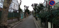
At the traffic lights, turn left into Rue Emmanuel Fairon, lined with detached houses. At the Stop sign, carry on straight ahead onto Rue Béranger. Cross Allée de la Régate and continue straight ahead.

(5) At the ‘Stop’ sign, turn right onto Rue Henri Douillot. Then take thesecond left onto Allée du Rendez-Vous. At the Fork in the road, turn right onto the same street. Continue straight ahead and cross Allée Allice. Further on, cross Allée Berthie Albrecht and continue along Allée Robespierre.

At the traffic lights, turn left onto Allée Pierre Brossolette. Takethe first right onto Allée des Chalets. Turn left onto this road and ignore the housing estate of the same name on your right. After a few dozen metres, before numbers 11 and 22, turn right onto a footpath. At the end, follow the road to the right until you reach a junction.

(6) Go round the Brackley Crossroads on the left and cross Avenue Franklin. Then turn left onto Allée du Rendez-Vous (which is a continuation of the street of the same name taken earlier).

At the traffic lights, cross (with care) the tram tracks and then Boulevard d’Aulnay, and enter Le Raincy via Allée Valère Lefebvre. Further on, cross Boulevard de l’Ouest and walk alongside the Lycée Albert Schweitzer on the left-hand side. At the traffic lights, continue straight ahead along Allée Valère Lefebvre, which begins to climb. At the next set of traffic lights (with the war memorial opposite), turn right onto Avenue de la Résistance and follow it to the Church of Notre-Dame de l’Assomption.

Yellow markings

(7) Continue along Avenue de la Résistance until you reach a roundabout. Then turn left onto Allée Gambetta. Climb a flight of steps and then continue uphill.

No markings

Before the ‘Stop’ sign, take thefirst right onto Allée du Rocher. Cross Allée de la Fontaine and continue downhill along Allée du Rocher. At the end, turn right (Boulevard du Midi on the map) and continue downhill. At the traffic lights, turn left onto Allée Nicolas Carnot.

Yellow signposting

(8) At the next junction, turn right onto Allée de Gagny and head slightly downhill. Cross Allée Victor Hugo and go straight on. At the next junction (with Allée Clémencet), veer left and cross the bus park to reach Le Raincy-Villemomble-Montfermeil station (E).

To get back home:
- RER – Line E, towards Paris or Chelles-Gournay.

Waypoints

  1. S : mi 0 - alt. 161 ft - Bobigny Pablo Picasso – Metro and Tram
  2. 1 : mi 0.26 - alt. 161 ft - La Bergère Departmental Park
  3. 2 : mi 0.47 - alt. 194 ft - Fork in the road
  4. 3 : mi 0.64 - alt. 174 ft - Towpath - Canal de l'Ourcq
  5. 4 : mi 2.14 - alt. 171 ft - Passerelle des Écoles - Canal de l'Ourcq
  6. 5 : mi 2.68 - alt. 171 ft - Rue Béranger x Rue Henri Douillot
  7. 6 : mi 3.42 - alt. 190 ft - Brackley Crossroads
  8. 7 : mi 4.07 - alt. 249 ft - Notre Dame de L'Assomption (Le Raincy)
  9. 8 : mi 4.53 - alt. 210 ft - Allée Nicolas Carnot x Allée de Gagny
  10. E : mi 4.71 - alt. 210 ft - Gare de Le Raincy-Villemonble-Montfermeil

Notes

Train timetables: see the Transilien website.

A good pair of trainers is all you need for this route, which is entirely on tarmac, concrete or gravel surfaces.

Bars, restaurants and shops near the starting metro station and the finishing railway station.

A detailed map is required (at the very least the one accompanying this description).

Walk completed by the author on 18 January 2019.

Worth a visit

- The Ourcq Canal.

- Suburban areas in the town of Pavillons-sous-Bois and beautiful houses in the town of Le Raincy.

- Notre-Dame de l’Assomption Church (1923), nicknamed ‘the Sainte-Chapelle of reinforced concrete’ (2).
Exterior: an impressive bell tower and, on the tympanum, a Pietà by Antoine Bourdelle.
Inside (open to the public during the day except during services): abstract blue stained-glass windows in the chancel; side windows depicting the life of Mary; the first window on the left as you enter, depicting the Battle of the Ourcq, the first phase of the Battle of the Marne in September 1914.

Always be cautious and plan ahead when you're outdoors. Visorando and the author of this route cannot be held responsible for any accidents occurring on this route.

The GR® and PR® markings are the intellectual property of the Fédération Française de Randonnée Pédestre.

Reviews and comments

4.1 / 5
Based on 5 reviews

Reliability of the description
4.8 / 5
Ease of following the route
4.8 / 5
Route interest
2.6 / 5
Yannick Barbeau
Yannick Barbeau

Overall rating : 4.7 / 5

Date of your route : Jul 08, 2026
Reliability of the description : ★★★★★ Very good
Ease of following the route : ★★★★★ Very good
Route interest : ★★★★☆ Good
Very busy route : No

It was very hot today. The route is quite pleasant, but the banks of the canal are taken up by a cycle path with bikes and scooters whizzing past at full speed. The speed is supposedly limited, and there’s little room to pull over.
I’d advise against crossing the canal at the Bondy footbridge and instead continuing on the same side, especially as the wasteland has been replaced by brand-new blocks of flats and a lovely neighbourhood.
You can cross the canal further on at the ‘Passerelle des Écoles’ footbridge and rejoin the route.

Machine-translated

ozogiminy
ozogiminy

Overall rating : 3.7 / 5

Date of your route : Nov 11, 2024
Reliability of the description : ★★★★★ Very good
Ease of following the route : ★★★★★ Very good
Route interest : ★☆☆☆☆ Very disappointing
Very busy route : No

It’s dreary and unattractive along the canal – wasteland, derelict sites, factories… a large migrant camp near the A86 tunnel;
only the end of the walk at Au Raincy is pleasant.

Machine-translated

Kilomètres à pied
Kilomètres à pied

Overall rating : 4.5 / 5

Date of your route : Feb 18, 2021
Reliability of the description : ★★★★★ Very good
Ease of following the route : Not used / Not applicable
Route interest : ★★★★☆ Good
Very busy route : No

This walk was enjoyable, varied and interesting.
I’d particularly like to compliment and thank NETRA, the creator of this walk and of almost all the others I choose to do via Visorando.
His descriptions are becoming increasingly precise and accurate. We don’t even need the map, such is the detail of the directions he provides.
So, a big thank you to him and to Visorando!
Kilometres walked

Machine-translated

marchjm
marchjm

Overall rating : 3.7 / 5

Date of your route : May 21, 2020
Reliability of the description : ★★★★☆ Good
Ease of following the route : ★★★★☆ Good
Route interest : ★★★☆☆ Average
Very busy route : Yes

Hello Sir
Having completed three walks suggested by Visorando, I am pleased with your on-the-ground directions for the routes. They are reliable and require little interpretation, apart from on a few rare occasions, but my overall impression is a positive one.
Kind regards

Machine-translated

levallois
levallois

Overall rating : 3.7 / 5

Date of your route : Jan 29, 2019
Reliability of the description : ★★★★★ Very good
Ease of following the route : ★★★★★ Very good
Route interest : ★☆☆☆☆ Very disappointing

A monotonous walk through derelict industrial ruins and shanty towns along the canal.
The second part takes you through dreary, monotonous suburban streets, finally reaching the station for the return journey.

Machine-translated

Other walks in the area

For more walks, use our search engine .

The GPS track and description are the property of this route's author. Please do not copy them without permission.