Country:
 City:
City:


The walk starts from Montsoult Maffliers station, coming from Paris-Gare du Nord. Take the H train towards Persan Beaumont.
(S/E) With your back to the station, take Avenue Fernand Foucade on the D64 opposite.
(1) Cross Rue Parmentier and continue straight on, still on Avenue Fernand Foucade.
(2) At the junction, turn left onto Rue de la Mairie towards L’Isle-Adam, on the D64, and you’ll arrive at the Church of Saint-Sulpice in Montsoult.
(3) At the roundabout by the church car park, turn right onto Rue Alphonse Daudet for a few metres, then turn left onto a path off Rue aux Loups.
(4) Turn right, then left, and continue along Ruelle aux Loups. Cross Allée de Marronniers and enter the woodland via Rue de la Ferme. At Place Talleyrand du Périgord, turn right onto Rue de Merville (D64).
(5) At the junction, turn left onto Rue du Four and walk past the Church of Notre-Dame des Champs. Take Rue du Bois Carreau, which is slightly to the right. At the end of this street, turn left, then immediately left again onto a path leading into the woods.
(6) At the end of this path, when you reach a field in front of you, turn left onto Chemin Fanchon Mazier. Cross the fields, then follow the edge of the woodland. Continue straight on for about 500 metres. Turn right, then left into the fields.
(7) Take Chemin des Tuileries on the left, join the D64 and turn left onto Rue Saint-Claude.
(8) Turn right onto the Sentier rural des Bois; further on, take a path on the left through the woodland and you’ll come out onto a road.
(9) At the Maison Forestière du Bois Carreau, enter the woods by turning right, pass the picnic tables and reach the Route Forestière des Deux Châteaux, which cuts across.
(10) Follow it to the left and, at the next junction, turn right onto the Route de la Tente.
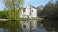
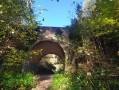
(11) At the end of this road, turn left, following the PR® sign, cross the Pont d’Arcole and enter Montsoult. Walk through the village to the castle, then return to the junction where you started the circular route on the way out.
(3) Continue straight ahead, following the route in the opposite direction to the outward journey, until you reach Montsoult Maffliers station (S/E).
 Visorando Member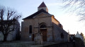
 Moderate

 Difficult
  Association / Club / Walk leader