


Refine your search for walks in Sallagriffon
Sallagriffon walks


 The Clues of Aiglun and the Riolan
 Visorando Member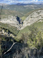
 5.94 mi
 +1,923 ft
 -1,900 ft
 4h 25
4h 25
 Difficult
 Departure from Sallagriffon (Alpes-Maritimes)
A very pleasant walk through a mixed forest offering some beautiful scenery. The views of the two gorges are magnificent, particularly that of the Riolan. The section running alongside the upper Estéron valley offers a sumptuous panorama and allows you to make out the peaks of the Mercantour in the distance.
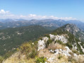
Cacia Circular Loop
 5.29 mi
+2,021 ft
-2,021 ft
4h 10
5.29 mi
+2,021 ft
-2,021 ft
4h 10
 Moderate
Departure from Sigale (Alpes-Maritimes)
Moderate
Departure from Sigale (Alpes-Maritimes)
This hike takes place in the welcome and much-appreciated shade of the trees in summer, except during the 500-metre ascent of the rocky ridge of Les Molières.
Please note, this hike should only be undertaken in good weather as the section between waypoints (5) and (7) climbs quite steeply and some sections can be slippery and daunting for those who suffer from vertigo.
The 360° view from the summit of La Cacia is extraordinary!
Bréche du Mont-Saint-Martin via Sallagriffon
 7.09 mi
+2,372 ft
-2,372 ft
5h 20
Moderate
Departure from Sigale (Alpes-Maritimes)
7.09 mi
+2,372 ft
-2,372 ft
5h 20
Moderate
Departure from Sigale (Alpes-Maritimes)
This circuit is ideal on sunny days and a surprising route thanks to the diversity and beauty of the valley, which is still wild. On the northern slope, you'll appreciate the quiet atmosphere of the pine forests and the oaks that dominate the verdant agricultural plain of Sallagriffon, with a panoramic view up to the foothills of the Mercantour mountain range. On the southern slope, you'll appreciate the magnificent mineral landscapes with tremendous views of deep clues carved out by the capricious course of the rivers.
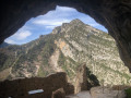
Aiglun, its cave fortress and its waterfall
 6.89 mi
+2,054 ft
-2,028 ft
4h 55
Difficult
Departure from Aiglun (Alpes-Maritimes) (Alpes-Maritimes)
6.89 mi
+2,054 ft
-2,028 ft
4h 55
Difficult
Departure from Aiglun (Alpes-Maritimes) (Alpes-Maritimes)
An exceptional hike, combining history, nature and fitness. The troglodyte fortress is unique, the Vegay waterfall is rivalled only by its Icelandic twin sisters, and the rough section of the nature trail will test your sense of direction. The route concludes with a tour of Aiglun’s beautiful architectural heritage.
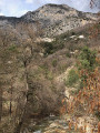
The listed Vegay Waterfall as seen from the village of Aiglun
 3.37 mi
+1,004 ft
-1,004 ft
2h 25
Moderate
Departure from Aiglun (Alpes-Maritimes) (Alpes-Maritimes)
3.37 mi
+1,004 ft
-1,004 ft
2h 25
Moderate
Departure from Aiglun (Alpes-Maritimes) (Alpes-Maritimes)
A moderately strenuous but very pleasant walk. It is the largest recorded and listed natural waterfall in the Alpes-Maritimes, with its three successive drops. The waterfall is exceptional and, in terms of height, is matched only by its Icelandic twin sisters. The start and end of this route offer a chance to discover the beautiful architectural heritage of Aiglun. Thanks to its strategic location, the inn is a popular spot at the end of this round trip in the Estéron.
The troglodyte fortress of Aiglun
 1.43 mi
+958 ft
-961 ft
1h 30
1.43 mi
+958 ft
-961 ft
1h 30
 Easy
Departure from Aiglun (Alpes-Maritimes) (Alpes-Maritimes)
Easy
Departure from Aiglun (Alpes-Maritimes) (Alpes-Maritimes)
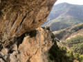
Located a stone’s throw from the village, on the edge of an impressive canyon, the troglodyte fortress known as the “Château d’Aiglun”, with its stone-masonry walls, nestled in its natural surroundings, bears witness to a mysterious past . This rural built heritage, a veritable bastion situated beneath the Giet cliff, is believed to be the largest of its kind in France, spanning nearly 80 metres. The construction of stone steps, the installation of metal steps, the safety works on the access routes, the installation of signage and attractive information points allow visitors to fully enjoy these magical, timeless places.
The Cime de la Cacia from Sigale
 6.33 mi
+2,303 ft
-2,306 ft
4h 55
Moderate
Departure from Sigale (Alpes-Maritimes)
6.33 mi
+2,303 ft
-2,306 ft
4h 55
Moderate
Departure from Sigale (Alpes-Maritimes)
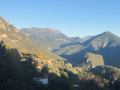
The gradual climb to the summit of Cime de la Cacia offers views of the Barre des Molières, a natural rock face that is also used by rock climbers. The summit, which is reached after crossing a scree slope, offers beautiful 360° views. The return trail follows the only route that once connected France to the County of Savoy.
Arpille summit from Le Mas
 8.20 mi
+2,503 ft
-2,493 ft
5h 55
Moderate
Departure from Le Mas (Alpes-Maritimes)
8.20 mi
+2,503 ft
-2,493 ft
5h 55
Moderate
Departure from Le Mas (Alpes-Maritimes)
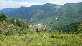
This round trip hike, starting from the charming village of Le Mas, takes you to the summit of L'Arpille. L'Arpille is considered one of the most beautiful viewpoints in the Alpes-Maritimes on the Mercantour.
Circular route in the Haut-Estéron region
 26.19 mi
+6,932 ft
-6,913 ft
3 days
Moderate
Departure from Le Mas (Alpes-Maritimes)
26.19 mi
+6,932 ft
-6,913 ft
3 days
Moderate
Departure from Le Mas (Alpes-Maritimes)
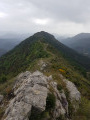
Spectacular landscapes, a remote, wild region, villages nestled in the mountains: you are in the Haut-Estéron region.
Three days’ hiking in this magnificent setting, alternating between paths and tracks through the woods, across the plains and along the ridges, whilst passing through some beautiful, isolated villages.
Le Mas - Amirat
 8.31 mi
+2,480 ft
-2,598 ft
6h 00
Moderate
Departure from Le Mas (Alpes-Maritimes)
8.31 mi
+2,480 ft
-2,598 ft
6h 00
Moderate
Departure from Le Mas (Alpes-Maritimes)
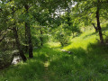
The first stage of the journey through the Haut Estéron region: the landscapes are magnificent and the area extremely wild; we didn’t come across a single other hiker. The trails are varied and well-marked. We’ll set off from the village of Le Mas to reach Amirat (lodge) via the Charamel mountain and the village of Les Mujouls.
The Col de Rigaudon
 6.33 mi
+2,198 ft
-2,198 ft
4h 50
Moderate
Departure from Puget-Théniers (Alpes-Maritimes)
6.33 mi
+2,198 ft
-2,198 ft
4h 50
Moderate
Departure from Puget-Théniers (Alpes-Maritimes)
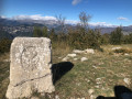
A very pleasant hike criss-crossing the sunny and shady sides of this mountainous area, offering two contrasting types of vegetation and views of the Alps that will have you stopping regularly to take in the scenery.
The Col du Trébuchet, starting from Amirat
 8.77 mi
+2,523 ft
-2,497 ft
6h 15
Moderate
Departure from Amirat (Alpes-Maritimes)
8.77 mi
+2,523 ft
-2,497 ft
6h 15
Moderate
Departure from Amirat (Alpes-Maritimes)
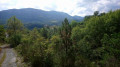
A fairly easy route straddling the Alpes-Maritimes and the Alpes de Haute-Provence in the Haut-Estéron massif.
The route runs mainly through coniferous and beech woodland. It takes you to two lovely villages: the small village of Amirat, which offers a panoramic view of the valley from its beautiful square, and the village of Castellet-Saint-Cassien with its castle.
Amirat - Saint-Auban
 9.15 mi
+2,989 ft
-2,461 ft
6h 50
Difficult
Departure from Amirat (Alpes-Maritimes)
9.15 mi
+2,989 ft
-2,461 ft
6h 50
Difficult
Departure from Amirat (Alpes-Maritimes)
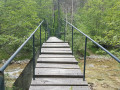
Second stage of the journey through the Haut-Estéron region. This stage takes you to Saint-Auban via the pretty villages of Gars and Briançonnet, then over the somewhat steep Col de l’Escoussier; a variety of landscapes and a trek through wild countryside await!
Cheiron and Jerusalem peaks
 4.02 mi
+1,640 ft
-1,647 ft
3h 15
Moderate
Departure from Gréolières (Alpes-Maritimes)
4.02 mi
+1,640 ft
-1,647 ft
3h 15
Moderate
Departure from Gréolières (Alpes-Maritimes)
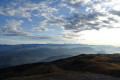
Starting from the Gréolières-les-Neiges resort, this short circular hike will take you to the Cime du Cheiron, the highest point of the massif of the same name.
You will then follow the ridge to Jérusalem for some magnificent views of the Mercantour and the plateaus further south, Saint-Barnabé, Calern and Caussols, before descending via the slopes.
During this hike, you may encounter vultures, chamois and even marmots.
The Pivoines Route from Gréolières-les-Neiges Ski Resort
 4.88 mi
+673 ft
-673 ft
2h 50
Moderate
Departure from Gréolières (Alpes-Maritimes)
4.88 mi
+673 ft
-673 ft
2h 50
Moderate
Departure from Gréolières (Alpes-Maritimes)
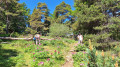
A short hike to enjoy between late April and mid-June to admire the peonies in bloom.Much of the route is through woodland, so it stays cool during hot weather.This mid-mountain walk is a great way to enjoy the area outside the ski season.
Circular route via Croix de Verse, Jérusalem and Cime du Cheiron
7.03 mi
+1,611 ft
-1,624 ft
4h 40
Moderate
Departure from Alpes-Maritimes
A magnificent hike passing Croix de Verse, Jérusalem and Cime du Cheiron in Gréolières les Neiges. Not particularly difficult, with a 360° view between the peaks of Mercantour, Vallée du Loup and the Mediterranean on a clear day.
Depending on the season, paragliders take off from the route.
On the slopes of Mont Long between Cuébris and Roquestéron
 4.58 mi
+1,932 ft
-1,916 ft
3h 45
Moderate
Departure from Roquesteron (Alpes-Maritimes)
4.58 mi
+1,932 ft
-1,916 ft
3h 45
Moderate
Departure from Roquesteron (Alpes-Maritimes)
A circular walk in the beautiful Estéron valley.
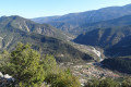
You’ll set off from the village of Roquestéron to climb up to the hidden village of Cuébris, then follow a charming little stream before ascending through the Pali State Forest towards the Mont Long ridge at L’Abeille.
You’ll then be treated to a stunning panoramic view of the eastern part of the valley, featuring the peaks of the Mont Vial ridge, Mont Lion and Mont Auvière… and the Estéron as it winds its way between the villages.
From Roquestéron to L’Iscle via Sainte-Pétronille
 3.56 mi
+1,257 ft
-1,260 ft
2h 45
Moderate
Departure from Roquesteron (Alpes-Maritimes)
3.56 mi
+1,257 ft
-1,260 ft
2h 45
Moderate
Departure from Roquesteron (Alpes-Maritimes)
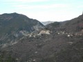
This route will take you on a tour of Roquestéron and La Roque-en-Provence (formerly Roquestéron-Grasse), two villages separated by the Estéron, which formed the border (before 1860) between France and Savoy. Return to Roquestéron via a local track running alongside the Estéron.
Editor’s note added on 20/09/2021: some of the paths on this 2016 hike are difficult to find. See the comments at the bottom of this page
 Croix de Verse via the Cheiron forest
 6.82 mi
+1,516 ft
-1,427 ft
5 hrs
Moderate
Departure from Alpes-Maritimes
6.82 mi
+1,516 ft
-1,427 ft
5 hrs
Moderate
Departure from Alpes-Maritimes
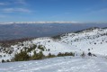
A beautiful snowshoe hike (or not in winter) with no difficulty and panoramic views of the Mercantour peaks and the French Riviera on a clear day.
After a pleasant first section in the Cheiron forest, you cross a small valley before climbing up to Plan des Baumetes and reaching the Crête du Cheiron at Croix de Verse (1,706 m).
360° view of the sea at Argentera!
Bau de l'Arc from Roquesteron
 7.79 mi
+2,582 ft
-2,582 ft
5h 50
Moderate
Departure from Roquesteron (Alpes-Maritimes)
7.79 mi
+2,582 ft
-2,582 ft
5h 50
Moderate
Departure from Roquesteron (Alpes-Maritimes)
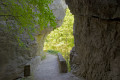
To reach the summit of Bau de l'Arc (980m), you pass through the charming little village of Cuébris. Superb panorama at the summit: to the south, the resort of Gréolières les Neiges, the village of Cuébris and the upper Estéron valley; to the west, the Bernade ridge and Mont Saint-Honorat (2,520 m); to the north-east, the Vial ridge.
The trail is currently closed between markers 88 and 89 and between markers 104 and 105.
Information provided by Randoxygene.
For more information, visit https://randoxygene.departement06.fr/
The Roquesteron botanical trail
 3.40 mi
+712 ft
-712 ft
2h 10
Easy
Departure from Alpes-Maritimes
3.40 mi
+712 ft
-712 ft
2h 10
Easy
Departure from Alpes-Maritimes
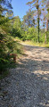
Discover two villages, Roquestéron and La Roque-en-Provence, historically separated by the Estéron River, which marks the border between Provence and the County of Nice. Roquestéron on the left bank became French in 1860. Take a walk in the forest along a forest trail converted into a botanical trail and discover the trees and plants of the middle country.
Circular Gars and Briançonnet loop
 6.08 mi
+1,250 ft
-1,276 ft
3h 55
Moderate
Departure from Gars (Alpes-Maritimes)
6.08 mi
+1,250 ft
-1,276 ft
3h 55
Moderate
Departure from Gars (Alpes-Maritimes)
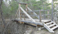
Circular route from the village of Gars to Briançonnet. This hike takes you to the impressive Source de Gars, the birthplace of Célestin Freinet, pioneer of modern education. It is a varied route that passes through the village of Briançonnet and the ruins of its feudal castle, from where there is a beautiful view of the surrounding area. Both villages are well worth a visit for their rich heritage.
Gars–Amirat–Briançonnet circular loop
 11.59 mi
+2,703 ft
-2,726 ft
7h 40
Difficult
Departure from Gars (Alpes-Maritimes)
11.59 mi
+2,703 ft
-2,726 ft
7h 40
Difficult
Departure from Gars (Alpes-Maritimes)
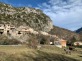
Far from the most popular trails in the Alpes-Maritimes, this walk takes you through a few small villages in the upper Estéron valley. The circular route described here also offers some lovely panoramic views of the Mercantour mountains and features a fairly varied landscape, ranging from woodland to farmland.
A long route with significant elevation gain but no technical difficulties.
Please note: there appears to be an issue regarding private property.However, there is an issue between the waymark (7) and (8). The path is now closed by the owner of the farm. You must continue via the Crête des Rochers des Côtes and then rejoin the path at the far end of the Rochers de Notre-Dame.
The unmarked trails of the wooded ridges of the Haut-Estéron
 6.35 mi
+1,657 ft
-1,670 ft
4h 20
Moderate
Departure from Val-de-Chalvagne (Alpes-de-Haute-Provence)
6.35 mi
+1,657 ft
-1,670 ft
4h 20
Moderate
Departure from Val-de-Chalvagne (Alpes-de-Haute-Provence)
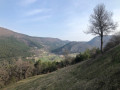
Discover a beautiful forest near Castellet Saint-Cassien. Following the ridges along unmarked paths offers a delightful way to explore this stunning Haut-Estéron National Forest.
Mont Auvière
 Association / Club / Walk leader
 5.75 mi
+2,293 ft
-2,264 ft
4h 40
Difficult
Departure from Roquesteron (Alpes-Maritimes)
5.75 mi
+2,293 ft
-2,264 ft
4h 40
Difficult
Departure from Roquesteron (Alpes-Maritimes)
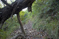
A beautiful hike above Roquesteron. Magnificent views of the villages of Pierrefeu, Toudon and Mont Vial.
Cheiron Peak
 8.42 mi
+2,175 ft
-2,175 ft
5h 45
Moderate
Departure from Gréolières (Alpes-Maritimes)
8.42 mi
+2,175 ft
-2,175 ft
5h 45
Moderate
Departure from Gréolières (Alpes-Maritimes)
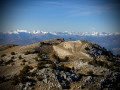
Cime du Cheiron via a trail that is little known to walkers. This trail has been cleared by our club and marked with cairns.
Moderator's note description from 2013; the situation on the ground seems to have changed with regard to the cairns marking certain sections. See reviews. GPS or Visorando app useful.
From Ascros to the Chapel of Sainte-Baume via Les Chats and Pécogiu
 6.74 mi
+1,411 ft
-1,388 ft
4h 20
Moderate
Departure from Ascros (Alpes-Maritimes)
6.74 mi
+1,411 ft
-1,388 ft
4h 20
Moderate
Departure from Ascros (Alpes-Maritimes)
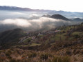
A beautiful circular walk in the heart of the Pré-Alpes d'Azur Regional Nature Park, starting from Ascros and passing through Les Chats, Pécogiu and the Var-Moyen State Forest on the way to the magnificent Sainte-Baume Chapel.
Route of the chapels on the Plateau de Dina
 7.99 mi
+2,956 ft
-2,956 ft
6h 15
Difficult
Departure from Rigaud (Alpes-Maritimes)
7.99 mi
+2,956 ft
-2,956 ft
6h 15
Difficult
Departure from Rigaud (Alpes-Maritimes)
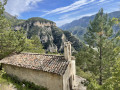
A lovely, challenging hike starting at the confluence of the Var and Cians rivers, leading up to the Plateau de Dina whilst taking in four chapels along the way. Beautiful panoramic views of the surrounding peaks.
The village of Auvare via the Montagne de Mairola, starting from Puget-Rostang
 9.01 mi
+3,015 ft
-2,995 ft
6h 45
Difficult
Departure from Puget-Rostang (Alpes-Maritimes)
9.01 mi
+3,015 ft
-2,995 ft
6h 45
Difficult
Departure from Puget-Rostang (Alpes-Maritimes)
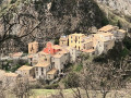
The first part of this hike, which is wooded and quite strenuous, will leave you breathless at the summit of Montagne de Mairola. After a break to take in the exceptional 360° view, exploring Auvare – the smallest commune in the department – with its old stone buildings, its wash house and its house facades in colours faded by the sun, will be a real treat for heritage enthusiasts.
Mairola route starting from Puget-Rostang
 6.99 mi
+2,986 ft
-2,995 ft
5h 50
Moderate
Departure from Puget-Rostang (Alpes-Maritimes)
6.99 mi
+2,986 ft
-2,995 ft
5h 50
Moderate
Departure from Puget-Rostang (Alpes-Maritimes)
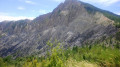
Exploring the Vallon and Montagne de Mairola shows that these vast spaces have been shaped by humans over the centuries: the south-facing cereal fields of Puget-Rostang, state forests reforested to combat erosion, the Dina plateau with its fields cleared of stones with patience, scattered farms now used only as shelters during the hunting season (Fournès, Villars, la Combe, Mairola)...
Les Hautes-Gréolières via the Font d’Antony
 3.38 mi
+1,073 ft
-1,066 ft
2h 30
Easy
Departure from Gréolières (Alpes-Maritimes)
3.38 mi
+1,073 ft
-1,066 ft
2h 30
Easy
Departure from Gréolières (Alpes-Maritimes)
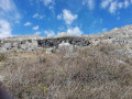
This sunny walk, at the foot of the rocky ridges of the Montagne du Cheiron, offers a beautiful panoramic view of the Calern plateau, Cipières and the Loup valley. The walk starts near the Tourist Office, by the D2 road, then climbs towards the Font d’Antony before descending to the ruins of the old medieval village of Les Hautes-Gréolières, where you can still admire the Chapel of Saint-Étienne. The route then descends via a wide, stony path which quickly leads back to the village and the starting point. After this journey into the past, take a stroll through the bustling streets of the modern-day village.
Cheiron Mountain
 13.19 mi
+4,183 ft
-4,180 ft
9h 40
Difficult
Departure from Gréolières (Alpes-Maritimes)
13.19 mi
+4,183 ft
-4,180 ft
9h 40
Difficult
Departure from Gréolières (Alpes-Maritimes)
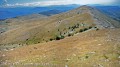
Superb hike along a long ridge with endless views across the entire department.
The hike is quite long but can be extended for the more athletic by passing through Coursegoules or even Bézaudin.
The luckiest hikers will catch a glimpse of Corsica in good weather.
It is common to see chamois and marmots.
The return via Vespluis and Les Miroirs (no difficulty) allows you to admire the entire ridge and the south-facing slope of this mountain in pastoral tranquillity.
Pic de l'Aiglo
 3.41 mi
+774 ft
-758 ft
2h 15
Easy
Departure from Le Mas (Alpes-Maritimes)
3.41 mi
+774 ft
-758 ft
2h 15
Easy
Departure from Le Mas (Alpes-Maritimes)
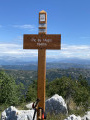
A very pleasant, easy family hike through pine forests and small meadows, ideal for a picnic in the mountains.
Pic de Fourneuby
 8.64 mi
+2,835 ft
-2,835 ft
6h 25
Moderate
Departure from Le Mas (Alpes-Maritimes)
8.64 mi
+2,835 ft
-2,835 ft
6h 25
Moderate
Departure from Le Mas (Alpes-Maritimes)
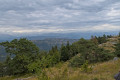
At an altitude of over 1,400 metres, this pleasant hike through the pine trees takes you on a journey of discovery through an enchanting environment. The Pic de Fourneuby overlooks the village of Le Mas and offers a 360° panorama of the foothills of the Alpes-Maritimes and neighbouring departments.
Circular Saint-Pons route towards Coursegoules MR
7.49 mi
+1,923 ft
-1,923 ft
5h 05
Moderate
Departure from Gréolières (Alpes-Maritimes)
Circular walk starting from the new car park in Saint-Pons (commune of Gréolières) towards Coursegoules, passing under the Cheiron. A very varied route passing by the 6th-century Saint-Michel Chapel. Return via the Chemin de l'Autreville and the Vespluis and Taillet valleys, with a small ford that is easy to cross. Ideal for a full day out with a nice stop in Coursegoules: restaurant or picnic, bakery and water point.
Route du Bois de Garavagne
 9.16 mi
+1,768 ft
-1,778 ft
5h 45
Moderate
Departure from Gréolières (Alpes-Maritimes)
9.16 mi
+1,768 ft
-1,778 ft
5h 45
Moderate
Departure from Gréolières (Alpes-Maritimes)
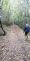
Starting from Tourounet, this mostly shaded route will take you to the Saint-Barnabé plateau, then to the outskirts of the village of Coursegoules, before descending via an ancient Roman road lined with pine and oak trees back to Tourounet.
The Col de la Baïsse, the Castellaras and the Château des Quatre Tours
 7.46 mi
+1,526 ft
-1,503 ft
4h 45
Moderate
Departure from Andon (Alpes-Maritimes)
7.46 mi
+1,526 ft
-1,503 ft
4h 45
Moderate
Departure from Andon (Alpes-Maritimes)
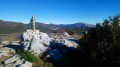
This hike is accessible to all. The highlight is the magnificent site of Castellaras, the only difficulty being the climb, which is nevertheless reasonable. The hike starts from the picturesque health resort of Thorenc. The route also offers views of Lake Thorenc and the Château des Quatre Tours. The variety of landscapes and paths is another interesting aspect of this hike. What's more, there are no navigation difficulties.
Circular walk between Lake Thorenc and the Col de Bleine
 6.24 mi
+1,299 ft
-1,299 ft
4h 00
Moderate
Departure from Andon (Alpes-Maritimes)
6.24 mi
+1,299 ft
-1,299 ft
4h 00
Moderate
Departure from Andon (Alpes-Maritimes)
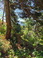
The walk starts and ends at the car park right next to Lake Thorenc. The aim is to enjoy the magnificent view at the foot of a TDF relay mast: to the south, the waters of the lake at the start of the walk reflect the surrounding forest, and further to the east stands the Castellaras, a natural defensive stronghold.