The village of Auvare via the Montagne de Mairola, starting from Puget-Rostang

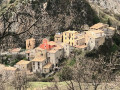
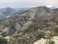
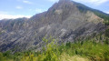
The first part of this hike, which is wooded and quite strenuous, will leave you breathless at the summit of Montagne de Mairola. After a break to take in the exceptional 360° view, exploring Auvare – the smallest commune in the department – with its old stone buildings, its wash house and its house facades in colours faded by the sun, will be a real treat for heritage enthusiasts.

Details

47836126
Creation:
Last update:
Last review:
  • Walking
    Activity: Walking
  • ↔
    Distance: 9.01 mi
  • ◔
    Average duration: 6h 45 
  • ▲
    Difficulty: Difficult

  • ⚐
    Back to start: Yes
  • ↗
    Ascent: + 3,015 ft
  • ↘
    Descent: - 2,995 ft

  • ▲
    Highest point: 5,226 ft
  • ▼
    Lowest point: 2,313 ft

Photos

Description of the walk

Park in the car park at the business and leisure park, near marker 179.

(S/E) Cross the metal footbridge where marker 179 is located, and head towards the Plateau de la Dina. This nature trail is dotted with information about the flora: you are now in the Mairola-Dina State Forest.

(1) At the junction with marker 171, on the left is the ‘Les Aubrics’ water reservoir. At the end of the low wall surrounding this water reservoir, a cairn marks the start of the magnificent pine-lined path, which runs parallel to the Piste de Dina for a while. Follow the red and white markings until you reach another cairn at a bend in the track. Continue along the ascending path, following the markings.

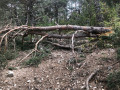
(2) Turn left at marker 170, towards the Col de la Barbenière. The path climbs steeper and steeper, and recent storms have caused branches and trees to fall. Reach the Col de la Barbenière (alt. 1,477 m) and marker 184.

(3) Cross the Piste de Dina and continue straight ahead on the path towards the Montagne de Mairola (incorrectly spelt on the IGN map), which lies directly ahead: yellow markings.

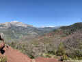
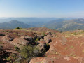
(4) Summit of Montagne de Mairola (1,596 m): take in the 360° view, then turn back towards the pass.

(3) Back at the Col de la Barbenière (alt. 1,477 m) and marker 184, turn right towards the Col de Mairola

(5) At this bend (cairn), leave the track and take the path through the woods. Join the track again.

(6) Cross it and follow the marked path on the opposite side, which descends towards the Col de Mairola.

(7) At the pass, continue to the left (marker 183). Reach the path junction at marker 182.

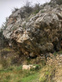
(8) Carry on straight ahead towards Auvare; you’ll soon come to a barn, next to which there’s a beautiful fountain beneath a 10-metre-high rock. You’ll reach a junction of trackways at marker 260.

(9) Turn left towards Auvare.

(10) Turn right onto the DFCI track at La Panégière: there is a ‘dead end’ sign. When you reach a bend in the track, keep left and you’ll arrive at marker 222.

(11) Please note: this marker is situated below the track, in the stream, and the sign for Auvare points to the left. Ignore this. Continue straight on, following the yellow markings. You’ll reach a crossroads of paths at marker 223.

(12) Turn left and head straight on to Auvare, continuing to follow the yellow markings. You’ll reach the bridge (marker 220).

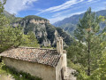
(13) Cross the bridge and, in the village of Auvarewhich is over a thousand years old – turn left onto the Camin do Cimenteri, then immediately right onto the Basso Carriera, which, towards the top of the lane, leads to St Peter’s Church and, above that, to the magnificent washhouse dating from 1844.

(14) Explore this charming, picturesque little village of Auvare, then cross the bridge again.

(13) Turn right towards Puget-Rostang and follow the red and white markings.

(15) Keep to the right onto the ancient path leading downhill, following the red and white markings.

(16) At this crossroads in the forest (signpost marked ‘Facteur’), continue straight on to reach the crossroads of paths at marker 221.

(17) Turn right towards Puget-Rostang, follow the markings and reach marker 181.

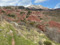
(18) Continue south on the path which winds its way past black marl formations. Puget-Rostang lies just below. Follow the path to the end to enter the village at marker 180.

(19) When you reach the tarmac section, turn left: there is a sign on the ground marked ‘accès pompier’ (fire brigade access). Follow this narrow lane for a short distance, then go down the long flight of steps on your left, which will take you to the church and the wash house.

(20) Just past the wash house, turn left onto “la paved slanting street of the granges” for about thirty metres, which leads to the “Écomusée en terre gavotte”. The car park (S/E) is below the wash house.


Waypoints

  1. S/E : mi 0 - alt. 2,316 ft - Village car park
  2. 1 : mi 1.04 - alt. 3,153 ft - Crossroads, marker 171
  3. 2 : mi 1.39 - alt. 3,419 ft - Trail junction
  4. 3 : mi 3.12 - alt. 4,846 ft - Col de la Barbenière
  5. 4 : mi 3.49 - alt. 5,226 ft - Summit
  6. 5 : mi 4.39 - alt. 4,547 ft - Cairn
  7. 6 : mi 4.61 - alt. 4,436 ft - Start of the trail
  8. 7 : mi 4.78 - alt. 4,222 ft - Col de la Mairola, marker 183
  9. 8 : mi 5.02 - alt. 4,035 ft - Trail junction, marker 182
  10. 9 : mi 5.41 - alt. 4,101 ft - Junction of tracks suitable for vehicles
  11. 10 : mi 5.9 - alt. 3,911 ft - Junction of tracks suitable for vehicles
  12. 11 : mi 6.47 - alt. 3,921 ft - Marker 222
  13. 12 : mi 6.98 - alt. 3,704 ft - Trail junction
  14. 13 : mi 7.16 - alt. 3,573 ft - Bridge
  15. 14 : mi 7.22 - alt. 3,638 ft - Washing house in the village of Auvare
  16. 15 : mi 7.65 - alt. 3,373 ft - Trail junction
  17. 16 : mi 7.92 - alt. 3,163 ft - Trail junction
  18. 17 : mi 8.38 - alt. 2,989 ft - Trail junction
  19. 18 : mi 8.48 - alt. 2,894 ft - Trail junction
  20. 19 : mi 8.9 - alt. 2,388 ft - Trail junction – road, marker 180
  21. 20 : mi 8.96 - alt. 2,339 ft - Ecomuseum
  22. S/E : mi 9.01 - alt. 2,316 ft - Village car park

Notes

A water point opposite the barn just after point (8).
A water point at the Auvare washhouse.

Make sure you have hiking boots and walking poles.

Worth a visit

Visit to the villages of Puget-Rostang andAuvare
Visit to the Ecomuseum. Admission and donations welcome. Open from May to October. From 10.00 to 12.00 and from 14.00 to 18.00.

Reviews and comments

4.8 / 5
Based on 2 reviews

Reliability of the description
5 / 5
Ease of following the route
5 / 5
Route interest
4.5 / 5
bernard bb
bernard bb

Thank you, Philippe_M-06---, for this review
A really lovely walk indeed
Best wishes, b.

Machine-translated

Philippe_M-06
Philippe_M-06

Overall rating : 5 / 5

Date of your route : Apr 21, 2025
Reliability of the description : ★★★★★ Very good
Ease of following the route : ★★★★★ Very good
Route interest : ★★★★★ Very good
Very busy route : No

A lovely walk, quite unspoilt and with varied scenery.
There were a few people at the Col de la Barbenière (a small group), but otherwise just the shepherd and his sheep before the village of Auvare.
But this walk is generally quite popular.
A slight variation: before point 11, we took the track on the right which climbs a little, and came back down via the path leading from the Col de Panégière. Lovely view of Auvare, then we reached point 12
Best done in spring or autumn.

Machine-translated

bernard bb
bernard bb

Thank you, JPCanet, for this feedback and for these important clarifications
I’ve requested the change
Best regards, Rando, B

Machine-translated

JPCanet
JPCanet

Overall rating : 4.7 / 5

Date of your route : May 05, 2024
Reliability of the description : ★★★★★ Very good
Ease of following the route : ★★★★★ Very good
Route interest : ★★★★☆ Good
Very busy route : No

Good evening,
We did this circular walk yesterday.
It’s definitely the best way to explore the Mairola countryside.
The path between markers 184 and 183 has been cleared. There’s no need to take the detour via the track on the way down from the summit.
Tip: the approach to Auvare is more impressive if you come via the ridge of the Vallon des Agemounes. Stick to the track veering to the right 150 metres before joining the B222, continuing to the altitude of 1254, where cairns indicate the path towards Auvare.
Thank you for your hiking suggestions.
JPC

Machine-translated

Other walks in the area

For more walks, use our search engine .

The GPS track and description are the property of this route's author. Please do not copy them without permission.