Ascent to the Roua bivouac from Puget-Théniers

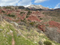
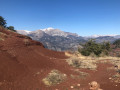
A day’s hike to reach the Roua bivouac site. The walk starts from the terminus of bus route 675 coming from Nice. The stop at the Roua bivouac allows you to then complete a circular Daluis Gorges route or climb the Dôme de Barrot, which overlooks the Permian red pelite massif. You cross the gorges and the Roudoule Valley, with its steep, wild ravines. After the village of La Croix-sur-Roudoule, you complete the ascent via the Roman road through the landscape of red pelites.

Details

n°111083792
Creation:
Last update:
Last review:
–
  • Walking
    Activity: Walking
  • ↔
    Distance: 8.34 mi
  • ◔
    Average duration: 7h 05 
  • ▲
    Difficulty: Difficult

  • ⚐
    Back to start: No
  • ↗
    Ascent: + 3,714 ft
  • ↘
    Descent: - 837 ft

  • ▲
    Highest point: 4,232 ft
  • ▼
    Lowest point: 1,329 ft
  • ⚐ Country: France
  • ⚐
    Area: Alps
  • ⚐ City: Puget-Théniers (06260)
  • ⚑
    Start: N 43.954872° / E 6.89353°
  • ⚑
    End: N 44.03126° / E 6.865068°
  • ❏
    IGN map(s): Ref. 3540ET, 3640OT, 3641OT
  • Hour-by-hour weather

Description of the walk

Access via the 675 bus in the morning from Nice Grand Arena, the tram stop, TER station and bus terminal at Nice Airport.

(S) Get off at Place Aristide Maillol to start the walk (get off at the next stop for the supermarket). Take the bridge to cross the Roudoule. Do not follow the river but cross through the village and climb up behind the church until you reach marker 174, then join the D16.

(1) Follow the D16 uphill. Take care: visibility is poor on the winding sections of the road. You’ll reach the sanctuary of Notre-Dame de la Roudoule.

(2) Continue along the road until you reach marker 176.

(3) Turn right onto the path; there is a steep climb, then cross the small ravine on the left. Follow the maintenance track for the electricity pylons. Take care on the steep sections hidden by vegetation. Walk along the gorge, then cross a small valley on a wooded north-facing slope. You will reach the torrent.

(4) Ford the stream – be careful: the banks are steep and difficult to cross. You’ll reach the D116 road towards Puget-Rostand just above the stream. Turn immediately left onto the road bridge and continue to marker 117 bis.

(5) Take the path on the right and follow the direction of La Croix-sur-Roudoule, avoiding the tracks and paths leading off to the right (ignore the old, displaced marker visible in autumn 2026). Reach the Ravin de Ruinas.

(6) Cross it and continue straight ahead along a relatively flat stretch, passing the Ruisseau du Vallon de Giatageai to reach the Bergerie du Serre.

(7) Carry on, cross the Ravin des Foundous, pass marker 228, and reach the D416 at marker 229.

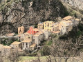
(8) Turn right onto it with care, arriving at the village of La Croix-sur-Roudoule (church on the left)

(9) Cross the car park and take the track at marker 231. Continue along the track to marker 232, towards Léouvé and the Col de Roua. Follow the track until its first hairpin bend to the right.

(10) Leave the road here and head straight ahead onto the yellow-marked path towards Léouvé. Pass the transmission masts and the Chapel of Saint-Sébastien. After crossing the pine forest, you’ll reach a pasture where the path disappears. Follow the electricity pylons and rejoin the path below on the right to reach the road and then marker 238. A little further on, continue to the left towards the Col de Roua, crossing a bridge over the Roudoule.

(11) Here, you have two options:
- stay on the road – a longer but easier route;
- continue along the signposted path – this is the route shown on the map – but the climb is more difficult.
In both cases, you’ll reach marker 240.

(12) Turn right onto the old Roman road, which is partially maintained and consists of a stone-paved track. You will then come to the Ruisseau du Vallon de Garnier.

(13) Cross it and continue along the Roman road to the Col de Roua, marker 250.

(14) Follow the signs opposite for Guillaumes and Amen; veer slightly left at marker 141 to join the track. You will then reach marker 141a.

(15) Turn right; the route is marked with grey stone blocks as the red pelite path erodes in the rain. Follow the path to the Roua bivouac (E).

(E) After a night at the campsite, take the same route in the opposite direction to return to the car park at Place Aristide Maillol in Puget-Théniers (S).

Waypoints

  1. S : mi 0 - alt. 1,332 ft - Place Aristide Maillol - Gare de Puget-Théniers
  2. 1 : mi 0.21 - alt. 1,401 ft - Waymark 174
  3. 2 : mi 0.62 - alt. 1,506 ft - Sanctuaire Notre-Dame de la Roudoule (Puget-Théniers)
  4. 3 : mi 0.93 - alt. 1,552 ft - Waymark 176
  5. 4 : mi 1.78 - alt. 1,713 ft - Fording
  6. 5 : mi 1.89 - alt. 1,745 ft - Marker 177 bis – Trailhead
  7. 6 : mi 2.68 - alt. 2,635 ft - Ruinas Ravine
  8. 7 : mi 3.16 - alt. 2,740 ft - Bergerie du Serre
  9. 8 : mi 3.55 - alt. 2,631 ft - Waymark 229
  10. 9 : mi 3.86 - alt. 2,792 ft - Église Saint-Michel (La Croix-sur-Roudoule)
  11. 10 : mi 4.57 - alt. 2,753 ft - Path to Léouvé
  12. 11 : mi 5.27 - alt. 2,438 ft - Bridge over the Roudoule
  13. 12 : mi 6.02 - alt. 3,130 ft - Waymark 240
  14. 13 : mi 6.74 - alt. 3,438 ft - Vallon de Garnier stream
  15. 14 : mi 7.74 - alt. 4,213 ft - Col de Roua (1287m)
  16. 15 : mi 8.19 - alt. 4,049 ft - Marker 141a
  17. E : mi 8.34 - alt. 4,232 ft - Bivouac de Roua

Notes

Please note: there is a narrow, unavoidable ford in the first quarter of the walk, at the Mayola torrent. After two days of storms, the flow was manageable, but there are log jams up to a man’s waist. I therefore think it must be impassable when the flow is strong.

(E) This walk can be done as a round trip with an overnight stay at the Roua bivouac. It can be extended to include the Daluis Gorges Balcony Route (official route) or the ascent of the Dôme de Barrot ( an old route; I was unable to complete this section due to the weather).

There are toilets at the car park at the start in Puget (S), at the playground in La Croix-sur-Roudoule (9) and at the Roua campsite (E) (dry toilets).
A tapped spring provides a source of water. Hikers planning to camp are advised to top up their water supplies before the climb up to the campsite.

There is an untested drinking fountain at La Croix-sur-Roudoule (9) and a tapped spring near the Roua campsite (E). This spring had run dry during the summer of 2026.

Regarding the Roua campsite, booking is compulsory via the official website of the Gorges de Daluis nature reserve, and the donation box is located in the shelter. The tent pitches are on wooden planks, so it is best to bring extra ropes and pegs or use a freestanding tent. Please note: we were able to sleep peacefully on days when there was no hunting, but we were woken up by hunters on a day when hunting was taking place (late autumn 2026).

This route passes through a protected area, which may be subject to special regulations:

Worth a visit

The Gorges de la Roudoule and the road bridge that crosses them.

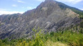
As you climb above Léouvé, you can admire the red pelite formations, which change with the rain and erosion. You can see the remains of the valley’s mining heritage as well as the remains of the Roman road, which have recently been restored. In autumn, you can hear the stags’ bellowing.
The Marbrée des Pélites

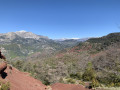
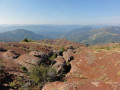
Once past the Col de Roua, you can see the southern entrance to the Daluis Gorges, with the River Var flowing through them below; it takes 2 hours to walk down to them.

Other walks in the area

For more walks, use our search engine .

The GPS track and description are the property of this route's author. Please do not copy them without permission.