Le Bau de l’Arc and the Crête des Gauthiers from Cuebris

This walk, starting from Cuebris and beginning with a canyon, takes us to the Bau de l’Arc at an altitude of 988 metres. The off-trail crossing of the Crête des Gauthiers will make for a truly unique and beautiful day out.

Details

n°20213949
Creation:
Last update:
Last review:
  • Walking
    Activity: Walking
  • ↔
    Distance: 6.41 mi
  • ◔
    Average duration: 5h 00 
  • ▲
    Difficulty: Moderate

  • ⚐
    Back to start: Yes
  • ↗
    Ascent: + 2,359 ft
  • ↘
    Descent: - 2,352 ft

  • ▲
    Highest point: 3,179 ft
  • ▼
    Lowest point: 1,581 ft

Photos

Description of the walk

Walk through Cuebris. On leaving the village, turn right at marker 85: the car park is about fifty metres further on.

(S/E) Walk through this beautiful, picturesque village in the opposite direction until you reach marker 84.

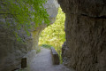
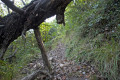
(1) Turn left onto an old path that leads downhill. This section is damp. Whatever the season – especially in winter – you must tread carefully to avoid slipping. Walk past the sewage treatment plant and the stream known as the Petit Riou, before reaching a bridge spanning a canyon with steep grey walls, carved out by the Gros Riou. Continue along this path to reach marker 88 at a bend.

(2) Carry on straight ahead for a few metres, then, just past the nearby forest gate, take the path on the left which winds its way through terraced fields in the woodland. Further on, this path requires caution, and a metal staircase has been installed in a rocky section. When you reach a three-way junction, ignore the right-hand branch and carry on straight ahead until you reach the next junction at marker 89.

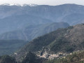
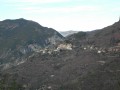
(3) Turn onto the path on the left. Cross the Gros Riou, which is ‘gros’ (big) in name only. Continue along this stony path, which offers views of Cuebris throughout the climb; the village appears to be clinging between two rocky cliffs.

(4) Turn left at this crossroads of paths towards the Bau de l’Arc (marker 310). In the final metres of the climb, the forest path gives way to a rocky area marked with cairns.

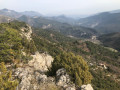
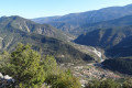
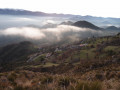
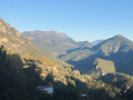
(5) Summit of the Bau de l’Arc (alt. 988 m). This rocky plateau offers exceptional panoramic views of Cuebris, as well as the cliffs and the Crête des Gauthiers – our next destination, situated due west. Turn back.

(4) Turn left towards the Baisse des Gauthiers. The path winds through a sparsely wooded area and then through a marl zone marked by cairns. At marker 103, continue straight on towards the Baisse des Gauthiers.

(6) Marker no. 104 bears the inscription “Baisse des Gauthiers / altitude 814 m”. Cross the forest track at right angles towards the other marker 104 situated opposite, bearing the directional sign “la Pinea”. Head towards this marker and turn left at it, heading towards the start of the ridge, which can be made out about a hundred metres away through the trees.

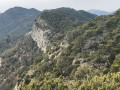
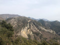
Begin the ascent towards the Les Gauthiers ridge. There are no signposts or marked paths, but scattered tracks help you make your way. The vegetation is dense in places but always passable. Follow the Les Gauthiers ridge, which runs along the cliff edge overlooking Cuebris below. Take care on certain rocky sections. All along this long ridge, and a few metres inland from it, lies a geological curiosity: a sort of ‘spine’ made up of flat rocks, 1 to 4 metres high and running parallel to the ridge. Follow it by walking on top of it or alongside it, sometimes even along the rocky line where the slope breaks. The views over Cuebris are magnificent.

(7) At this point, turn left onto the descending path.

(8) At this old house in the hamlet of Les Gauthiers, the yellow markings are faded. Walk alongside the east wall of the house and go round it, as the path resumes at the south-facing side. Continue along the zigzagging path downwards.

(9) At this point, first turn right then left and take the descending path which leads out onto the Route de la Morge. Turn left onto this tarmac road, which leads downhill.

(10) Keep to the left towards the forest track. Turn right just after the barrier onto the yellow-marked descending path, which rejoins the Route de la Morge further down. Turn left and follow the tarmac road.

(11) At this point, leave the Route de la Morge and turn right onto a short path marked in yellow. After running alongside a terraced wall, this path becomes tarmac again and you enter the built-up area. Continue along the Route des Canabiers, which leads to a junction where the sign marking the entrance to the town of Cuebris is located. Carry on straight ahead along the Route de la Graou, then turn left to return to the car park (S/E).


Waypoints

  1. S/E : mi 0 - alt. 1,752 ft - Car park
  2. 1 : mi 0.1 - alt. 1,716 ft - Marker 84
  3. 2 : mi 0.44 - alt. 1,644 ft - Marker 88
  4. 3 : mi 1.07 - alt. 2,142 ft - Marker 89
  5. 4 : mi 2.51 - alt. 3,025 ft - Marker 310. Direction of the - bau de l'arc
  6. 5 : mi 2.71 - alt. 3,133 ft - Bau de l’Arc
  7. 6 : mi 3.59 - alt. 2,605 ft - Baisse des Gauthiers
  8. 7 : mi 4.84 - alt. 2,966 ft - Path
  9. 8 : mi 5.27 - alt. 2,598 ft - Old house
  10. 9 : mi 5.5 - alt. 2,349 ft - Path x Road suitable for vehicles
  11. 10 : mi 5.69 - alt. 2,231 ft - Bend in the road
  12. 11 : mi 6.07 - alt. 1,988 ft - Start of the trail
  13. S/E : mi 6.41 - alt. 1,752 ft - Car park

Notes

Hiking boots and walking poles are recommended.

The walk does not present any particular technical difficulties, but the lack of a path between points (6) and (7) requires care.

There are no water points along the route.

Reviews and comments

3.8 / 5
Based on 2 reviews

Reliability of the description
4.5 / 5
Ease of following the route
3 / 5
Route interest
4 / 5
bernard bb
bernard bb

Thank you, Dominique, for this review
Hiking friends, B

Machine-translated

Dominique CHALLANDE
Dominique CHALLANDE

Walk taken on 3 March 2025
I would like to point out a few issues with this route. At the starting point between points 2 and 3, a landowner has placed branches, pieces of wire fencing and other debris to block the path that runs along the outside of their property, alongside their fence. Furthermore, and most importantly, since this walk was posted in 2022, the Crête des Gauthiers has become very difficult. Lots of fallen dead trees, dry branches and, above all, thorny and non-thorny bushes make progress difficult. Most importantly, you can no longer see the path that branches off to the left at point 7 and descends from the ridge to rejoin the signposted path. Although it isn’t very long, this section leading back to the path is practically impassable.

Machine-translated

bernard bb
bernard bb

Thank you, Viva06, for your review,
Best wishes for your hike, b.

Machine-translated

viva06
viva06

Overall rating : 5 / 5

Date of your route : Apr 07, 2024
Reliability of the description : ★★★★★ Very good
Ease of following the route : ★★★★★ Very good
Route interest : ★★★★★ Very good
Very busy route : No

Hello,

We did this walk on 6 April 2024.
Everything was fine, except that the section between points 2 and 3 was closed by the authorities.
We took a detour as shown on this route:
https://www.visorando.com/randonnee-4771...

Machine-translated

bernard bb
bernard bb

Thank you, Zorg, for your review
The off-trail route does indeed run alongside the ridge
In some cases, I think the Visorando app can help with decision-making
Have a great week, best wishes, Rando B.

Machine-translated

zorg06
zorg06

Overall rating : 2.7 / 5

Date of your route : Aug 20, 2022
Reliability of the description : ★★★★☆ Good
Ease of following the route : ★☆☆☆☆ Very disappointing
Route interest : ★★★☆☆ Average
Very busy route : No

Hike completed on 20 August 2022. Beyond point 6, the route takes you off the beaten track; you have to make your own way through the branches along the ridge for a long distance. Progress is slow and arduous… until you reach point 7, which is not marked. At this point, we were reluctant to start a descent down an unmarked path. We had to return to point 6, crossing through the thorny undergrowth once more to marker 104, and head back to Cuebris via the GR 510. On the plus side, it’s a lovely route up to point 6; the walk is shaded up to that point.

Machine-translated

Other walks in the area

For more walks, use our search engine .

The GPS track and description are the property of this route's author. Please do not copy them without permission.