Gars–Amirat–Briançonnet circular loop

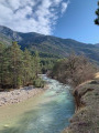
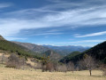
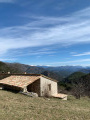
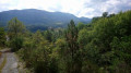
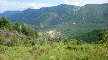
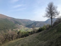
Far from the most popular trails in the Alpes-Maritimes, this walk takes you through a few small villages in the upper Estéron valley. The circular route described here also offers some lovely panoramic views of the Mercantour mountains and features a fairly varied landscape, ranging from woodland to farmland.

A long route with significant elevation gain but no technical difficulties.

Please note: there appears to be an issue regarding private property.

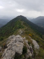
However, there is an issue between the waymark (7) and (8). The path is now closed by the owner of the farm. You must continue via the Crête des Rochers des Côtes and then rejoin the path at the far end of the Rochers de Notre-Dame.

Details

3063235
Creation:
Last update:
Last review:
  • Walking
    Activity: Walking
  • ↔
    Distance: 11.59 mi
  • ◔
    Average duration: 7h 40 
  • ▲
    Difficulty: Difficult

  • ⚐
    Back to start: Yes
  • ↗
    Ascent: + 2,703 ft
  • ↘
    Descent: - 2,726 ft

  • ▲
    Highest point: 4,049 ft
  • ▼
    Lowest point: 2,369 ft

Photos

Description of the walk

The walk starts from the village of Gars, which you reach by heading up the Estéron valley towards Collongues and then Briançonnet. You should park in the small car park at the entrance to the village. However, if there are no spaces available there, there is another, larger car park situated below the village, near the river.

(S/E) From the car park at the entrance to the village, head towards the centre, then follow the signs for Chapelle Saint-Jeannet/Les Mujouls (marker 40). Start with a fairly steep but short climb. Follow the red and white markings ofthe GR® 510. You’ll reach the Chapelle Saint-Jeannet crossroads at marker 41.

(1) Turn left towards Collongues, continuing to follow the red and white markings. Proceed along a track which turns into a footpath after crossing the road for the first time. You’ll rejoin the road at marker 42. Continue towards the Chapelle Saint-Jeannet.

At a green gate, leave the road and take a small path leading off to the right into the forest. A red and white marker indicates this route, which cuts across the final bend in the Gars road. At the road junction, look out for marker 43.

(2) Here, there are two options:
- As shown on the map and described below, continue towards Collongues, staying on the GR®. Keep to the edge of the Vallon de Cressonnière stream. You will reach marker 54.
- Head for the point (7) by following the signs for the Oratoire Notre Dame d’Amirat.

(3) Turn left here, leaving theGR® to take a well-marked path signposted in yellow, and begin the climb to reach a road at marker 50 just before the hamlet of Les Agots.

(4) Follow this road, turning right towards the village of Amirat. You’ll reach marker 51 just after a road bridge.

(5) Turn left towards Castellet Saint-Cassien. Follow the red and white markers, this time on theGR® 4. You’ll reach the fire tank at elevation 959 just before the power line.

(6) Take the track on the left; this allows you to avoid crossing private property located on the path a little further up.

(7) Please note: private property issue. See information in the introduction.
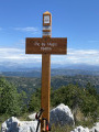
At the end of the track, continue to the right along the path to reach the Notre Dame d’Amirat wayside shrine at marker 44.

(8) Continue along the path which runs on from the track. Walk along a virtually level section to reach the Col du Buis at marker 46.

(9) Leave the road and turn left onto the path leading down into the forest. Cross the Vallon du Loup stream before reaching the junction at marker 39.

(10) Turn right towards Briançonnet. Cross the road at marker 38. Pass marker 37 quickly. Stay on this path, skirting the hamlet of Les Ruinas, and continue on to the junction with a road at marker 29.

(11) Turn right onto this road and follow it until you reach the village of Briançonnet at marker 20.

(12) Continue for a few metres along Rue Principale until you reach marker 21. Here, rejoin theGR®510, turn left and follow it until you reach the car park in the village of Gars (S/E).

Waypoints

  1. S/E : mi 0 - alt. 2,438 ft - Car park at the entrance to Gars
  2. 1 : mi 0.78 - alt. 2,657 ft - Marker 41
  3. 2 : mi 1.48 - alt. 3,035 ft - Marker 43 – Road junction - Chapelle Saint-Jannet (Amirat)
  4. 3 : mi 2.36 - alt. 2,562 ft - Marker 54
  5. 4 : mi 2.87 - alt. 2,884 ft - Marker 50 – Les Agots
  6. 5 : mi 3.14 - alt. 2,844 ft - Marker 51
  7. 6 : mi 3.52 - alt. 3,136 ft - Crossroads of tracks – Fire-fighting tank
  8. 7 : mi 4.7 - alt. 3,668 ft - Junction between track and footpath
  9. 8 : mi 5.21 - alt. 3,973 ft - Notre-Dame d’Amirat
  10. 9 : mi 6.32 - alt. 3,937 ft - Marker 46 - Col du Buis
  11. 10 : mi 6.98 - alt. 3,389 ft - Waymark 39
  12. 11 : mi 8.06 - alt. 2,999 ft - Marker 29
  13. 12 : mi 8.92 - alt. 3,287 ft - Waymark 20 – Briançonnet
  14. S/E : mi 11.59 - alt. 2,438 ft - Car park at the entrance to Gars

Notes

Between (12) and (S/E), the final section between Briançonnet and Gars follows a path that presents no real technical difficulties, but which has some very steep sections, particularly towards the end. You should therefore take care after heavy rain, as the path can be slippery.

Note on this circular route: the route described here starts from Gars, but it is perfectly possible to start from any of the other three villages. Please note, however, that if you start from Amirat, you will have to finish the walk with an uphill section – admittedly not very long, but quite steep.

Worth a visit

(5) Once you reach marker 51, you can make a round trip to the village of Amirat to have a look around. As the village is very small, this short detour shouldn’t take very long.
(12) You could also do the same here and visit Briançonnet. It’s probably possible to climb up to the village’s castle, but I couldn’t find the path leading up to it.
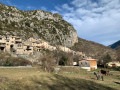
Of the three villages encountered on this walk, Gars is the one that deserves the most time and, in my opinion, is one you really should take the time to visit. This village is full of charm and its location at the foot of the cliff adds to its unique character.

Always be cautious and plan ahead when you're outdoors. Visorando and the author of this route cannot be held responsible for any accidents occurring on this route.

The GR® and PR® markings are the intellectual property of the Fédération Française de Randonnée Pédestre.

Reviews and comments

4.4 / 5
Based on 3 reviews

Reliability of the description
4.7 / 5
Ease of following the route
4.3 / 5
Route interest
4.3 / 5
lion90
lion90

That’s a good suggestion; personally, I had a right struggle in the woods to reach the end of the ND rocks.
I’m not sure if you can get all the way to marker 44 from marker 47; I haven’t seen anything about it on the FFR 06 website.
You’ll need to let Suricate know so they can update the information and pass it on to the IGN. This section is marked in red on the map.
As the section through the rocks isn’t difficult, it might make the hike more challenging in my opinion.
I haven’t done it myself, as I already have two applications pending with them as a GR trail marker.
Kind regards
Francis

Machine-translated

restefond2800
restefond2800

Thank you for your feedback,
If there are too many issues with private property on this walk (which I completed well before it was privatised), it might be best to remove it so as not to mislead other walkers and/or cause problems for the landowners and anyone who might wish to do the walk

Machine-translated

lion90
lion90

Overall rating : 4.3 / 5

Date of your route : Dec 06, 2024
Reliability of the description : ★★★★☆ Good
Ease of following the route : ★★★★☆ Good
Route interest : ★★★★★ Very good
Very busy route : No

Same problem as above: the path has become private, so we can no longer reach marker 44. I think this walk needs to be revised. To reach the path away from the house where the path is off-limits, you have to go through the woods and brambles without a proper path, or do as described above.
Kind regards
Francis

Machine-translated

Evelyne 06
Evelyne 06

Overall rating : 4.7 / 5

Date of your route : May 20, 2024
Reliability of the description : ★★★★★ Very good
Ease of following the route : ★★★★★ Very good
Route interest : ★★★★☆ Good
Very busy route : No

A pleasant walk in the Upper Esteron

Machine-translated

oenolatre
oenolatre

Overall rating : 4.3 / 5

Date of your route : Feb 29, 2024
Reliability of the description : ★★★★★ Very good
Ease of following the route : ★★★★☆ Good
Route interest : ★★★★☆ Good
Very busy route : No

I’ve just done this walk, which is a really interesting route. The three villages you pass through are charming and very picturesque, set in the Nice hinterland. What’s more, all three have been beautifully restored and are very welcoming.
However, there is a problem between waymarks 7 and 8. The path is now closed off by the farm owner. You need to carry on via the ridge of the Rocher des Côtes and then rejoin the path at the far end of the Rocher Notre Dame.
It’s a lovely walk with beautiful views over the Estéron valley and the surrounding mountains.

Machine-translated

Other walks in the area

For more walks, use our search engine .

The GPS track and description are the property of this route's author. Please do not copy them without permission.