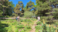
Les Hautes-Gréolières via the Font d’Antony

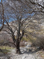
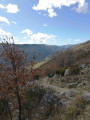
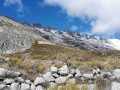
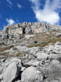
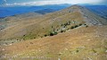
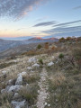
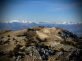
This sunny walk, at the foot of the rocky ridges of the Montagne du Cheiron, offers a beautiful panoramic view of the Calern plateau, Cipières and the Loup valley. The walk starts near the Tourist Office, by the D2 road, then climbs towards the Font d’Antony before descending to the ruins of the old medieval village of Les Hautes-Gréolières, where you can still admire the Chapel of Saint-Étienne. The route then descends via a wide, stony path which quickly leads back to the village and the starting point. After this journey into the past, take a stroll through the bustling streets of the modern-day village.

Details

46405765
Creation:
Last update:
Last review:
  • Walking
    Activity: Walking
  • ↔
    Distance: 3.38 mi
  • ◔
    Average duration: 2h 30 
  • ▲
    Difficulty: Easy

  • ⚐
    Back to start: Yes
  • ↗
    Ascent: + 1,073 ft
  • ↘
    Descent: - 1,066 ft

  • ▲
    Highest point: 3,839 ft
  • ▼
    Lowest point: 2,753 ft

Photos

Description of the walk

Park at the Tourist Office or in the car park at the entrance to the village, on the D402.

(S/E) With your back to the Tourist Office, turn left onto the D402; pass the start of the return path and the flight of steps (a few dozen metres long) on your left. Turn left at marker 30, heading towards Font d’Antony, Les Miroirs and Saint-Pons.

(1) When you reach Font Rougière, follow the stony path to the right which climbs to an altitude of 1163 m, at marker 192.

(2) Turn left onto the Les Miroirs traverse, heading towards Font d’Antony.

(3) Turn right and head for the climbing area, where you’ll join theGR®4, marked with red and white signs.

(4) Turn left, following theGR®, and you’ll soon reach the junction marked by signpost 193. Continue straight on, passing the Font de Mouis. Once you reach the ruins of the village of Les Hautes Gréolières, take a short detour to the right to visit the Chapelle Saint-Étienne.

(5) Retrace your steps and rejoin the route by turning right. Cross a track, continue straight ahead, then go down the steps to return to the D402. Follow the D402 to the right to return to the Tourist Office car park (S/E).

Waypoints

  1. S/E : mi 0 - alt. 2,779 ft - Tourist Office
  2. 1 : mi 0.39 - alt. 2,808 ft - Gravel path on the right
  3. 2 : mi 1.48 - alt. 3,812 ft - Marker 192, turn left
  4. 3 : mi 2.29 - alt. 3,704 ft - Turn right at the fork
  5. 4 : mi 2.56 - alt. 3,671 ft - Climbing site, GR junction
  6. 5 : mi 3.07 - alt. 3,015 ft - Saint-Étienne Chapel
  7. S/E : mi 3.38 - alt. 2,779 ft - Tourist Office

Notes

Free parking is available near the Tourist Office and along the D402 road at the entrance to the village
This walk is a much shorter alternative to the “Montagne du Cheiron” walk (no. 141154).

Worth a visit

Visit Hautes-Gréolières, the lively village of Gréolières and the ruins of its feudal castle, which will remind you of the village’s former power.

Always be cautious and plan ahead when you're outdoors. Visorando and the author of this route cannot be held responsible for any accidents occurring on this route.

The GR® and PR® markings are the intellectual property of the Fédération Française de Randonnée Pédestre.

Reviews and comments

4.2 / 5
Based on 4 reviews

Reliability of the description
4.5 / 5
Ease of following the route
4.3 / 5
Route interest
3.8 / 5
Pat98000
Pat98000

Overall rating : 4.3 / 5

Date of your route : Apr 28, 2025
Reliability of the description : ★★★★★ Very good
Ease of following the route : ★★★★☆ Good
Route interest : ★★★★☆ Good
Very busy route : No

The walk is exactly as described. Best done in spring or autumn. Allow around 3 hours if you want to take in the scenery. Don’t miss a visit to the pretty village of Gréolières.

Machine-translated

Gabriele
Gabriele

I always use the Visorando GPS for the walk in question, and I’ve never got lost yet.

Machine-translated

Pascale1965
Pascale1965
• Edited:

Overall rating : 3.3 / 5

Date of your route : Jan 26, 2025
Reliability of the description : ★★★☆☆ Average
Ease of following the route : ★★★☆☆ Average
Route interest : ★★★★☆ Good
Very busy route : Yes

It’s true, there aren’t that many signposts, which means you might get a bit lost, but if Visiorando isn’t interested in this, I’d prefer to have some other help, because for me, it’s the signposts that make it easiest to find my way. In fact, on this walk I went all the way to the spring instead of turning off earlier, but there were no signs at all! It’s a shame, but otherwise it’s a lovely walk with beautiful views – best done in winter as there are no trees, so you’re in the sun the whole time!

Machine-translated

Guy.
Guy.

Overall rating : 4.3 / 5

Date of your route : Nov 10, 2024
Reliability of the description : ★★★★★ Very good
Ease of following the route : ★★★★★ Very good
Route interest : ★★★☆☆ Average
Very busy route : No

A pleasant walk

Machine-translated

domanoo
domanoo

Thank you, Gabriele, for your comment

Machine-translated

Gabriele
Gabriele

Overall rating : 4.7 / 5

Date of your route : Apr 07, 2024
Reliability of the description : ★★★★★ Very good
Ease of following the route : ★★★★★ Very good
Route interest : ★★★★☆ Good
Very busy route : No

I’d rate this walk as moderate; the very steep ascent and descent aren’t easy. It took me nearly 3 hours instead of the 2 hours 30 minutes stated. But everyone walks at their own pace.

Machine-translated

domanoo
domanoo

Hello,
Thanks to the moderator Mady for posting this hike.
Michel, also known as Domanoo

Machine-translated

Other walks in the area

For more walks, use our search engine .

The GPS track and description are the property of this route's author. Please do not copy them without permission.