Editor’s note added on 20/09/2021: some of the paths on this 2016 hike are difficult to find. See the comments at the bottom of this page


 Country:

 City:
City:



Car park in the town centre, near the main road (Route de Sigale).
(S/E) From the Roquestéron car park, take the steps next to the bar-tobacconist’s and go down to the small square by the fountain, where the hairdresser’s is located. At the bottom of the steps, turn immediately left and go down the small street leading to the village washhouse. Take Rue des Alziary on the left and walk uphill to Place de l’Église. Turn right, walk past the town hall and head down Rue du Pont de France (GR®510, marked in white and red).
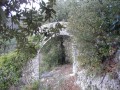
(1) Cross the Pont de France bridge over the Estéron (note the old boundary marker). At the end of the bridge, take the steps opposite, heading up whilst keeping to your left until you reach the small square where you can see the village coat of arms, which has been recreated on the ground. After the village, continue straight up a wide path to reach the Chapel of Saint-Pétronille (14th century).
(2) Follow the path on the right – unmarked but easily recognisable – which climbs through the holm oaks. Walk alongside some old terraced fields leading to a passage in the old village’s surrounding wall. Above, you can see the rock that served as a defence tower. A few metres further up, join a forest track and follow it to marker no. 33.
(3) Then take the path westwards towards Baisse de la Chabrière. After passing through a wooded area, you’ll come out onto a forest track again; cross this to rejoin the path opposite, which climbs up to marker no. 34.
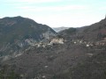
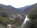
(4) Turn left towards Baisse de la Chabrière. A little further up, cross the logging track and rejoin the path which runs on level ground through the black pines to marker no. 35. Then turn sharply right (north-west) and follow the path which climbs gently through the rocky outcrops, from where you have a view of the two villages and the former Harki camp to the north of Roquesteron.
(5) Once you’ve rejoined a forest track (marker no. 224), take it to the right. After about fifty metres, turn left onto the old path which crosses the track several times before reaching the first small wooden bridge spanning the Chabrière.
(6) After crossing the bridge, turn right onto the tarmac local road and head towards marker no. 222. Continue eastwards and cross a second wooden bridge. Follow the local road (GR®510), ignoring the path that descends to the left. At the end of the route, walk alongside the Estéron on your left. Cross the Pont de France once more.
(1) As you come off the bridge, turn immediately left into a small car park. Walk up Rue du Docteur Passeron. Keep to the right to reach the wash house, then climb the stone steps back up to the starting point (S/E).






 Visorando Member


 Easy
Easy  Association / Club / Walk leader
 Difficult