Country:

 City:


Park in the car park at Puget-Théniers station. Before setting off, take a look around the western side of the station, where there is a museum and depot for vintage railway carriages.
(S) With your back to the station, turn left onto Avenue Alexandre Barety (D6202) towards Entrevaux. Continue to marker 160.
(1) Turn right towards the Col de Vélacs and continue along Boulevard François Boyer. At the end of the straight stretch, at marker 161, turn right onto the tarmacoured uphill track known as the Chemin des Trénières. Continue along this tarmacoured uphill section, following the red and white GR® signposts. Every marker up to the pass will be signposted ‘Col de Vélacs’. Reach marker 162.
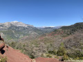
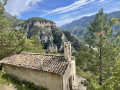
(2) Continue along the winding uphill path through a beautiful olive grove. At marker 162b, turn right and continue along this path carved into the rock, which runs along the top of the cliff. Take in the view of Puget-Théniers with due care, then continue through the pine forest. At marker 163, keep to the left towards the Col de Vélacs.
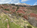
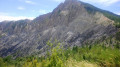
(3) The path winds through a very pleasant, sparsely wooded forest. On the wooded ridge of Aurafort, at marker 164, turn left onto the path leading down towards the pass. The path widens and becomes suitable for vehicles. After the hairpin bend, continue straight down, ignoring a new track that will be on your left.
(4) Marker 165: a wooden sign indicating the Col de Vélacs (alt. 820 m). Leave the red and white markings and follow the yellow markings, veering to the left. After about twenty metres, you’ll reach a meadow. Turn left. In the distance, you can make out a ruined building and an electricity pylon. Walk alongside the ruins.
(5) Continue at the foot of this pylon (yellow markings) to reach the nearby downhill forest track suitable for vehicles. Follow it to the left.
.
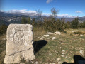
(6) Just after a sharp bend to the left, leave the track and turn right onto the footpath: there is a cairn and some faded yellow markings. The narrow path runs alongside an old terraced wall in poor condition, then turns to the right and descends towards some ruins. Just before reaching the ruins, veer to the right towards the solitary chapel in a meadow that you can see. Leave the footpath and take the track to reach the chapel in the hamlet of Les Lacs.
(7) Don’t go looking for one or more lakes; in this region, the word ‘lac’ refers to a small pass. Turn back, rejoin the track leading towards the hamlet and walk through the ruins. There is a yellow sign indicating “Les Lacs, alt. 710 m, Entrevaux 1h30 – 4 km”. Continue along this track and, shortly afterwards, turn right, following the yellow markings in place.
(8) Cross the bridge. Make sure you close the gate properly and continue along the track until you reach a junction with a sign reading “La Citadelle 3 km / Entrevaux 4 km”.
(9) Leave the track and turn right onto the path winding uphill through the woods. Continue straight on along this path, which is clearly marked with yellow signposts. You’ll reach a junction with a yellow sign pointing towards Entrevaux.
(10) The Entrevaux citadel comes into view. Continue through the woods along this path, which zigzags between the pine trees and leads out above the citadel.
(11) As you approach from above, the sheer scale of the structure is imposing. Cross the access bridge to the north gate of this fortification. Take the time to visit this citadel, a perfectly maintained historic monument built on the slopes of a rocky outcrop overlooking the village of Entrevaux.
At the end of your visit, take the footpath back down to the village. This access route to the fort is 800 metres long, spread over nine terraces. After a 150-metre descent, just before leaving the site, visit the Musée de la Poudrière, a very interesting museum detailing the town’s history. This museum is situated to the right of the turnstile exit.
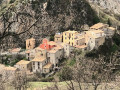
(12) Turn immediately left onto Rue de l’Orbitelle and walk along the stone wall. Turn right twice, then take the first left onto Rue de l’Église. Visit the Baroque-style cathedral. Continue along Rue Basse des Remparts, which begins in front of the cathedral. Walk through the village from east to west to reach the exit.
(13) At this point, you’ll find a stone bridge built in 1668 spanning the River Var, as well as the fortified royal gate, the main entrance to the village of Entrevaux. Turn left, stay on the pavement of Avenue Vauban which runs alongside the River Var, then take the pedestrian crossing leading to the station (E).


 Visorando Member
 Association / Club / Walk leader
 Difficult