Country:

 City:
City:


Red-and-white markings
(S/E) From the car park in the centre of the village, take the road that climbs to the right past the gendarmerie.
At the end of this, take the steps that run alongside a few houses and continue straight on until you reach the road to Cuébris at marker 81.
(1) Turn right onto the road, following the signs for Cuébris via the GR®510. Follow the road for about 400 m until you reach another marker, number 82.
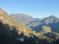
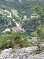
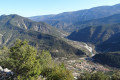
(2) Head up to the left towards Cuébris and the Notre-Dame de Cuébris Chapel along the path that climbs through the pine forest. The view over the Estéron valley begins to open up, then the path descends again before reaching the chapel, from where you can just make out the village, hidden behind a rock face.
Continue along this path, which joins the road at marker 83.
(3) Take the road to cross the village via the main street. Pass marker 84, then 85, heading towards L’Abeille / Roquestéron, and arrive at marker 86 on leaving the village.
Yellow markings
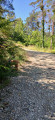
(4) Turn left onto the path which follows the stream upstream towards L’Abeille via Le Petit Riou. The path follows the stream for a short while, then climbs into a pine forest, many of whose trees have been ravaged by successive gales. The actual route of this path does not correspond to the IGN map.
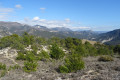
Continue along the signposted path until you reach a junction near the ridge. Turn left to descend towards the ridge path and reach a small pass directly opposite a small hillock corresponding to the altitude of 785 .
Don’t hesitate to climb up to enjoy the view, then continue along the path which descends towards marker 87.
(5) Turn right towards La Roubine / Roquestéron. The path is more or less level, then climbs slightly before crossing a scree slope.
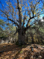
As you pass the foot of Mont Long, begin a steep and slippery descent which can be challenging if you’re not wearing suitable footwear. The leaves of the white oaks conceal stones, and the steep gradient doesn’t make things any easier...
The village isn’t far away, and you’ll arrive above it in the Adrech neighbourhood. Turn left to join the Cuébris road and then left again onto it to find marker 81, which you passed on the ascent.
Red-and-white markings
(1) Head down to the right via the steps to follow the route back down the way you came and return to the car park where you started (S/E).


 Visorando Member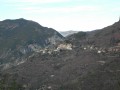

 Easy
Easy  Association / Club / Walk leader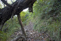
 Difficult