The Col du Trébuchet, starting from Amirat

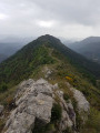
A fairly easy route straddling the Alpes-Maritimes and the Alpes de Haute-Provence in the Haut-Estéron massif.
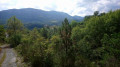
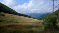
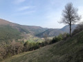
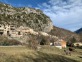
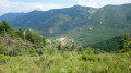
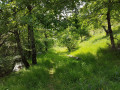
The route runs mainly through coniferous and beech woodland. It takes you to two lovely villages: the small village of Amirat, which offers a panoramic view of the valley from its beautiful square, and the village of Castellet-Saint-Cassien with its castle.

Details

n°2582526
Creation:
Last update:
Last review:
  • Walking
    Activity: Walking
  • ↔
    Distance: 8.77 mi
  • ◔
    Average duration: 6h 15 
  • ▲
    Difficulty: Moderate

  • ⚐
    Back to start: Yes
  • ↗
    Ascent: + 2,523 ft
  • ↘
    Descent: - 2,497 ft

  • ▲
    Highest point: 4,035 ft
  • ▼
    Lowest point: 2,694 ft
  • ⚐ Country: France
  • ⚐
    Area: Alps
  • ⚐ City: Amirat (06910)
  • ⚑
    Start/End: N 43.890135° / E 6.822778°
  • ❏
    IGN map(s): Ref. 3542ET, 3641OT
  • Hour-by-hour weather

Photos

Description of the walk

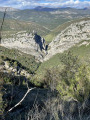
Leave your car in the small car park at marker 51. Continue on foot for a short distance to enjoy the view of the valley if you wish (not shown on the route map) and return to marker 51.

(S/E) Follow the tarmac track, which climbs gently and turns into a dirt track a few hundred metres further on.

(1) Turn right onto the path marked in yellow and signposted “Col du Trébuchet”. Walk past the hamlet of Barlet before reaching a crossroads marked by a cairn.

(2) Turn left at the cairn. The path, which is still clearly marked in yellow, climbs gently up to the Col d’Avenos. A few dead trees block the path but can easily be bypassed.

(3) From the pass, the path widens and descends rapidly to the Col du Trébuchet.

(4) Follow the D10 to the left until you reach the first hairpin bend.

(5) Leave the road and take the unmarked track opposite.
At the end of the climb, take the path opposite which leads down to an electricity pylon. You’ll reach a large clearing where you can enjoy a pleasant break.

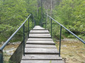
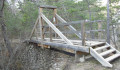
(6) Join theGR®4, which starts to the left of the pylon, and head down the valley until you reach a bridge. Cross the bridge on the right to reach the church and the château of Castellet Saint-Cassien.

(7) Follow theGR®4, which continues down to the right, lower down the slope, until you reach the valley of the Castellet stream.

(8) Cross the bridge and head uphill opposite to the hamlet of Ubac d’Amirat (marker 49).

(9) Head left up the track leading to the Chadastier ridge. Continue to the large cairn to clearly spot marker 48, which is a few metres further on.

(10) Turn left to follow the path which joins the track at marker 53.
Turn left there, then leave the track and take a path on the right which allows you to avoid several hairpin bends before rejoining the track at the original junction.

(1) Turn right and follow the track to the car park where you started (S/E).

Waypoints

  1. S/E : mi 0 - alt. 2,838 ft - Car park marker 51
  2. 1 : mi 0.73 - alt. 3,235 ft - Junction of the circular loop
  3. 2 : mi 0.95 - alt. 3,196 ft - Cairn, on the left
  4. 3 : mi 2.74 - alt. 4,032 ft - Col d'Avenos (1222m)
  5. 4 : mi 2.98 - alt. 3,743 ft - Col du Trébuchet (1140m)
  6. 5 : mi 3.32 - alt. 3,638 ft - Unmarked track opposite
  7. 6 : mi 4.43 - alt. 3,573 ft - Electricity pylon
  8. 7 : mi 5.78 - alt. 2,831 ft - Village square in Castellet Saint-Cassien
  9. 8 : mi 6.01 - alt. 2,700 ft - Bridge over the Castellet valley
  10. 9 : mi 6.51 - alt. 3,071 ft - The Ubac d’Amirat
  11. 10 : mi 7.48 - alt. 3,750 ft - Marker 48, towards Amirat
  12. S/E : mi 8.77 - alt. 2,848 ft - Car park marker 51

Always be cautious and plan ahead when you're outdoors. Visorando and the author of this route cannot be held responsible for any accidents occurring on this route.

The GR® and PR® markings are the intellectual property of the Fédération Française de Randonnée Pédestre.

Reviews and comments

4.2 / 5
Based on 2 reviews

Reliability of the description
4.5 / 5
Ease of following the route
4 / 5
Route interest
4 / 5
christian.accarias
christian.accarias

Overall rating : 4 / 5

Date of your route : Aug 02, 2021
Reliability of the description : ★★★★☆ Good
Ease of following the route : ★★★★☆ Good
Route interest : ★★★★☆ Good
Very busy route : No

A pleasant route through the forest – a mix of pine and deciduous trees – with a steep climb on the way back. Very few people about; the GR markings are almost worn away in places. Several tree trunks lying across the path. Lovely villages.
Parking is very difficult in Amirat.

Machine-translated

Patrick V2.
Patrick V2.

Overall rating : 4.3 / 5

Date of your route : Oct 17, 2020
Reliability of the description : ★★★★★ Very good
Ease of following the route : ★★★★☆ Good
Route interest : ★★★★☆ Good
Very busy route : No

A pleasant walk (although, unfortunately, punctuated by the gunshots from the ‘war’ that hunters wage against the poor wild animals, and the barking coming from their hide at the Ubac d’Amirat). A fairly long walk but without any significant elevation gain, although the final ascent and descent before the finish are a bit ‘tiring’ at the end of the day. Beautiful woodland. A fairly unspoilt area with villages and isolated houses.

Machine-translated

jmnpapy
jmnpapy
• Edited:

for use at a later date

Machine-translated

jmnpapy
jmnpapy
• Edited:

hike planned for later

Machine-translated

Other walks in the area

For more walks, use our search engine .

The GPS track and description are the property of this route's author. Please do not copy them without permission.