


Refine your search for walks in Saint-Molf
Saint-Molf walks


 A cycling trip in the Pays Blanc
 Visorando Member
 27.51 mi
 +207 ft
 -226 ft
 3 hrs
 Moderate
 Departure from Saint-Molf (Loire-Atlantique)
In contrast to the ‘Pays Noir’ (Black Country) of the Brière, the western side of the Guérande Peninsula has come to be known as the ‘Pays Blanc’ (White Country).
This name derives from the colour of the salt produced in the salt marshes of the two basins of Batz-Saillé and Le Mès, situated on either side of the medieval town. A cycle ride starting from Saint-Molf takes you through the countryside and its villages to link the two basins, then along the entire coastline between Pen Bron and Merquel before returning to the starting point.
 Circular route through the marshes: Étier de Boulay, Île de Rostu, Kercabellec
 6.55 mi
+66 ft
-66 ft
3h 05
Moderate
Departure from Mesquer (Loire-Atlantique)
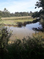
A walk through a varied landscape where the marshes tell the story of their distant origins, shaped by the earth and the ocean, with low, undulating vegetation carved out by small streams, and their domestication by man, with salt marshes and oyster beds, not to mention the iconic cabanes à carrelet (fishing huts).
Le Rostu in the heart of the Mès salt marshes
 4.43 mi
+33 ft
-33 ft
2h 05
 Easy
Departure from Mesquer (Loire-Atlantique)
This hike is located in Mesquer, in the hamlet of Rostu.
The Bassin du Mès is an area where salt marshes have been created for centuries and were once highly developed. They are fed with seawater by channels leading from the "Merquel - Rostu - Pen-Bé" traicts, which are an enclave of the sea between the Pointe de Pen-Bé and the Pointe de Merquel. Oyster and mussel farming have also developed in this area. There are some beautiful views to be discovered.
Mesquer - Quimiac
 13.66 mi
+69 ft
-66 ft
6h 20
Easy
Departure from Mesquer (Loire-Atlantique)
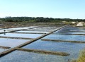
This route connects the three main areas of the municipality: Mesquer, Quimiac and Kercabellec. It allows you to discover the diversity of the area, first the marshes, then the countryside and the sea, which is particularly present around the Pointe de Mesquer.
Walk in the marshes around Kercabellec
8.17 mi
+36 ft
-36 ft
3h 45
Moderate
Departure from Mesquer (Loire-Atlantique)
Mesquer has a coastline opening onto the Bay of Vilaine and the open sea, but around Kercabellec, a small port between the village and Quimiac, there is a much more secret route between the marshes and the Merquel and Rostu tidal flats. Immerse yourself in this unique landscape where salt and shellfish farming are closely intertwined.
Les Faillies Brières and Les Crolières de Gras
 5.96 mi
+33 ft
-33 ft
2h 45
Easy
Departure from Herbignac (Loire-Atlantique)
The Mès, a small coastal river in the north of the Guérande peninsula, flows through a low, wide valley consisting mainly of marshes, draining the water into the ocean.
The proposed route allows you to discover the upper part of these marshes and cross them via the Gras bridge, an ancient stone footbridge.
This route should only be attempted when the water level in the marshes allows the paths surrounding them to be used.
From Tréambert to Sorloc via the marshes and coastline
4.66 mi
+23 ft
-23 ft
2h 10
Easy
Departure from Mesquer (Loire-Atlantique)
Between Mesquer and Quimiac, the marsh cuts deep between two rocky mounds. The slopes here form a grid-like pattern in which the old shellfish beds are set, and, further back, salt pans that are still in use.This bird paradise has benefited from extensive restoration work, the results of which are maintained by sheep as they graze on the vegetation.A stroll through the streets of Quimiac takes you to the coast, opening up the view onto the Bay of Vilaine.
Pointe de Merquel
 3.83 mi
+33 ft
-33 ft
1h 45
Easy
Departure from Mesquer (Loire-Atlantique)
A lovely walk through the salt marshes and Mesquer Bay.
La Brière océane
11.68 mi
+98 ft
-98 ft
5h 25
Moderate
Departure from Assérac (Loire-Atlantique)
To the west of the Brière Regional Nature Park, the Brière coast stretches from Pont Mahé beach to the Pen Bé strait. It offers a varied landscape of beaches, shorelines, wild coastlines, moors and salt marshes. A return trip connects to this route for a foray into Morbihan to Pointe du Bile.
Pointe de Merquel
5.31 mi
+23 ft
-23 ft
2h 30
Easy
Departure from Mesquer (Loire-Atlantique)
This is a hike to undertake when other trails are impassable in winter.
From the Pont Mahé marshes to those of Le Mès
8.05 mi
+125 ft
-118 ft
3h 50
Moderate
Departure from Assérac (Loire-Atlantique)
The Pointe de Pen Bé juts out with its ochre cliffs between the Traict de Rostu and Pont Mahé Bay. These two stretches of sea, which are revealed at low tide, form the foreground to the marshes – one a salt marsh, the other a freshwater marsh – which extend behind the coastal sandbars.
The circular walk that links them offers a lovely glimpse of this coastal countryside.
Pen Bé Tower
 4.30 mi
+43 ft
-43 ft
2h 00
Easy
Departure from Assérac (Loire-Atlantique)
The Pointe de Pen Bé juts out like a ship between Pont Mahé Bay and the Pen Bé and Rostu straits. While its maritime location is undeniable at high tide, it changes completely at low tide, as the sea then deserted the coastal areas. Whether at high or low tide, this is a route that is worth exploring at any time, as the landscape is so changeable.
Quimiac, between sea and marsh (2)
 5.49 mi
+66 ft
-66 ft
2h 35
Easy
Departure from Mesquer (Loire-Atlantique)
One-third salt marsh, one-third countryside and one-third sea: a superb recipe for a salty cocktail!
Quimiac, between sea and marsh
 9.98 mi
+30 ft
-30 ft
4h 35
Moderate
Departure from Mesquer (Loire-Atlantique)
The hike begins with three beaches and ends at Pointe de Merquel, which marks the entrance to the Bassin du Mès, famous for its salt marshes, mussels and oysters. The landscapes are magical, whether on the sea or marsh side.
La Cour aux Loups
9.07 mi
+72 ft
-102 ft
4h 15
Moderate
Departure from Herbignac (Loire-Atlantique)
Although Herbignac is not the commune in Brière with the most thatched cottages, the villages along this route offer some fine examples.
Between land and sea at Pont Mahé
7.00 mi
+66 ft
-72 ft
3h 15
Moderate
Departure from Assérac (Loire-Atlantique)
This route forms a circular loop between Pont Mahé Bay and Pen Bé Bay.
Between thatched cottages and marshes in Saint-Lyphard
 7.45 mi
+26 ft
-26 ft
3h 25
Moderate
Departure from Saint-Lyphard (Loire-Atlantique)
This hike allows you to discover the different faces of Brière: its marshes, its thatched cottages, its flora and fauna. Lots of paths, a few roads, all lined with oak trees, pines, gorse, willows and chestnut trees. Superb!
Chemin du Bocage in Kerhinet
 Tourist office0.54 mi
+10 ft
-10 ft
0h 15
Easy
Departure from Saint-Lyphard (Loire-Atlantique)
This small village of 18 thatched-roof houses was acquired in the 1970s by the Brière Regional Nature Park with the intention of renovating it and turning it into a showcase of traditional Brière housing. Kerhinet is a village situated to the south-west of the municipality of Saint-Lyphard, on the western side of the marshes. The village is open to visitors free of charge. You can enjoy a drink or an ice cream on site. There is a picnic area as well as free, designated parking.
Sea, marshes and countryside around Caire
8.82 mi
+138 ft
-121 ft
4h 10
Moderate
Departure from Assérac (Loire-Atlantique)
The beach and marshes of Pont Mahé, the Pointe de Pen Bé, the area around the Étang du Pont de Fer and the moors of Monchoix each offer a unique perspective on the landscapes of Asserac. Walking through this agricultural landscape that borders the coast serves as a reminder that the seashore was once a natural environment before urbanisation took over.
From Guérande to La Baule and back via the salt marshes
21.23 mi
+180 ft
-174 ft
2.5 hrs
Moderate
Departure from Guérande (Loire-Atlantique)
Guérande overlooks the Pays Blanc from its hillside. A cycle path allows you to reach La Baule beach in peace and quiet, before following the coastline past Le Pouliguen. From Kervalet, the scenery changes: the vastness of the marshes, criss-crossed by numerous embankments, invites you to take one of the small, winding roads that run through them. Finally, it will take a fair bit of effort to climb back up and reach the outskirts of the medieval town.
Tour de Larmor in Pénestin
 6.98 mi
+56 ft
-56 ft
3h 15
Easy
Departure from Pénestin (Morbihan)
Pénestin is just a stone's throw away from being an island. Although its ocean side faces the Atlantic, it is only connected to the hinterland by a strip of land wedged between two marshes. The suggested route takes you through the southern part of the area, formerly known as Larmor, between the Pont Mahé marshes and the cliffs of Lanchale and Le Bile.
The Pont Mahé Marshes Circuit
6.66 mi
+59 ft
-59 ft
3h 05
Moderate
Departure from Pénestin (Morbihan)
Behind the Pont-Mahé dune ridge lies a large marsh which is still regularly mown during the summer months. Connected to the sea by the channel that flows into Le Palandrin, it is still more or less subject to tidal effects but each summer regains its appearance as a meadow grazed by herds, in the heart of a basin bordered by dense woodland.
It’s up to you to explore it via a few secret paths, when the water level allows.
Balade autour de la cité médiévale de Guérande
4.18 mi
+184 ft
-180 ft
2h 05
Easy
Departure from Guérande (Loire-Atlantique)
Walk around the ramparts of Guérande to finish in the heart of the medieval town. The walk starts at the Gaudinais car park, around the ramparts, then follows a path that joins a short section ofthe GR® 34.
From the medieval town to the hillside manor houses
4.67 mi
+135 ft
-138 ft
2h 15
Easy
Departure from Guérande (Loire-Atlantique)
From the ring of ramparts encircling the walled town, the suggested route heads westwards, following the hillside overlooking the salt marshes. Once isolated on the hillside, several small manor houses dot the route: Colveux, Chateaumady and Drezeux. Whilst the first is now joined by suburban housing estates, the protection afforded by the hillside has allowed the other two to retain their seclusion and their unobstructed views of the salt marshes.
Birdwatching walk around the Lesté marsh
2.20 mi
+36 ft
-36 ft
1h 05
Easy
Departure from Pénestin (Morbihan)
Sheltered behind the sea wall and the dunes of L’Espernel, the Lesté marsh is a true wildlife reserve. Its network of canals and old sea walls suggests that it was once developed as a salt pan. But nature has reclaimed the area, and the site is now home to hundreds of birds seeking tranquillity, as well as a few cows, which help to maintain it.
Pont Mahé Bay and Dunes
4.57 mi
+36 ft
-49 ft
2h 10
Easy
Departure from Pénestin (Morbihan)
Straddling the departments of Morbihan and Loire-Atlantique, Pont Mahé Bay is a vast sandbank at low tide and a renowned spot for board sports once the sea has returned. Connecting the two headlands that mark its boundaries is a pleasant way to cross administrative borders
From land to sea around Saint-Sébastien to Piriac
 9.72 mi
+98 ft
-98 ft
4h 35
Moderate
Departure from Piriac-sur-Mer (Loire-Atlantique)
This walk, which presents no major difficulties, aims to help you discover the countryside around the village of Saint-Sébastien. This route, straddling three municipalities, runs mainly inland before ending on a high note by the sea, even allowing you to go for a swim before getting back into your car.
La Brière between Sandun and Saint-André-des-Eaux
 8.21 mi
+59 ft
-62 ft
3h 50
Moderate
Departure from Guérande (Loire-Atlantique)
La Brière, France's second largest freshwater marsh, is a secret land hidden behind the surrounding hedgerows. The suggested route allows you to explore it from the land bordering it to the west and even catch a glimpse of it from the Sandun hill, which rises to a height of 28 metres. A real mountain in this flat country!But be careful, marshes are best explored when the water level allows it.Circuit temporarily closed
Tour of the thatched-roof villages of Saint-Lyphard
18.20 mi
+138 ft
-148 ft
2 hrs
Easy
Departure from Saint-Lyphard (Loire-Atlantique)
Remnants of a time when much of what enabled the people of Bréca to make a living was extracted from the marsh, thatched cottages are still very much in evidence around Saint-Lyphard. There are said to be no fewer than 500 of them.
To discover this exceptional heritage, why not hop on your bike and explore the narrow roads and farm tracks that criss-cross the Saint-Lyphard area? A complete change of scenery is guaranteed!
The Herbignac Potters’ Trail
8.17 mi
+79 ft
-79 ft
3h 50
Moderate
Departure from Herbignac (Loire-Atlantique)
Passing through clay extraction sites and former pottery villages, this route pays tribute to one of Herbignac’s traditional trades, which continued until the mid-20th century.
In the woods to the west of Herbignac
4.91 mi
+85 ft
-82 ft
2h 20
Easy
Departure from Herbignac (Loire-Atlantique)
Between the Brière and the Vilaine lie woods and forests interspersed with more open farmland. Immediately to the west of the market town of Herbignac lie the Kerdavy woodlands, followed by the Bois de l’Épine. Further on, as you cross the departmental boundary, you enter the Coët Castel forest, followed by the Bois de Trégrain. It is through this wooded and hedgerow-lined landscape that the proposed route winds its way.
Pénestin in the countryside
6.52 mi
+151 ft
-154 ft
3h 10
Moderate
Departure from Pénestin (Morbihan)
In Pénestin, far from the hustle and bustle of the coast, you can stroll in complete tranquillity along quiet paths that criss-cross the countryside between the Tréhudal marshes and those of Pont Mahé.
This walk is best enjoyed on sunny days, when it’s pleasant to walk in the shade.
The Trévaly Marshes
5.83 mi
+62 ft
-62 ft
2h 45
Easy
Departure from La Turballe (Loire-Atlantique)
The Trévaly Marshes occupy the westernmost part of the Guérande salt basin. This route takes you through them and up the hillside to the foot of the mill, where you can discover this exceptional landscape.
Between the Vilaine and the Étang du Pont de Fer
6.27 mi
+249 ft
-243 ft
3h 05
Easy
Departure from Camoël (Morbihan)
To the south of the Vilaine estuary, the gentle terrain encourages the intermingling of wetlands and agricultural land. The village of Camoël is built on a slight rise overlooking both the river and the marshes situated upstream of Pont Mahé Bay.The suggested route allows you to explore the river where its estuary begins and one of the streams that feed the Étang du Pont de Fer, a hidden nature reserve that can be glimpsed when the foliage is not too dense.
Landieul as seen from Herbignac
 6.49 mi
+131 ft
-115 ft
3h 05
Moderate
Departure from Herbignac (Loire-Atlantique)
When I retired, I chose to settle in Herbignac and discovered that this town has a very long history of producing domestic pottery. A long time ago, it was the Romans who discovered clay of exceptional quality and passed on the techniques for making pots to the local farmers.
Pot-making spread to the villages to the south and west of Herbignac, where the clay deposits were found. The pots were mainly used for storing food. Landieul was the last village to be home to potter-farmers, right up until the 1950s. Tin and plastic eventually saw the better of our good old clay.
Circular route through coastal and countryside scenery between La Mine d'Or and Loscolo
4.86 mi
+43 ft
-69 ft
2h 15
Easy
Departure from Pénestin (Morbihan)
As well as its magnificent coastal path stretching over 14 km, Pénestin boasts a multitude of trails criss-crossing the local area. The circular route allows you to explore some of these paths as far as the edge of the Pont Mahé Marshes, before returning to the coast via the coastal path. And if the weather and season permit, do make the most of the lovely beaches that line this route.
From Maresclé beach to Haut-Pénestin along the coast and other paths
 8.06 mi
+98 ft
-108 ft
3h 45
Moderate
Departure from Pénestin (Morbihan)
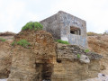
This hike starts at the car park of the Mine d’Or beach, along the coast north to Haut-Pénestin, to return by internal paths to reach the sea at Maresclé beach and then the starting point.
A walk around the Férel bell tower
 5.67 mi
+69 ft
-72 ft
2h 40
Easy
Departure from Férel (Morbihan)
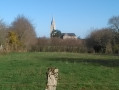
Situated about ten kilometres inland from the coast, on a plateau sloping down from the banks of the Vilaine to the first marshes of Briéron, the commune of Férel has managed to preserve its bocage landscape and a network of paths offering a wide range of walking options. This route offers an almost constant view of the bell tower, which, being tall and sharply pointed, is one of the area’s main landmarks.
Route des Coulées
7.52 mi
+138 ft
-138 ft
3h 35
Moderate
Departure from Férel (Morbihan)
The plateau on which the village of Férel lies is situated at an altitude of 30 to 50 metres above sea level. It overlooks the southern bank of the Vilaine, sometimes quite steeply, and the streams flow along the bottoms of wooded valleys (the Coulées), which are ideal for walks in all seasons.
The paths of Saint-Dys
7.32 mi
+112 ft
-92 ft
3h 30
Moderate
Departure from Férel (Morbihan)
The commune of Férel comprised five ‘frairies’ (sub-parishes), including that of Saint-Dys (or Teiz), which covers the wooded south-western part of the commune’s territory. The suggested route follows country lanes and forest tracks around Coët Castel and Ally.
Pointe and woods of Penbron
 4.02 mi
+20 ft
-20 ft
1h 50
Easy
Departure from La Turballe (Loire-Atlantique)
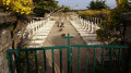
The Pointe de Pen Bron is only a stone's throw from Le Croisic, but the channel that separates it and feeds a large part of the Guérande salt marshes is a dangerous stretch of sea. The sand spit that juts out between the ocean and the Traict is a remarkably peaceful place, offering a way to be in the middle of the waves while keeping your feet on solid ground.
Circular cycling route: Férel – Pénestin – Assérac
33.38 mi
+486 ft
-459 ft
4 hrs
Moderate
Departure from Férel (Morbihan)
Between Mès and Vilaine lies a little-known corner where the landscapes change constantly, from the banks of the Vilaine to the Atlantic coast at Pénestin, via the salt marshes of Mès and the wooded areas of Monchoix and Coët Castel. So hop on your bike and explore it along roads and paths away from heavy traffic.
Tour of Haut Pénestin
 4.94 mi
+98 ft
-105 ft
2h 20
Easy
Departure from Pénestin (Morbihan)
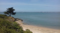
The Pointe du Halguen marks the southern limit of the Vilaine estuary. This promontory overlooking the ocean is also the northern end of the ochre cliffs that line the ocean front of Pénestin. A lovely walk is available around the village of Haut Pénestin, where long stretches of sandy beach precede secluded coves and abandoned salt marshes.