Country:

 City:
City:


(S/E) From the Marche aux Boeufs car park, look out towards the sea and take the path on the right leading to the properties above the shore. Before you reach the end of it, a narrow path leads off to the left between a hedge and a fence. This takes you to the coastal path, which you then follow until you reach L’Éclis and the end of the vast Pont Mahé Beach.
(1) Walk up the beach for about 300 metres before passing through the fence protecting the dunes, near the first areas of woodland. A path has been laid out which winds through the woodland, passing from damp areas to drier pine forests. As you go, don’t miss the curious circular pine tree at the side of the path. At the end of the trail, go back through the fence just before reaching the Moulin de l’Éclis campsite, then follow the shoreline again for about 150 metres to reach the main access to the beach.
(2) Leave the beach and walk up the street leading from it until you reach the county road. Cross it here and continue opposite, along the path that runs alongside the Pont Mahé campsite. Turn right when you reach a large green space with a pond in the centre. A track allows you to walk round the pond, ignoring the path that branches off to the left. Further on, you’ll come to a small road which you follow for about 150 metres, before leaving it when it branches off to the right.
(3) Continue straight on along the path that descends towards the marshes. As you approach the wetland, the path makes a first turn left then right before running alongside the hedge bordering the marsh. Further on, when the hedge disappears, you can take in the full extent of the wet meadows criss-crossed by canals, stretching all the way to the opposite slope where a few fine farms stand. Pass a path on your right and carry straight on until you reach the next one.
(4) Leave the edge of the marsh and head uphill, taking a path to the right between two farm fields. When you reach the top of the slope, it’s worth turning round to take in the whole of the marsh. In winter, a veritable lake spreads out before your eyes.
Carry on until you reach the departmental road and turn left, following the parallel greenway which leads to Caire.
(5) When the greenway joins the county road, cross it carefully and take the road opposite leading to Pen Bé. Follow this road past the last houses, before turning left onto a farm track. This track first descends into a valley floor before climbing up the opposite slope via a wide right-hand bend. The landscape alternates between farmland and woodland until you reach a crossroads. The pinkish surface of the road you join indicates that it is a cycle path.
(6) Continue straight ahead towards Kergéraud until you come out onto the road overlooking the salt marshes. At the road, turn left, then right at the next junction. You’ll immediately come to a stretch of abandoned marshes which you follow until you pass a shed and its store of equipment, which looks rather out of place in such a setting. Just before reaching the barrier blocking the path, turn right just before the electricity substation.
(7) From this point, follow the coastal path as close to the sea as possible, first taking the path carved into a marsh embankment, then along the Kermalinge dunes, before climbing the small cliff leading up to Anse de Mesquéry. You’ll rejoin the road at the boat launch.
(8) Walk up this road for about fifty metres, then turn left onto the path that winds its way between two hedges. It leads out onto an area of meadows grazed by horses and sheep, before returning to run close to the coastline. Once past Pointe Noire, it continues along the top of the cliff until it reaches the head of Pen Bé Bay.
When you reach the road, take the pavement that runs alongside the low wall protecting it from high water until it opens out onto the lay-by where the mussel farmers’ equipment is stored. Walk a few dozen metres further up the road leading to the headland, and you’ll reach the Café de la Marine.
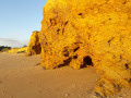
(9) Walk past the café, taking the path that goes round it to the left. A little further on, this joins the road that circles the headland. Passing between the houses clinging to the cliff face overlooking the sea and the shellfish farms, it circles the headland and leads to a few charming coves nestled at the foot of the cliffs. Continue along the coast until you’ve passed the last houses, then head into the moorland that has been restored in this part of the headland. Carry on along the paths leading to the left until you reach the furthest point of the headland jutting into the bay.
(10) From the tip of this headland, the view is splendid, particularly on windy days when Pont Mahé Bay is dotted with the colourful sails of water sports enthusiasts. Go round the headland via the path that follows the cliff edge until you return to the first house. Then turn right to walk alongside it, then left twice to rejoin the path leading back to the car park where you started (S/E).

 Visorando Member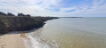
 Easy
Easy