Country:
 City:
City:


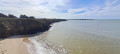
(S/E) Starting from the Palandrin car park, behind the beach of the same name, head back towards the holiday centre, go past it, and at the nearby crossroads, take the path that climbs to the right, along the edge of a farm field. After about 150 m, you’ll reach the edge of the Palandrin cliff. There’s a lovely view over Pont Mahé Bay.
(1) Continue along the cliff top until you reach the stepped path leading down from it, then cross the stream that feeds the marshes. Continue along the beach until you reach the main access point, about 600 m further on.
(2) Leave the beach on the left and walk up the avenue leading from it until you reach the D 82.
Cross it carefully and carry on straight ahead, following the campsite fence. Pass through a residential area before reaching a large green space on the right-hand side of the road, near Impasse des Bruyères.
Enter this area, keeping a pond on your right. Walk alongside a fence; at the end of it, a small path opens up to the north between two horse pastures. Further on, it leads into the hamlet of Limarzel. Turn right, then left before the first farmhouse.
(3) After passing an equestrian centre, take a wide farm track leading towards the marsh. Turn right at the first track you come to, which leads to the foot of the hill. Enter the marsh, which you cross after going over a footbridge over a secondary watercourse. Once on the other side, follow the path to the left then to the right to reach the top of the plateau and Kerarno Farm.
(4) After passing through the hamlet of Kerarno, you’ll come out onto a road; follow this to the left until you reach Le Carroué.
Opposite a beautiful thatched farmhouse, turn left towards Avaloué, which you’ll reach by walking straight on until you’ve passed the last houses. Take the farm track that continues from the road down to the bottom of the slope.
(5) Just before the track turns left, look out for the path leading off to the right into the thicket. As it is rarely used, it can be difficult to spot when the vegetation is dense. It gradually veers away from the track to reach the patch of marshland behind the curtain of willow trees lining the track (you can clearly see this patch behind the hedge when you reach the bend in the track, if you have gone too far). When you reach this meadow, follow the edge of the marsh for about 60 metres, then veer right through the undergrowth, following the wooded edge. After about fifty metres, turn left to enter the reed bed and reach the footbridge that takes you across the Étier du Foy.
(6) Cross the stream, continue straight on to reach the other bank of the marsh and turn left onto the path running above it. Shortly afterwards, pass beneath the buildings of the Trébestan farm and, when you reach the path leading back up to it, continue to the left, following the boundary between farmland and marsh. Walk round the Trébestan hillock along a pleasant path that follows the high-water mark, offering lovely views of the marsh.
(7) Once you have gone round the hillock and the landscape narrows as you enter a wooded valley, let a path branch off to the right and carry on straight ahead, crossing the small stretch of marsh that winds its way into the valley. Once you have crossed this wetland, turn left to continue following the boundary between farmland and marsh.
Further on, you’ll come to the Inly campsite, which you should go round to the left of, still following the edge of the marsh.
(8) As you approach the bend to the right that takes you past the campsite, you’ll find a footbridge on the left that crosses the Kerfalher watercourse. The path that crosses it leads to the other side of the marsh
(9) At the end of the path, turn left onto the lovely tree-lined track which runs alongside the marsh once more.
Carry on straight ahead, ignoring any paths or tracks on the right that might lead you off course.
This well-maintained path is also a cycle route, and it is not uncommon to come across cyclists here.
(10) At this point, let a path branch off to the right and continue to the left to return to a more open area. The hills opposite are the ones you walked along the foot of from L’Avaloué.
Carry on along this path, ignoring all the paths leading up the slope to the right, until you reach the RD 201, near the Kerseguin well.
(11) Cross the road carefully and head up to the right along the road leading to the village of Kerséguin. Turn left onto the first path you come to, to reach the centre of the village and the road leading to Le Palandrin.
When you come out onto this road, turn left and head down to the beach. Behind a long boundary wall, you’ll pass a rather surprising, somewhat kitsch-looking house on your right, with multiple towers topped in various styles.
Walk past the holiday centre and head back to the car park where you started. (S/E)


 Visorando Member
 Easy
Easy