Birdwatching walk around the Lesté marsh

Sheltered behind the sea wall and the dunes of L’Espernel, the Lesté marsh is a true wildlife reserve. Its network of canals and old sea walls suggests that it was once developed as a salt pan. But nature has reclaimed the area, and the site is now home to hundreds of birds seeking tranquillity, as well as a few cows, which help to maintain it.

Details

n°1646380
Creation:
Last update:
Last review:
  • Walking
    Activity: Walking
  • ↔
    Distance: 2.20 mi
  • ◔
    Average duration: 1h 05 
  • ▲
    Difficulty: Easy

  • ⚐
    Back to start: Yes
  • ↗
    Ascent: + 36 ft
  • ↘
    Descent: - 36 ft

  • ▲
    Highest point: 56 ft
  • ▼
    Lowest point: 10 ft
  • ⚐ Country: France
  • ⚐ City: Pénestin (56760)
  • ⚑
    Start/End: N 47.445818° / W 2.476042°
  • ❏
    IGN map(s): Ref. 1022OT
  • Hour-by-hour weather

Description of the walk

Start from the car park at the Espernel slipway. This slipway, like all those providing access to the foreshore, must be kept clear. It is used to lower the mussel farmers’ equipment down to the mussel beds.

(S/E) With your back to the slipway, follow the road to the right for 80 metres and take the path that branches off to the right, behind the dune. Follow it to the Pointe de l’Espernel.

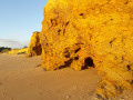
(1) This schist rock, situated at the forefront of the dunes, is notable for containing two veins of white quartz, which are the source of the large boulders scattered across this headland.
Head down to the beach, which stretches northwards, and do not leave it until you have passed the rock revetment before Plage du Palandrin. Climb back up the dune and take the sunken path that leads uphill to the left. It comes out onto the coastal road in the village of Kerandré.

(2) At the road, turn right, then left onto the first path. It descends gently towards the marsh, between two hedgerows. A few clearings already offer glimpses of the wetland and its possible inhabitants. Follow this path until you come to another path, then turn left. Ignore the path branching off to the right and follow the one that skirts the head of the marsh. In winter, this section can be wet and difficult to walk on. A series of bends leads to the ditch at the bottom of the valley, which you cross via a wooden footbridge. Climb up the opposite slope via the footpath that winds round the meadow overlooking the wetland. It follows the road leading to the Pointe du Bile, then the one leading to Le Durnic.

(3) When you come out onto the track, head straight ahead and continue along the path that runs alongside it. It runs along the western edge of the marsh, offering magnificent views of the wetland, the dune and the bay in the background. On the other side of the slope, the ochre-coloured Lesté manor house seems to stand guard over the area.

(4) At the road, turn left to head down towards the bay. At the foot of the cliff, a concrete structure juts out into the sea. Despite its appearance, this is not a small jetty, but the mouth of the channel that feeds and drains the marsh, on the other side of the dyke.
Walk the final few metres along the beach or along the road if the tide does not allow it. Return to the car park at Cale de l’Espernel (S/E).

:

Waypoints

  1. S/E : mi 0 - alt. 20 ft - Car park at the Cale de l’Espernel
  2. 1 : mi 0.16 - alt. 30 ft - Pointe de l’Espernel
  3. 2 : mi 0.7 - alt. 52 ft - Kerandré
  4. 3 : mi 1.57 - alt. 23 ft - The Durnic
  5. 4 : mi 2 - alt. 39 ft - Back onto the coastal road
  6. S/E : mi 2.2 - alt. 20 ft - Car park at the Cale de l’Espernel

Notes

Between L’Espernel and Kerandré, the route follows the beach. At spring tides, it may be impassable. A quick glance at the tide table will help you avoid having to take the road between these two locations.

If you want to make the most of this birdwatching walk, bring a pair of binoculars or a spotting scope. You can spot birds both along the coast (brant geese, sandpipers, various waders, etc.) and from the edges of the marsh. This sanctuary is home to numerous resident and migratory species throughout the year.

To ensure the best possible viewing experience, please avoid anything that might disturb the peace and quiet of the area and its inhabitants: silence is recommended, and dogs are not permitted.

Worth a visit

Pont Mahé Bay is one of the quietest on the Atlantic coast. At low tide, the foreshore stretches for nearly 2 km, giving way to a vast sandy expanse that is a delight to walk across barefoot. Do, however, watch out for the odd stray oyster, particularly near the rocky shores.

The boundary of the lowest tide is marked by rows of thousands of wooden posts used for mussel farming. These are the famous ‘bouchots’ that have made Pénestin mussels so renowned.

In winter, this vast expanse serves as a feeding ground for hundreds of barnacle geese that come here to feed. The seabed in certain parts of the bay is carpeted with eelgrass, aquatic plants that are a delicacy for the birds. If you’re walking along the bay, avoid these feeding areas.

At high tide, it is a renowned spot for board sports (windsurfing and kitesurfing), and in summer, the water can reach temperatures unheard of elsewhere in Brittany.

Reviews and comments

3.7 / 5
Based on 3 reviews

Reliability of the description
4 / 5
Ease of following the route
4.3 / 5
Route interest
2.7 / 5
User 14420121

Overall rating : 3.7 / 5

Date of your route : Jul 27, 2026
Reliability of the description : ★★★★☆ Good
Ease of following the route : ★★★★☆ Good
Route interest : ★★★☆☆ Average
Very busy route : No

A lovely walk through the trees

Machine-translated

voyage
voyage

Overall rating : 4.3 / 5

Date of your route : Oct 12, 2025
Reliability of the description : ★★★★★ Very good
Ease of following the route : ★★★★★ Very good
Route interest : ★★★☆☆ Average
Very busy route : No

A pleasant, accessible little walk. Land and sea are always enjoyable in the sunshine. However, there is little visibility over the marsh and few birds at this time of year.

Machine-translated

christianpavageau
christianpavageau

Overall rating : 3 / 5

Date of your route : Sep 27, 2020
Reliability of the description : ★★★☆☆ Average
Ease of following the route : ★★★★☆ Good
Route interest : ★★☆☆☆ Disappointing
Very busy route : No

You can only just make out the marsh and the birds from a great distance.
The path itself isn’t particularly interesting (apart from a stretch through the woodland) and is rather poorly signposted.

Machine-translated

Other walks in the area

For more walks, use our search engine .

The GPS track and description are the property of this route's author. Please do not copy them without permission.