Route des Coulées

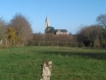
The plateau on which the village of Férel lies is situated at an altitude of 30 to 50 metres above sea level. It overlooks the southern bank of the Vilaine, sometimes quite steeply, and the streams flow along the bottoms of wooded valleys (the Coulées), which are ideal for walks in all seasons.

Details

801770
Creation:
Last update:
Last review:
  • Walking
    Activity: Walking
  • ↔
    Distance: 7.52 mi
  • ◔
    Average duration: 3h 35 
  • ▲
    Difficulty: Moderate

  • ⚐
    Back to start: Yes
  • ↗
    Ascent: + 138 ft
  • ↘
    Descent: - 138 ft

  • ▲
    Highest point: 151 ft
  • ▼
    Lowest point: 10 ft
  • ⚐ Country: France
  • ⚐ City: Férel (56130)
  • ⚑
    Start/End: N 47.47532° / W 2.347522°
  • ❏
    IGN map(s): Ref. 1021SB, 1022ET, 1022OT
  • Hour-by-hour weather

Description of the walk

Park at the sports centre, Rue du Pré de la Dame, Férel.

(S/E) Leave the sports complex via the gate in the fence running alongside the path to the north of the sports grounds. Turn left until you reach the road, then left again, before heading up the path on the right towards Kerrouault.

(1) Turn right to cross the village and take the path running alongside the farm on the left. Continue to Le Guerny and turn right to join the RD34. Cross the road and continue straight ahead. At the next junction, take the path on the right then turn left.

(2) Halfway along the Chemin du Sable, turn left, following theGR®39(red and white markings), through the woodland. When you reach the path with the pink surface (cycle route), turn left and continue along this path until you come to a junction with two roads.

(3) At the second road, first turn left then right, continue straight ahead for 250 metres and turn right. The straight path winds its way into a small valley, which you’ll enter properly after crossing another path, near the hamlet of Trémorel. Head into the Coulée de Kerosten, which leads to the banks of the Vilaine. Once you reach the river, turn right and follow the bank until you reach the next tributary.

(4) At Prédemo, where the Coulée du Bourg stream joins the Vilaine, cross the footbridge and immediately turn right onto the path that runs alongside the river.

(5) In the middle of the Coulée du Bourg, cross to the other bank by turning right, then left 50 metres further on to reach Kerlégan via the left bank. The path was laid out from the banks of the Vilaine, following the track that used to serve the marshy meadow plots – which were more or less covered by the tide – before the Arzal dam was built.

(6) Head back up to the road, below Kerlégan, and turn left then right towards Kerverte. After this hamlet, follow the road for 300 metres and, at the junction, turn left, following the road you have just come along. Leave it after 100 metres by turning right. You will come out onto the RD34; turn left and follow it for 70 metres.

(7) After crossing the RD34, follow the footpath which runs alongside the houses of the Cité de la Noë-Blanche; then, where the path ends, follow the road opposite it. At the next junction, head straight on towards the Férel care home (EHPAD le Florilège). Once past the care home, take the path on the right that leads under the willow trees, then turn left to join the RD315. If the start of the path is flooded, continue along the Route de la Cour des Prés to the RD315, then follow this road up to the Métairies wayside cross. Then follow the original route.

(8) Cross the RD315, take the path opposite the wayside cross, then turn left when you reach the first houses of Les Hautes Métairies. Head back towards the RD315 but turn right just before it onto the path leading to Les Basses Métairies.

(9) In the hamlet, turn right and join the Chemin des Pogasés, which you should follow to the right. Cross the picnic area set up around the pond and continue along the path until you reach the gate leading into the sports complex (S/E).


Waypoints

  1. S/E : mi 0 - alt. 148 ft - Sports centre car park
  2. 1 : mi 0.54 - alt. 148 ft - Kerrouault: turn right, then left
  3. 2 : mi 1.32 - alt. 112 ft - Chemin du Sable
  4. 3 : mi 2.41 - alt. 125 ft - Kergal
  5. 4 : mi 3.61 - alt. 10 ft - Prédemo footbridge
  6. 5 : mi 4.5 - alt. 23 ft - Midway along the Coulée du Bourg
  7. 6 : mi 4.92 - alt. 75 ft - Kerlégan
  8. 7 : mi 5.62 - alt. 118 ft - RD34, the Noë Blanche
  9. 8 : mi 6.46 - alt. 115 ft - Calvaire des Dairy Farms
  10. 9 : mi 6.82 - alt. 115 ft - Basses Dairy Farms
  11. S/E : mi 7.52 - alt. 148 ft - Sports centre car park

Notes

In the village of Férel, all shops and services are available.
Some sections of the path may be damp or even flooded during wet weather. Follow the alternative routes if the main route is impassable.

Worth a visit

The watercourses that follow the riverbeds have retained their name ‘étier’. This stems from their former status as part of the maritime domain, when the lower Vilaine was still subject to the tidal cycle. Since the construction of the Arzal dam in the 1970s, certain parts of the ‘paluds’ (former floodplains along the river) have receded by more than 30 metres, particularly in the section covered by the route, along the banks of the Vilaine.

(4) During periods of high water, this section may be flooded. In this case, take the path leading uphill opposite the footbridge, turn right at the first fork, turn right again when you reach the road that bypasses the village of Drézet, and finally turn right, following theGR®39signposts. At the bottom of the slope, you will rejoin the route you left after the footbridge. Continue along it to the left.

Always be cautious and plan ahead when you're outdoors. Visorando and the author of this route cannot be held responsible for any accidents occurring on this route.

The GR® and PR® markings are the intellectual property of the Fédération Française de Randonnée Pédestre.

Reviews and comments

3.4 / 5
Based on 4 reviews

Reliability of the description
3.3 / 5
Ease of following the route
3.5 / 5
Route interest
3.5 / 5
bbeat
bbeat

Overall rating : 3.7 / 5

Date of your route : Jul 01, 2019
Reliability of the description : ★★★★☆ Good
Ease of following the route : ★★★★☆ Good
Route interest : ★★★☆☆ Average

The first part of the route is rather uninteresting. The walk takes you through fields and woodland. Some sections haven’t been mown (watch out for grass snakes). It’s an easy walk with very little elevation gain. The highlight is reaching the Vilaine at ARZAL, which offers a stunning view.

Machine-translated

pontus
pontus

Overall rating : 4 / 5

Date of your route : May 28, 2019
Reliability of the description : ★★★☆☆ Average
Ease of following the route : ★★★★☆ Good
Route interest : ★★★★★ Very good

I find the instructions for the very start of the walk a bit unclear
Here’s my suggestion:

For the start:
Coming from Ferel by car, you need to turn left to enter the sports complex car park.
The start of the walk follows the path (marked with a Red Cross) branching off to the RIGHT just before the car park entrance, known as the Chemin du Vignot.

The map is accurate, but you mustn’t follow the GR route all the way. There are far too few red markings.
I’m extremely pleased with the Geo Tracker app, which (without draining the battery) lets you know exactly where you are and where you’re going. It’s already saved our lives several times😉.

Machine-translated

jeanluclefebvre
jeanluclefebvre

Overall rating : 4.3 / 5

Date of your route : Mar 20, 2018
Reliability of the description : ★★★★★ Very good
Ease of following the route : ★★★★★ Very good
Route interest : ★★★☆☆ Average

Far too much of the route is through woodland, which is virtually impassable during periods of heavy rain.
It can sometimes be difficult to find your way around the woods, despite the very detailed description.

Machine-translated

philrandovilaine
philrandovilaine

And that’s precisely the appeal of Visorando routes: getting off the beaten track!
PhilRV

Machine-translated

gazok54
gazok54 ★

Thanks, louclaco, but Visorando isn’t a website that distributes guidebooks. These guidebooks, which refer to the signposting, are distributed by tourist information centres.
With Visorando, you often venture off the beaten track and don’t follow the signposts. So, yes, to avoid getting lost, you read the route description and look at the map.

Machine-translated

louclaco
louclaco

Overall rating : 1.7 / 5

Date of your route : Oct 15, 2017
Reliability of the description : ★☆☆☆☆ Very disappointing
Ease of following the route : ★☆☆☆☆ Very disappointing
Route interest : ★★★☆☆ Average

Good evening,
You should always check your route map, as there are no signposts apart from the GR.
Yet we’re used to hiking. It’s a shame, as there are some lovely paths.

Kind regards,

Machine-translated

Other walks in the area

For more walks, use our search engine .

The GPS track and description are the property of this route's author. Please do not copy them without permission.