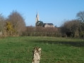
Landieul as seen from Herbignac

When I retired, I chose to settle in Herbignac and discovered that this town has a very long history of producing domestic pottery. A long time ago, it was the Romans who discovered clay of exceptional quality and passed on the techniques for making pots to the local farmers.
Pot-making spread to the villages to the south and west of Herbignac, where the clay deposits were found. The pots were mainly used for storing food. Landieul was the last village to be home to potter-farmers, right up until the 1950s. Tin and plastic eventually saw the better of our good old clay.

Details

n°62722242
Creation:
Last update:
Last review:
  • Walking
    Activity: Walking
  • ↔
    Distance: 6.49 mi
  • ◔
    Average duration: 3h 05 
  • ▲
    Difficulty: Moderate

  • ⚐
    Back to start: Yes
  • ↗
    Ascent: + 131 ft
  • ↘
    Descent: - 115 ft

  • ▲
    Highest point: 115 ft
  • ▼
    Lowest point: 26 ft

Photos

Description of the walk

There are plenty of car parks near Herbignac Town Hall.

(S/E) From the Place de la Mairie, walk round the church on the right, then turn left. Turn right onto Rue de Goreve, cross Rue de Bretagne and you’ll reach the junction with Rue Kerdebleu.

(1) First turn left then right, and continue along Rue de Kernéchal, which joins Rue le Clos Muré; turn left here.

(2) Turn right onto the Vélocéan and, at the next junction, turn left.

(3) Leave the Vélocéan, which branches off to the right, and continue straight ahead along the track to Trégrain Castle.

(4) When you reach the château, turn left, then right, and walk through the village to the road. Follow it to the left and continue along a path until you reach the junction with theGR®39.

(5) Take this to the left, ignore a road on the right and follow the departmental road for about 200 m until you reach a Fork in the road (junction with aPR®).

(6) At the bus shelter, carry on due south along theGR® between two piles of wood, on the edge of the Bois de l’Épine, and pass a ruined house.

(7) Turn right, leaving theGR®39. At the next junction (marked by a cross), turn left and continue to the potters’ village.

(8) After a visit, head back up the tarmac road and make your way to the hamlet of Haut Landieul.

(9) At the crossroads, turn left and continue towards the Croix de Landieul and theGR®39.

(10) Cut across theGR® and carry on straight ahead along the forest track until it ends at a junction.

(11) Turn right, follow the cobbled path then the tarmac road and walk through the village of Kergestin.

(12) At the next junction, take the street opposite towards the school, then the road opposite (no entry for cars). Continue along Rue de la Fontaine, past the secondary school, and carry on along this street until you reach Rue Pasteur.

(13) Turn left onto it towards the cultural centre until you reach the Church of Notre-Dame-la-Blanche. Turn right to return to Place de la Mairie (S/E).

Waypoints

  1. S/E : mi 0 - alt. 52 ft - Herbignac Town Hall Square
  2. 1 : mi 0.39 - alt. 59 ft - Junction with Rue Kerdebleu
  3. 2 : mi 0.89 - alt. 75 ft - T-junction
  4. 3 : mi 1.49 - alt. 92 ft - Straight ahead
  5. 4 : mi 1.75 - alt. 102 ft - Trégrain Castle is on the right.
  6. 5 : mi 2.42 - alt. 112 ft - GR junction
  7. 6 : mi 2.76 - alt. 105 ft - Piles of wood on both sides of the path.
  8. 7 : mi 3.29 - alt. 115 ft - There’s a fork in the road just past a ruined house
  9. 8 : mi 4.07 - alt. 59 ft - A former pottery village.
  10. 9 : mi 4.32 - alt. 115 ft - Haut Landieul hamlet
  11. 10 : mi 4.64 - alt. 98 ft - GR°°®°°39
  12. 11 : mi 5.22 - alt. 59 ft - T-junction
  13. 12 : mi 5.96 - alt. 33 ft - A crossroads of many paths
  14. 13 : mi 6.32 - alt. 59 ft - Rue Pasteur
  15. S/E : mi 6.49 - alt. 52 ft - Herbignac Town Hall Square

Notes

In Landieul, if it rains, take shelter in the bakery.
At the back of the building there is a bread oven. Women gather there once a week to bake their bread and share the latest village news.

Worth a visit

  • In Landieul, to the right of the pottery kilns, ask Laurence to tell you the story of the potters and explain how these top-loading kilns worked.
  • Before you arrive, if it is open, visit the Church of Notre-Dame la Blanche. Dating from the 13th century and renovated in 1779. Don’t miss the four stained-glass windows, featuring three medallions depicting soldiers from the First World War, each bearing their surname, first name and service number.

Always be cautious and plan ahead when you're outdoors. Visorando and the author of this route cannot be held responsible for any accidents occurring on this route.

The GR® and PR® markings are the intellectual property of the Fédération Française de Randonnée Pédestre.

Reviews and comments

4.7 / 5
Based on 1 review

Reliability of the description
5 / 5
Ease of following the route
5 / 5
Route interest
4 / 5
philrandovilaine
philrandovilaine

Overall rating : 4.7 / 5

Date of your route : Sep 04, 2025
Reliability of the description : ★★★★★ Very good
Ease of following the route : ★★★★★ Very good
Route interest : ★★★★☆ Good
Very busy route : No

Between points 3 and 4, the route follows a private road whose use by third parties is often disputed by some local residents. It is possible to bypass the estate by following the Vélocéan route, then returning to Trégrain via the road that leads there. You will then rejoin the route described without fear of being hassled.
Best regards
PhilRV

Machine-translated

Other walks in the area

For more walks, use our search engine .

The GPS track and description are the property of this route's author. Please do not copy them without permission.