Country:
 City:
City:


Start at the Place de la Mairie in Férel
(S/E) Head down Rue de la Coulée, to the left of the town hall. Cross the main road and carry straight on towards Kersauvage.
(1) After passing a thatched cottage on the right-hand side of the track, take the first road on the left. You’ll come to a cycle path characterised by its pinkish sandy surface and its white and green signposting. Follow it through the countryside, crossing the roads to Kerbalan, Trémorel and Kerosten, before reaching the road leading to Le Gastre.
Turn right to reach the village.
(2) On reaching the centre of the village, turn left towards the Rives de Vilaine campsite and continue as far as the last houses in Kercado. A path winds down through the ‘grée’ (a vast, hedgerow-free expanse) overlooking the river basin where the port of Arzal is situated, just upstream of the dam.
Follow this path until you reach a wooded edge, which you follow to the left until you come to the footpath running alongside the Vilaine. Please note that this final section of the path is rough and should be ridden with a hand on the brake, or even dismounting.
(3) A steep slope leads to the footbridge crossing the stream that forms the boundary between the communes of Férel and Camoël. Cross the stream to join the track leading to the harbour jetties, and follow it uphill until you reach the hillock separating the last boats from the Arzal Dam embankment. You’ll need strong calves to climb it!
At the top of the slope, turn left into the upper car park (before the barrier leading to the harbour). A cycle route runs through it and leads to the first houses in Vieille Roche.
(4) Cross the road that runs across the dam to reach the oldest part of Vieille Roche. Take the road that winds its way between the houses, towards the slipway.
(5) It forms a circular route, taking you round the whole village. At the end of the circular route, the view stretches out over the Vilaine and the downstream section of the Arzal Dam, where a few boats are moored.
(5) Once you’ve completed the circular route, turn left to head back towards the main road, and just before you reach it, take the small road on the right which climbs towards Le Lestin and Le Bosseno. This winding, shaded road is well worth a visit. It takes you to the village of Camoël via Kerguen, avoiding the main roads which are particularly unsuitable for cyclists.
Enter the village via Rue des Fontaines, which leads to the foot of Camoël church.
(6) Leave the village of Camoël by taking Rue de la Chapelle, opposite the main entrance to the church. This small road winds its way between tall trees, passing the former presbytery (lodges), then the fountain and the Notre-Dame de la Salette chapel, before reaching the village of La Grée.
Although it remains out of sight, the River Vilaine is just a stone’s throw away, and you can get closer to it by taking one of the two paths at the western end of the village.
Continue along the road to Kerarno.
(7) The village of Kerarno is built around a crossroads; here, take the right-hand road towards Tréhiguier.
Then pass through Camoëlin and go past the “Les Embruns” campsite. At the next junction, turn right again to go round the Tréhudal marshes, then cycle up the hill overlooking Tréhiguier harbour. Carry on until you reach the D192 (coastal road), which is signposted in brown. Turn right to head down towards the harbour.
(8) After a break to soak up the atmosphere of the estuary, get back on your bike and cycle up towards the old lighthouse via Rue du Port. At the bend just past the lighthouse, turn right towards Pointe du Scal. In a wide bend, as you pass a few oyster farms on your right, you’ll come past a megalith hidden on the left-hand side of the road: a large block of white quartz – hence its name, Pierre Blanche – standing on a patch of moorland.
Carry on until you rejoin the road coming from Tréhiguier, just above the Stade du Logo. Turn right and follow the road that runs alongside the stadium, passing the shellfish farms and then the houses of Le Branzais. A pine forest then marks the top of the beach, where you can stop for a break, weather and tide permitting.
As you cross the marshes at the bottom of the village of Pénestin, ignore the two roads branching off to the left – the second of which leads directly to the church – and head up the hillside, veering slightly to the right at the second junction. Further on, the path winds its way between the first houses of the village.
(9) After passing the developing residential area of Lienne and Brambert, the route enters a very narrow passage between the lowest-lying houses in the village of Pénestin, which you have just skirted around. Turn right immediately after emerging from this passage, then follow the coastal road until you reach the centre of Haut Pénestin.
(10) You can’t miss the place, as it’s home to a very welcoming spot. This is the Bateau Livre, a café and bookshop, where you can enjoy a pleasant break… when it’s open!
Walk past the café on the left to take the road leading to Pointe du Halguen. Several paths on the right lead down to the coast, in particular the one leading to Anse de Camaret.
(11) Pointe du Halguen marks the southern boundary of the Vilaine estuary, which closes in on the opposite bank at Pointe de Penlan. To port, towards the open sea, lies the Baie de Vilaine, which forms the backdrop to the walk as you head towards the southern tip of Pénestin, Pointe du Bile.
Continue along the road which follows the coastline slightly inland whilst offering lovely views of the sea. At Le Logui, cross the road leading to the beach and carry on straight ahead towards a housing estate. Turn left before entering it and follow the track until you rejoin the coastal road. Turn right and follow this road until you reach Le Lomer.
(12) The valley leading to Lomer Beach is home to several shellfish farms facing the approach road. Turn left and head up onto the plateau until you reach a roundabout in the countryside. Don’t panic – we’re definitely in Brittany and not in the Cantal, even though the cows you often see in the neighbouring meadows have the horns and coats typical of cattle from those volcanic regions.
After passing the entrance to the car park overlooking Plage de la Source, carry on for about 300 metres before turning right into Allée des Pins. This road runs through the residential area alongside Plage de la Mine d’Or, before leading out at the car park serving the beach.
(13) Whether or not you stop to take a look at the impressive ochre cliff overlooking the beach, you’ll need to get back on your bike to continue towards Poudrantais. To do this, go round the Hôtel l’Ancre d’Or on the right, then turn right at the third junction (coastal road). After passing through another residential area, you’ll reach the Poudrantais sailing centre.
(14) Turn your back on the sea and cycle up the Allée du Bihen towards Kerfalher. Turn right just before the campsite of the same name, onto the Route du Maresclé, and follow it until you reach Loscolo Beach
(15) From Loscolo, the coastal road follows the coastline about a hundred metres inland from the shore, offering stunning views of the Bay of Vilaine and the head of the Bay of Pont Mahé.
At low tide, the area between Pointe du Bile – towards which you are heading – and Pointe de Merquel, on the other side of the water, is covered with a multitude of wooden stakes, known as ‘bouchots’, on which the famous Pénestin mussels are cultivated.
After passing the Îles campsite, turn right to reach Pointe du Bile.
(16) Situated at the southern tip of the Pénestin peninsula, the Pointe du Bile offers a truly exceptional panorama that changes considerably with the tides.
Drive all the way round the headland following the one-way road, then turn right onto the coastal road. After crossing the causeway that encloses the Lesté marshes, the road climbs towards Kerandré. Pass through the village and turn right once you’ve passed the last houses. The road descends into a small valley where a lagoon lies, just behind Palandrin Beach, before reaching Kerséguin. Turn right at the first junction and head towards the centre of the village. Leaving the path leading down to the beach on your right, carry on straight ahead until you reach the D201.
(17) Turn right when you reach the departmental road. Once past the stream marking the departmental boundary, a cycle path has been laid out alongside the road. Follow it until the path widens, then turn right onto the path that runs through the housing estate to the main access point for Pont Mahé Beach. The beach is only about fifty metres away on the right, but at low tide, the water can be much further away!
(18) Retrace your steps until you reach the departmental road again, then turn right. You’ll now come to a section that can be a bit tricky in the summer, as you’ll need to cycle up this road for about 500 metres, taking great care. You’ll come to a cycle path on the opposite side, after the Limarzel road. All you have to do is follow it to the village of Caire. Leave the cycle path and cross the county road again.
(19) Carry on straight ahead. You’ll come to some small roads where cycling is no longer a walk in the park. Pass a road on your right and take the second one. Go round the Étoile de Mer campsite, leaving the Créno horse farm on your right, and cycle through a residential area before reaching the road leading to Pointe de Pen Bé. Follow it to the right.
(20) Pointe de Pen Bé forms the natural boundary of both the strait of the same name and Pont Mahé Bay. A stone’s throw away, Pointe de Merquel is its counterpart on the other side of the Mès, the small coastal river which we’ll follow later on.
Once past the Café de la Marine, turn right to rejoin the coastline 150 metres further on, then turn left to follow it.
The view over Pont Mahé Bay is simply exceptional, particularly at low tide, as the foreshore – which you overlook from a height of about twenty metres – is covered with thousands of mussel beds on which the famous Pénestin mussels are farmed.
Once back at the main road, you can continue round the headland, but you’ll need to dismount, as traffic is travelling in the opposite direction on this stretch of the headland. Ride past a few more oyster farms.
Once back near the Café de la Marine, turn right onto the path that runs beneath the café to rejoin the route you have already taken.
Follow this track until you reach the village of Mesquery.
(21) In Mesquery, ignore the main road branching off to the left and take the small road opposite. This winds its way above the marshes along the banks of the Mès; you can reach the river by turning off this road at any of the tracks leading to the right.
However, you’ll need to return to this road to continue the route, passing through the hamlets of Trologo, Kergéraud and Brésilbérin.
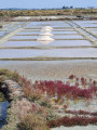
(22) Pass through the village of Kernay and turn immediately right towards Penbuzo. This hamlet opens out onto a landscape of salt marshes, which you’ll discover as you head up towards Pont d’Armes, after turning left.
As you emerge into the centre of Pont d’Armes, turn left and head up the departmental road.
(23) A large village situated above the marshes, Pont d’Armes has retained some traces of its rich salt-making past. Head up the road, carefully following the D33 towards Assérac. Pass the sports complex and reach the village clustered around its church with its squat bell tower. Between Pont d’Armes and Assérac, the road is narrow and may be very busy. So take care when driving along it.
(24) Go round the church on the right (Rue du Four) to find Rue de la Mal-à-Faire, which runs alongside the village cemetery. Pass the junction just beyond the cemetery and continue along the street of the same name, which soon leads out into the countryside.
(25) Leave the Château du Quenet on your right and carry on along the small road until the next junction. Then turn right and head up through the Bois de Monchoix. This heavily wooded stretch is fairly flat and easy to cycle along, and offers views of beautiful woodland, despite some recent clear-cutting.
(26) Before leaving the woods, turn right towards Kermoret and carry on until you reach the crossroads marking the northern boundary of the village.
(27) Turn left at this junction and cycle on to Kerbilet. A short but noticeable climb takes you to the foot of the old mill, which towers above the village houses. Carry on straight ahead to enter a wooded area once more. Let a road branch off to the right, and glide down into the damp valley that marks the departmental boundary.
(28) Make the most of the descent to catch your breath, as a steep climb follows to reach the Férel plateau. But this stretch of road is particularly stunning in autumn or when the sun plays through the foliage.
(29) At the Guernet crossroads (pronounced ‘Gwernet’), the village of Férel is not far away. Take this very flat road and you’ll soon catch sight of the tall bell tower and the nearby Town Hall Square (S/E).

 Visorando Member
 Easy
Easy