Sea, marshes and countryside around Caire

The beach and marshes of Pont Mahé, the Pointe de Pen Bé, the area around the Étang du Pont de Fer and the moors of Monchoix each offer a unique perspective on the landscapes of Asserac. Walking through this agricultural landscape that borders the coast serves as a reminder that the seashore was once a natural environment before urbanisation took over.

Details

1626223
Creation:
Last update:
Last review:
  • Walking
    Activity: Walking
  • ↔
    Distance: 8.82 mi
  • ◔
    Average duration: 4h 10 
  • ▲
    Difficulty: Moderate

  • ⚐
    Back to start: Yes
  • ↗
    Ascent: + 138 ft
  • ↘
    Descent: - 121 ft

  • ▲
    Highest point: 125 ft
  • ▼
    Lowest point: 10 ft

Description of the walk

Park in the car park at Pont Mahé beach, opposite the “Le Domaine de Pont Mahé” campsite.

(S/E) Cross the road (D82) and take the path that runs alongside the campsite on the right, continuing on to Limarzel, passing two small tracks on the left.

(1) When you reach the riding centre, take the path that turns left and heads towards the marshes. Please note that these cannot be crossed in winter, or whenever the water level is higher than the path.
Cross the canal and head up the opposite bank, following the path to the village of Kerarno. Join the road and follow it until you reach the RD83.

(2) Cross this road and take the wide, straight track that leads towards the dark mass of the Monchoix woods. At the bottom of the valley, on the left, lies the very unassuming Étang du Pont de Fer, which is designated a nature reserve. Turn right at the end of the straight stretch, then leave this track after a few metres to take the path on the right, which runs along the edge of the fields. It follows the field margins until it rejoins the RD83.

(3) Just before reaching the road, the path has been laid out to the left through the plots bordering it. Continue along this path, running parallel to the departmental road, before joining it at the junction with the Route de Kerbernard.
Cross the RD83 and turn onto the Kerbernard village road.

(4) At the next right-hand bend, continue along the track that goes straight on and leads to Bel-Air. Pass in front of the farm buildings and carry on straight ahead until you reach the RD82 (picnic area).
Cross this road with care, as there is heavy traffic on fine days, then continue along the path opposite.

(5) At the junction with the Vélocéan cycle route (pink surface), turn right and carry on until you reach a tarmac road (RD282).

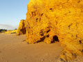
(6) Continue straight ahead, following the road leading towards Le Créno. At the junction after a campsite, turn left, then right 100 metres further on, to reach the Marche aux Bœufs car park. The ramp opposite the road leads down to sea level, to a spot where the ochre cliffs form coves that are completely isolated at high tide.
Head back up to continue the walk.

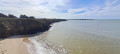
(7) From the car park, take the path heading north and, just before it ends, take the cleared path on the left, between two properties. This marks the start of the coastal path, which quickly reaches the top of the cliff and then follows it to the far end of Pont Mahé Bay. Walkers are treated to beautiful sea views and a lovely, peaceful beach throughout this section.

(8) At the end of the cliffs, head down to the vast Pont Mahé Beach after crossing a stream via a footbridge. Follow the top of the beach for 35 metres, until you reach the first wooded area.

(9) Turn right onto the path that climbs up the dune. It soon turns left and winds its way through the dune system. Follow the signposts to explore this route, along which information is provided about the dune’s significance and conservation. As you go, don’t miss the circular tree by the side of the path: a real oddity.

(10) Near the Moulin de l’Éclis campsite, climb over the fence via the ladder, then head towards the top of the beach, where you’ll find the beach access on your right. Follow this road to join the RD 2 and return to the starting point, the Pont Mahé car park (S/E).

Waypoints

  1. S/E : mi 0 - alt. 16 ft - Pont Mahé car park
  2. 1 : mi 0.45 - alt. 39 ft - Limarzel
  3. 2 : mi 2.01 - alt. 92 ft - The Red Cross
  4. 3 : mi 3.5 - alt. 89 ft - Access point near the RD83
  5. 4 : mi 3.85 - alt. 72 ft - Path around the bend
  6. 5 : mi 4.96 - alt. 66 ft - Junction with Vélocéan
  7. 6 : mi 6.38 - alt. 59 ft - Crossing the D282
  8. 7 : mi 7 - alt. 52 ft - La Marche aux Boeufs
  9. 8 : mi 7.6 - alt. 16 ft - Pont Mahé Beach
  10. 9 : mi 7.82 - alt. 23 ft - L’Éclis
  11. 10 : mi 8.52 - alt. 30 ft - Moulin de l’Éclis Campsite
  12. S/E : mi 8.82 - alt. 16 ft - Pont Mahé car park

Notes

The Pont Mahé marshes are flooded for part of the year. The path running through them is therefore impassable. Before setting off on this circular walk, make sure this section is accessible.

Pont Mahé Beach is very popular in the summer months, thanks to the water temperature at the bottom of the bay (up to 28°). It is also a hotspot for water sports (kitesurfing, windsurfing). Needless to say, it can sometimes be difficult to find a parking space there. To avoid any inconvenience, check the tide timetable. The sea recedes from the bay half the time. Low tide frees up parking spaces.

As is often the case by the seaside, during periods of very high tides, access to the upper part of the beach may be impossible. Here too, it’s essential to check the tide tables.

Worth a visit

The Limarzel equestrian centre has a unique feature: it is a rehabilitation centre for horses. The proximity to the sea allows for a treatment similar to thalassotherapy for humans.

When the sea is out and the wind is blowing, it’s a veritable feast of colours to watch the multitude of floating (and flying) craft gathering in the bay. It’s certainly a sight not to be missed.

Reviews and comments

4.7 / 5
Based on 2 reviews

Reliability of the description
5 / 5
Ease of following the route
4.5 / 5
Route interest
4.5 / 5
Nabru
Nabru

Overall rating : 4.7 / 5

Date of your route : Nov 11, 2024
Reliability of the description : ★★★★★ Very good
Ease of following the route : ★★★★★ Very good
Route interest : ★★★★☆ Good
Very busy route : No

A very pleasant autumn walk; the paths had had time to dry out after the heavy rains in October. There were still two slightly muddy sections between points 3 and 4 (the footpath running alongside the departmental road and near Bel Air Farm), but nothing insurmountable, especially at this time of year. The first part of the route is lovely, with beautiful views of rolling pastures. If possible, it’s best to cross the canal after Limarzel via the signposted hiking trail and avoid the dirt track. A farmer kindly pointed out to us that it was a private road; moreover, one of his cows was in the process of calving and our passing through might have disturbed her. However, he also mentioned that when the grassy track is flooded in winter, he doesn’t mind hikers using it all that much. We’ll bear that in mind… The section between point 5 and point 7, on the other hand, is monotonous and rather uninteresting (a wide cycle path with long, straight stretches), so it’s best to treat it as an unavoidable transition between the wooded area and the coast, nothing more… Fortunately, the route ends on a high note with cliffs, the beach and the woods. Just one correction perhaps: the tree marking the circular path is after point 10 (the first stilt), which will save future walkers from searching in vain for it where it isn’t, as we did… Thank you for suggesting this route to us.

Machine-translated

Phv
Phv

Overall rating : 4.7 / 5

Date of your route : Mar 20, 2021
Reliability of the description : ★★★★★ Very good
Ease of following the route : ★★★★☆ Good
Route interest : ★★★★★ Very good
Very busy route : No

A lovely walk inland; the marshes and wooded countryside are beautiful at this time of year. We encountered a few decametres of muddy path – it’s best not to venture there in late winter when it’s raining.
As for the route, just after the Limarzel marker, follow the yellow markings, which take you away from the main path for 500 metres and run closer to the marsh. Towards the end of the walk, the track through the grey dune – after the l’Eclis marker – is incorrect, but within this protected area the path is very clearly marked; to preserve the environment, it’s impossible to go wrong.
On the sea side, which is a bit short, you can walk along the beach at low tide; the coastal path above is narrow and you come across noisy groups who are shamelessly not wearing masks, but then again, it was a Saturday afternoon. In contrast, in the bocage, you hardly come across anyone. At this time of year, gorse and blackthorn are in bloom – a real feast for the eyes.

Machine-translated

Other walks in the area

For more walks, use our search engine .

The GPS track and description are the property of this route's author. Please do not copy them without permission.