Refine your search for walks in Rullac-Saint-Cirq
Rullac-Saint-Cirq walks


 The Massebaque stream
 Visorando Member
 4.57 mi
 +778 ft
 -768 ft
 2h 45
2h 45
 Easy
Easy
 Departure from La Selve (Aveyron) (Aveyron)
La Selve, a former Templar commandery, is situated on the D902, 10 minutes from Réquista and 40 minutes from Rodez. La Selve is primarily an agricultural community, with sheep farming being particularly well established there.
Around Taurines Castle
 3.21 mi
+679 ft
-686 ft
2h 05
Easy
Departure from Centrès (Aveyron)
3.21 mi
+679 ft
-686 ft
2h 05
Easy
Departure from Centrès (Aveyron)
An easy walk, combining wooded paths and tarmac roads.
A pleasant, shaded route despite the undulating terrain.
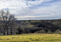
Trémolières: between Cône and Giffou
 5.51 mi
+1,001 ft
-1,014 ft
3h 25
Easy
Departure from Rullac-Saint-Cirq (Aveyron)
5.51 mi
+1,001 ft
-1,014 ft
3h 25
Easy
Departure from Rullac-Saint-Cirq (Aveyron)
A chance to explore the area around Trémolières, a hamlet in the commune of Rullac-Saint-Cirq, situated on a plateau between the Cône and Giffou valleys.
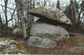
The Céor Meanders from Salmiech
 Tourist office
 6.22 mi
+696 ft
-709 ft
3h 30
Easy
Departure from Salmiech (Aveyron)
6.22 mi
+696 ft
-709 ft
3h 30
Easy
Departure from Salmiech (Aveyron)
Nestled in the Céor valley, a true paradise for fishermen, the village of Salmiech enjoyed a successful revival during the Salt Road era.
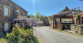
Le Ségala: Castelpers and Roc de Miramont
 6.96 mi
+1,375 ft
-1,378 ft
4h 25
6.96 mi
+1,375 ft
-1,378 ft
4h 25
 Moderate
Departure from Saint-Just-sur-Viaur (Aveyron)
Moderate
Departure from Saint-Just-sur-Viaur (Aveyron)
This walk is situated at the confluence of three valleys and between two picturesque villages, Saint-Just and Castelpers.The site of Castelpers is an ancient fortified settlement, mentioned in the Book of Miracles of Sainte-Foy de Conques. It has become a very popular destination. Of this former seigneury and barony belonging to the Castelpers family (13th to 17th centuries), all that remains on the rock is the pre-Romanesque chapel known as Notre-Dame du Roc.This small sanctuary overlooks the Giffou Gorges from a height of 150 metres and houses a statue of the Virgin Mary crushing three black snakes.The Chapel of Saint-Jean de Castelpers (2 km away), nestled amidst the woods, was originally a small abbey which became a flourishing priory until the end of the Crusades.
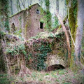
Circular walk starting from Lédas-et-Penthiès
 4.13 mi
+318 ft
-328 ft
2h 10
Easy
Departure from Lédas-et-Penthiès (Tarn)
4.13 mi
+318 ft
-328 ft
2h 10
Easy
Departure from Lédas-et-Penthiès (Tarn)
Discover the village of Lédas-et-Penthiès by following the “Randonnée Paysanne”, which will take you from the village to the Cérou valley, home to the ruins of the Moulin de Penthiès.
(October 2024: installation of around forty signposts (featuring a millwheel symbol) to guide you along the circular route – update to the route by removing a section of road)
From Durenque to the summit of Lagast
8.71 mi
+1,073 ft
-1,079 ft
4h 55
Moderate
Departure from Durenque (Aveyron)
A walk on the border between Ségala and Lévézou, passing through the beautiful Lagast forest and up to the summit of Lagast.
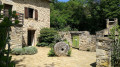
The Moulin de Roupeyrac
 6.98 mi
+866 ft
-873 ft
4h 00
Moderate
Departure from Durenque (Aveyron)
6.98 mi
+866 ft
-873 ft
4h 00
Moderate
Departure from Durenque (Aveyron)
A walk that follows, for the most part, the Roupeyrac beech forest and offers beautiful views over the Lévézou.
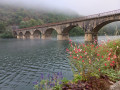
From the Ségala plateau to the Tarn valley
 9.12 mi
+1,637 ft
-1,627 ft
5h 35
Moderate
Departure from Réquista (Aveyron)
9.12 mi
+1,637 ft
-1,627 ft
5h 35
Moderate
Departure from Réquista (Aveyron)
From Réquista, situated to the south of the Ségala plateau, to Lincou, on the banks of the Tarn.
Numerous viewpoints overlooking the Tarn valley and the Réquista countryside, a land of livestock farming, particularly the Lacaune sheep, whose milk is used to make Roquefort.
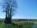
Nauze Valley
 7.01 mi
+1,079 ft
-1,099 ft
4h 10
Moderate
Departure from Camboulazet (Aveyron)
7.01 mi
+1,079 ft
-1,099 ft
4h 10
Moderate
Departure from Camboulazet (Aveyron)
Partly forest walk down into the Nauze and Viaur valley where the Versailles site is located: a little paradise by the stream, ideal for a picnic, a spot of fishing or simply a break.
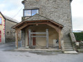
The Moulin de la Gineste
 2.50 mi
+312 ft
-318 ft
1h 25
Easy
Departure from Arvieu (Aveyron)
2.50 mi
+312 ft
-318 ft
1h 25
Easy
Departure from Arvieu (Aveyron)
A short, idyllic circular route through the cultivated, wooded and lush countryside of Lévézou.
The Old Tanus Route
 4.38 mi
+486 ft
-512 ft
2h 25
Easy
Departure from Tanus (Tarn)
4.38 mi
+486 ft
-512 ft
2h 25
Easy
Departure from Tanus (Tarn)
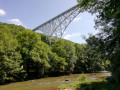
This easy midday walk is best undertaken in hot or very hot weather. Indeed, it takes place entirely in the woodland and along the Viaur, and almost entirely on signposted paths. However, it is not a circular route; nevertheless, the view over the Viaur is very pleasant and, above all, it is very comfortable there, sheltered from the heat. This path is little used. It is situated on the Chemin des Planques.
From Tanus to Las Planques
 9.86 mi
+1,759 ft
-1,759 ft
6h 05
Moderate
Departure from Tanus (Tarn)
9.86 mi
+1,759 ft
-1,759 ft
6h 05
Moderate
Departure from Tanus (Tarn)
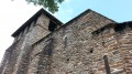
The Las Planques chapel is a remarkable example of southern Romanesque art.It is nestled on a rocky promontory in the middle of the woods and majestically overlooks the Viaur Gorges.This long circular route is less difficult to access than the one from Pampelonne (published on Visorando).Although classified as moderately difficult, you will need to be reasonably fit to cover the distance and negotiate the rollercoaster terrain of the Viaur.
PLEASE NOTE: Following the flooding of the Viaur, as of 20 February 2026, the trail is inaccessible between the Viaduct and the Tanus Bridge, and most likely for the section leading to the Las Planques footbridge.
Naucelle–Sauveterre-de-Rouergue circular loop
10.62 mi
+1,614 ft
-1,601 ft
6h 15
Moderate
Departure from Naucelle (Aveyron)
This circular route, which constantly goes up and down, follows mostly narrow paths through the woodland alongside a stream; it may therefore prove difficult, or even impassable, in wet weather.
It is well signposted in yellow in the first section, but once you’ve left Sauveterre, there are no signposts, so you’ll need to follow the route description carefully.
Discover the Chapel of Las Planques
 4.52 mi
+958 ft
-958 ft
2h 55
Moderate
Departure from Tanus (Tarn)
4.52 mi
+958 ft
-958 ft
2h 55
Moderate
Departure from Tanus (Tarn)
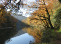
A shortened circular route to explore the Chapel of Las Planques, nestled in the woods. Although short, this route requires some effort to tackle the numerous ascents and descents that follow one another in succession.
Las Planques, Short Version
 5.06 mi
+1,309 ft
-1,309 ft
3h 30
Moderate
Departure from Tanus (Tarn)
5.06 mi
+1,309 ft
-1,309 ft
3h 30
Moderate
Departure from Tanus (Tarn)
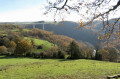
A beautiful, small but challenging unpaved circuit for a half-day of physical exertion.
Although classified as moderately difficult, you will need to be reasonably fit to tackle the rollercoaster ride of the Viaur.
Woods, water, views and old stones are here for your viewing pleasure.
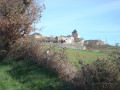
Circular walk starting from Lavabre, in the commune of Connac
 5.91 mi
+1,191 ft
-1,161 ft
3h 45
Moderate
Departure from Connac (Aveyron)
5.91 mi
+1,191 ft
-1,161 ft
3h 45
Moderate
Departure from Connac (Aveyron)
A former vineyard belonging to Vabres Abbey, the site of a major battle against the Norman invaders in 864,
you start this walk in the hamlet of Lavabre, where an old Templar barn still stands.
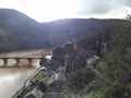
The banks of the Tarn, my way, starting from Lincou
 9.39 mi
+1,535 ft
-1,529 ft
5h 40
Moderate
Departure from Réquista (Aveyron)
9.39 mi
+1,535 ft
-1,529 ft
5h 40
Moderate
Departure from Réquista (Aveyron)
Beautiful views over the Tarn valley and charming villages: Lincou, Connac, Lavabre.
The last three kilometres are a very pleasant stroll along the Tarn. Beautiful stone crosses all along the route. Yellow markings on certain sections of the path.
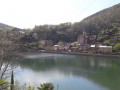
From Lincou to Brousse-Le-Château, following the river...
 8.02 mi
+331 ft
-322 ft
4h 00
Moderate
Departure from Réquista (Aveyron)
8.02 mi
+331 ft
-322 ft
4h 00
Moderate
Departure from Réquista (Aveyron)
A very pleasant stroll, there and back along the banks of the River Tarn, connecting two charming villages: Lincou and Brousse-le-Château. The latter is listed among the "Most Beautiful Villages of France".
Around Magrin – views of the Viaur valley and the wind turbines
3.52 mi
+184 ft
-197 ft
1h 45
Easy
Departure from Calmont (Aveyron)
A circular walk passing through the village of Magrin. The final section of the walk offers a lovely view of the Viaur valley and the wind turbines.
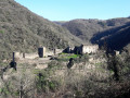
Saint-Igest trail in the Tarn valley
 6.47 mi
+1,421 ft
-1,437 ft
4h 15
Moderate
Departure from Montclar (Aveyron) (Aveyron)
6.47 mi
+1,421 ft
-1,437 ft
4h 15
Moderate
Departure from Montclar (Aveyron) (Aveyron)
Overhanging path offering magnificent views of the Tarn valley, Brousse-le-Château and the Lévézou.
Yellow markings along the entire route.
From Combradet to Frayssines
 4.88 mi
+951 ft
-968 ft
3h 05
Easy
Departure from Réquista (Aveyron)
4.88 mi
+951 ft
-968 ft
3h 05
Easy
Departure from Réquista (Aveyron)
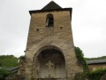
Two small villages nestled on the slopes of the Tarn, amidst magnificent and peaceful countryside. The River Tarn winds its way through the valley, and the paths lined with low dry-stone walls that once linked the two villages are steeped in history.
From the basilica to the oratory at Ceignac
 2.50 mi
+344 ft
-367 ft
1h 25
Easy
Departure from Calmont (Aveyron)
2.50 mi
+344 ft
-367 ft
1h 25
Easy
Departure from Calmont (Aveyron)
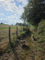
A walk to enjoy on your own or with the family. Lots of tree-lined paths, some of which are narrow. Starting from the Basilica of Notre-Dame de Ceignac, the route follows small streams before becoming circular and returning to the start, passing in front of the oratory.
Combradet Trail
 5.81 mi
+1,102 ft
-1,089 ft
3h 40
Moderate
Departure from Réquista (Aveyron)
5.81 mi
+1,102 ft
-1,089 ft
3h 40
Moderate
Departure from Réquista (Aveyron)
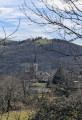
Combradet, a hamlet in the commune of Réquista, is built on a ridge overlooking the La Croux Dam on the River Tarn.This circular walk offers numerous views of the Tarn valley.
Exploring the Ségala on foot: The Lakes Trail
 6.29 mi
+614 ft
-614 ft
3h 25
Moderate
Departure from Baraqueville (Aveyron)
6.29 mi
+614 ft
-614 ft
3h 25
Moderate
Departure from Baraqueville (Aveyron)
This is the land of white water and a thousand springs that feed numerous streams and small lakes further downstream. A short detour at the town’s main crossroads allows you to see three spires: since 1997, they have stood at the centre of the crossroads where Baraqueville was founded, clearly marking the place the town intends to retain at the heart of the Ségala, that of the main hub for events and interaction. The three spikes symbolise the Ségala’s past and give way between them to the three roads of the crossroads, which, when viewed from above, form the spokes of a turning wheel.