From Combradet to Frayssines

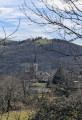
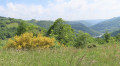
Two small villages nestled on the slopes of the Tarn, amidst magnificent and peaceful countryside. The River Tarn winds its way through the valley, and the paths lined with low dry-stone walls that once linked the two villages are steeped in history.

Details

1108309
Creation:
Last update:
Last review:
  • Walking
    Activity: Walking
  • ↔
    Distance: 4.88 mi
  • ◔
    Average duration: 3h 05 
  • ▲
    Difficulty: Easy

  • ⚐
    Back to start: Yes
  • ↗
    Ascent: + 951 ft
  • ↘
    Descent: - 968 ft

  • ▲
    Highest point: 1,358 ft
  • ▼
    Lowest point: 988 ft

Photos

Description of the walk

Walk through the small village of Combradet and turn right towards La Rivaldié. Park on a lay-by next to the cross.

Yellow and green signposts.

(S/E) Retrace your steps back to the village, leave the small road on your right and turn right at the second junction.

(1) Carry on straight ahead and, after the last house, the path winds its way through the woodland.

(2) Just before you reach a ‘tipi’ camp, turn left, crossing the small stream, and follow the winding path up through the forest to the houses at Flamarenq.

(3) Walk through the hamlet and follow the grassy path to the left, which crosses another stream.

(4) After passing the second hut, ignore the path straight ahead and follow the one that descends to the left towards La Valette, continuing past this hamlet.

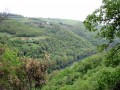
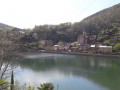
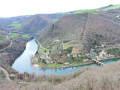
(5) Leave the road and follow the path to the right, which follows the meandering course of the Tarn below. There are lovely views over the valley as you reach Frayssines.

(6) The return journey follows the same path in the opposite direction back to the starting car park (S/E).

Waypoints

  1. S/E : mi 0 - alt. 1,152 ft - Car park on the hard shoulder near La Rivaldié
  2. 1 : mi 0.16 - alt. 1,122 ft - At the second crossroads, turn right
  3. 2 : mi 0.5 - alt. 997 ft - Crossing the stream
  4. 3 : mi 0.93 - alt. 1,348 ft - The hamlet of Flamarenq
  5. 4 : mi 1.51 - alt. 1,115 ft - Turn left towards La Valette
  6. 5 : mi 1.73 - alt. 1,024 ft - Take the path on the right as you leave the road - Tarn (rivère)
  7. 6 : mi 2.42 - alt. 1,230 ft - Frayssines
  8. S/E : mi 4.88 - alt. 1,152 ft - Car park on the hard shoulder near La Rivaldié

Notes

Sturdy footwear and walking poles may be useful for the climb through the woodland.

Worth a visit

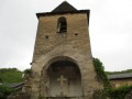
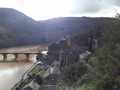
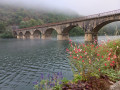
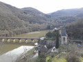
Combradet: the hamlet is built on a ridge overlooking the Croux dam, with numerous views over the valley.
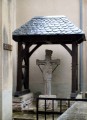
In Frayssines, there are two beautiful 16th-century carved stone crosses.
To visit the church, you’ll need to ask for the key at the house opposite.

Reviews and comments

3.9 / 5
Based on 3 reviews

Reliability of the description
4 / 5
Ease of following the route
4 / 5
Route interest
3.7 / 5
User 27031919
• Edited:

Overall rating : 3.5 / 5

Date of your route : Aug 11, 2025
Reliability of the description : ★★★☆☆ Average
Ease of following the route : Not used / Not applicable
Route interest : ★★★★☆ Good
Very busy route : No

The circuit is not well maintained for 1.5 km at the exit of Combradet
There are no signposts either

Machine-translated

Christian 12170
Christian 12170
• Edited:

Overall rating : 3 / 5

Date of your route : Feb 18, 2024
Reliability of the description : ★★★★☆ Good
Ease of following the route : ★★★☆☆ Average
Route interest : ★★☆☆☆ Disappointing
Very busy route : No

A route through the woods that’s not particularly interesting, apart from a few lovely views as you approach Frayssines

Machine-translated

BOUZAT
BOUZAT

Overall rating : 5 / 5

Date of your route : Feb 02, 2019
Reliability of the description : ★★★★★ Very good
Ease of following the route : ★★★★★ Very good
Route interest : ★★★★★ Very good

Hello, here’s my question: is there a footpath leading from Combradet to the Lacrous dam?
Thank you for your reply
Daniel BOUZAT.

Machine-translated

Other walks in the area

For more walks, use our search engine .

The GPS track and description are the property of this route's author. Please do not copy them without permission.