The Moulin de la Gineste

A short, idyllic circular route through the cultivated, wooded and lush countryside of Lévézou.

Details

4368634
Creation:
Last update:
Last review:
  • Walking
    Activity: Walking
  • ↔
    Distance: 2.50 mi
  • ◔
    Average duration: 1h 25 
  • ▲
    Difficulty: Easy

  • ⚐
    Back to start: Yes
  • ↗
    Ascent: + 312 ft
  • ↘
    Descent: - 318 ft

  • ▲
    Highest point: 2,415 ft
  • ▼
    Lowest point: 2,077 ft

Photos

Description of the walk

Car park on the village square in Caplongue, opposite the café.

(S/E) Follow the road towards Arvieu/La Calmette for 500 m. Pass the cemetery.

(1) At the cross, turn left onto the small road leading to La Gineste. After 250 m, immediately after the first house, turn sharply left (90°) onto a stony track which continues as a sunken track and joins a wide dirt track coming from the village. Continue downhill to the right and then to the left until you reach the Moulin de la Gineste and the small access road leading to Ventajou.

(2) Take a sharp right-hand bend onto the small road, passing the pretty stream known as the Céor. After 400 metres, turn left onto a wide gravel track. Descend once more to the Céor and cross it. Then head back uphill for 250 metres.

(3) At the bend, turn left, going round a disused barn along a level dirt track for 400 m. You are now on theGRP® (red and yellow markings). Further on, turn right onto a grassy path lined with hedgerows, which curves slightly to the right and then to the left, to rejoin the Route de la Gineste.

(4) Follow the road to the right for 150 m and, at the wayside shrine, continue to the left for 100 m towards Caplongue. Then turn 90° to the left onto a dirt track leading uphill towards the village.

(5) At the next junction, turn right and follow the street to return to your car park on the village square (S/E).

Waypoints

  1. S/E : mi 0 - alt. 2,388 ft - Village square
  2. 1 : mi 0.14 - alt. 2,408 ft - Cross
  3. 2 : mi 0.7 - alt. 2,139 ft - Route. Towards the - Céor (rivière)
  4. 3 : mi 1.48 - alt. 2,152 ft - Old barn
  5. 4 : mi 2.02 - alt. 2,175 ft - Route de la Gineste
  6. 5 : mi 2.36 - alt. 2,326 ft - Crossroads
  7. S/E : mi 2.5 - alt. 2,388 ft - Village square.

Worth a visit

Nearby, on certain weekdays during the high season, you can enjoy a meal at the La Calmette farmhouse inn, just before the village of Caplongue. Traditional local cuisine. Information and bookings: 06 24 24 03 83.

Reviews and comments

4.2 / 5
Based on 3 reviews

Reliability of the description
4.7 / 5
Ease of following the route
4.7 / 5
Route interest
3.3 / 5
vincent agnes
vincent agnes

Overall rating : 3.7 / 5

Date of your route : May 27, 2024
Reliability of the description : ★★★★☆ Good
Ease of following the route : ★★★★☆ Good
Route interest : ★★★☆☆ Average
Very busy route : No

We did this route in the middle of the afternoon after it had rained.
We chose it because it was close to our holiday let and the elevation gain was advertised as low, but
by the end of the route, the elevation gain was 350 metres rather than the expected 170…
For members of the group aged over 80, this difference is significant

Machine-translated

hilaire.vachon
hilaire.vachon

Overall rating : 4.7 / 5

Date of your route : Jul 10, 2023
Reliability of the description : ★★★★★ Very good
Ease of following the route : ★★★★★ Very good
Route interest : ★★★★☆ Good
Very busy route : No

A short, pleasant walk

Machine-translated

mouche12
mouche12

Overall rating : 4.3 / 5

Date of your route : Sep 11, 2021
Reliability of the description : ★★★★★ Very good
Ease of following the route : ★★★★★ Very good
Route interest : ★★★☆☆ Average
Very busy route : No

Nothing to report on the route.
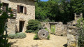
Except that the “Gineste mill” isn’t (any longer?) a mill. I was a bit disappointed by that.

Machine-translated

Other walks in the area

For more walks, use our search engine .

The GPS track and description are the property of this route's author. Please do not copy them without permission.