From the Ségala plateau to the Tarn valley

From Réquista, situated to the south of the Ségala plateau, to Lincou, on the banks of the Tarn.
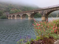
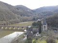
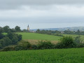
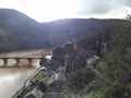
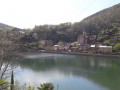
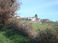
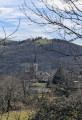
Numerous viewpoints overlooking the Tarn valley and the Réquista countryside, a land of livestock farming, particularly the Lacaune sheep, whose milk is used to make Roquefort.

Details

30303122
Creation:
Last update:
Last review:
  • Walking
    Activity: Walking
  • ↔
    Distance: 9.12 mi
  • ◔
    Average duration: 5h 35 
  • ▲
    Difficulty: Moderate

  • ⚐
    Back to start: Yes
  • ↗
    Ascent: + 1,637 ft
  • ↘
    Descent: - 1,627 ft

  • ▲
    Highest point: 1,926 ft
  • ▼
    Lowest point: 758 ft

Photos

Description of the walk

Car park: Rue du Sergent Goulesque or Place Abbé Bessou, just below the multi-disciplinary health centre.
The walk is fully signposted in yellow (Short Walk).

(S/E) Leave the car park, walk past the health centre, turn left onto Avenue Vallée du Tarn, then right in front of the church. Opposite, take Boulevard du Docteur Cluzel until you reach the left-hand bend.

(1) At the bend, leave the boulevard and head opposite onto Chemin de Sermet; atthe first bend on the right, enter the field opposite. Walk alongside the hedge, keep to the left, then turn left onto a path leading to Boa.

(2) Turn right and follow the road, which becomes a track. After walking alongside fields, head down into a fir forest and, after several hairpin bends, you’ll reach the Ruisseau de Raujet.

(3) Do not cross it, but follow it to the left. After a few hundred metres, the path climbs to the left, moving away from the stream, and, continuing uphill, passes under the high-voltage power line several times before reaching a junction (not far from a pylon).

(4) At the junction, turn right and descend via several hairpin bends to La Devèze.

(5) Walk through the hamlet, turning first left then right, and follow the small road to a crossroads near the stream.

(6) Turn left towards Le Clot. Cross the small bridge and head up a wide, vehicle-accessible track heading south to reach the four-way junction (see Practical Information).

(7) Take thefirst path on the right for about a hundred metres, then turn right again onto a downhill track which becomes steep (remnants of paved slanting streets). Walk down to the Ruisseau de Jauret (cross), then reach the D200 road.

(8) Turn right onto it, cross the road (take care), turn left then right to climb up to the wayside shrine. There is a picnic table and a magnificent view.

(9) Descend from the calvary slightly to the left (cross on a wall), then turn right and take the steps leading to the church forecourt. Go downhill, cross the bridge and head towards the ‘Galerie du Manoir’ (museum). Turn left and walk uphill to the D902.

(10) Cross the road and, turning right then left, head up towards the cemetery (view of the Lincou bridge). After the cemetery, at the last house, the road becomes a track. Head up to Mas Falipot (numerous views of Lincou and the Tarn).

(11) Above the sheepfold (cross), turn left onto a track that climbs through the woodland and then crosses fields (lovely views) to a pine forest. Continue to the junction with a small road at Combelongue.

(12) Carry on straight ahead along the small road, heading north-west. It joins the D344; turn right onto it for a few metres, towards a junction, and cross (take care).

(13) Turn left towards Saint-Julien. At the T-junction, turn right, heading due north, and head for the village.

(14) At the junction, turn left, go through the hamlet and turn right to rejoin the D344 at the entrance to Réquista. Follow it to the left until you reach Réquista. At the roundabout, continue straight ahead onto Rue du Sergent Goulesque and head for the car park (S/E).


Waypoints

  1. S/E : mi 0 - alt. 1,837 ft - Place Abbé Bessou - Église Saint-Pierre (Réquista)
  2. 1 : mi 0.23 - alt. 1,844 ft - Sermet Path
  3. 2 : mi 0.66 - alt. 1,919 ft - Boa; turn right
  4. 3 : mi 1.77 - alt. 1,490 ft - Raujet stream. Do not cross it.
  5. 4 : mi 3.03 - alt. 1,611 ft - Crossroads (near a pylon)
  6. 5 : mi 3.65 - alt. 1,184 ft - La Devèze
  7. 6 : mi 3.96 - alt. 1,014 ft - Crossroads – Towards Le Clot.
  8. 7 : mi 4.31 - alt. 1,191 ft - Crossroads
  9. 8 : mi 4.83 - alt. 833 ft - The D200 road, running alongside the - Tarn (rivère)
  10. 9 : mi 4.94 - alt. 873 ft - Calvaire – Picnic table and viewpoint - Église Saint-Saturnin (Lincou)
  11. 10 : mi 5.06 - alt. 791 ft - D902 - Point de vue sur Lincou et la rivière Tarn, aménagé sur un promontoire rocheux
  12. 11 : mi 6.22 - alt. 1,480 ft - Junction – Mas Falipot
  13. 12 : mi 7.49 - alt. 1,900 ft - Combelongue – Narrow road
  14. 13 : mi 8.11 - alt. 1,841 ft - D344 – Towards Saint-Julien
  15. 14 : mi 8.41 - alt. 1,824 ft - Saint-Julien – Crossroads - Chapelle Saint-Julien (Requista)
  16. S/E : mi 9.12 - alt. 1,837 ft - Place Abbé Bessou - Église Saint-Pierre (Réquista)

Notes

(7) The actual terrain does not always correspond to the map. For example, the track upstream of (7) does not exist. Please follow the directions provided in the description carefully.

- Picnic table and viewpoint at the Lincou Calvary (9)
- Toilets and drinking water point at the bottom of the hamlet of Lincou

Worth a visit

(S/E) Réquista:
- Sheep market every Monday (the country’s leading sheep market),
- Société pour la fabrication du Roquefort dairy (not open to visitors)
- Bronze statue of a ewe and her lamb (in front of the town hall)
- Trompe-l’œil mural (in the village, Avenue de Millau)

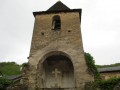
(14) Saint-Julien: Romanesque chapel.

(9) Lincou:
- Very old village overlooking the River Tarn with cobbled streets,
- Gothic church,
- Art gallery and museum at the Manoir de Lincou.

Reviews and comments

4.8 / 5
Based on 3 reviews

Reliability of the description
5 / 5
Ease of following the route
5 / 5
Route interest
4.3 / 5
pyrene12
pyrene12

Thank you for your very positive comment.
There are plenty more lovely walks to discover on my page.
Wishing you some lovely walks!
Pyrene12

Machine-translated

User 14745195

Overall rating : 4.7 / 5

Date of your route : Jul 13, 2026
Reliability of the description : ★★★★★ Very good
Ease of following the route : ★★★★★ Very good
Route interest : ★★★★☆ Good
Very busy route : No

The route took 3 hours 30 minutes at a brisk pace. The signposting is very clear, so there’s no risk of getting lost 🙂 The first half of the circular route is very shaded, whilst the second half (the climb up towards Réquista) is more exposed, so it’s best to set off early in the morning.

Machine-translated

pyrene12
pyrene12

Hello Maiko
Thank you for your comment.
I’m delighted that you’ve discovered and enjoyed this lovely walk.
If you’d like to go on more walks around the Réquistanais or the Tarn Valley, do have a look at the other walks I’ve posted. Just click on my profile to visit my page.
Happy hiking!
Marie-Clotilde (I’ve been called Maiko for a long time...)

Machine-translated

Maiko
Maiko

Overall rating : 5 / 5

Date of your route : May 05, 2024
Reliability of the description : ★★★★★ Very good
Ease of following the route : ★★★★★ Very good
Route interest : ★★★★★ Very good
Very busy route : Yes

A lovely walk, well signposted in yellow. Beautiful paths along the water’s edge. The pretty village of Lincou, where we had our picnic.
Stunning views over the village of Lincou, as well as over the River Tarn and the Requistan countryside.
I’d recommend this hike through the countryside, which is of moderate difficulty.
Eliane

Machine-translated

pyrene12
pyrene12

Hello La Miche,
Thank you for your comment.
I’m delighted that you’ve discovered and enjoyed this lovely walk.
If you’d like to go on more walks around the Réquistanais or the Tarn Valley, do have a look at the other walks I’ve posted. Just click on my profile to visit my page.
Enjoy your walks!

Machine-translated

La Miche
La Miche

Overall rating : 4.7 / 5

Date of your route : Feb 16, 2023
Reliability of the description : ★★★★★ Very good
Ease of following the route : ★★★★★ Very good
Route interest : ★★★★☆ Good
Very busy route : No

A superb walk, completed in line with the forecast, with a quarter-hour break halfway through. No significant difficulties along the route. Very clearly visible yellow markings. The lovely little village of Lincou on the banks of the Tarn. Well worth a visit...
On the way back, we spotted some roe deer at the edge of the woods.
Well worth a visit....

Machine-translated

Other walks in the area

For more walks, use our search engine .

The GPS track and description are the property of this route's author. Please do not copy them without permission.