Saint-Dalmazy from Brasc

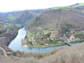
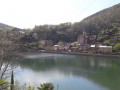
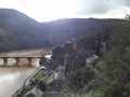
From the village of Brasc on the plateau (at an altitude of around 600 m) to the banks of the Tarn, with numerous viewpoints overlooking the river, the villages and the southern slope of the Tarn valley.
The direction has been reversed compared with a previous publication so that the steepest section is on the descent, making the walk easier.

Details

n°31898183
Creation:
Last update:
Last review:
  • Walking
    Activity: Walking
  • ↔
    Distance: 6.09 mi
  • ◔
    Average duration: 4h 00 
  • ▲
    Difficulty: Moderate

  • ⚐
    Back to start: Yes
  • ↗
    Ascent: + 1,424 ft
  • ↘
    Descent: - 1,427 ft

  • ▲
    Highest point: 2,021 ft
  • ▼
    Lowest point: 761 ft

Photos

Description of the walk

Car park: park in Brasc, on the Place de l’Église (toilets and drinking fountain).

(S/E) Leave the square by turning right onto the D552, heading towards Montclar for approximately 500 m.

(1) Take the road on the left, towards Senils. Pass through the hamlet and continue, veering slightly to the right, along the wide farm track.
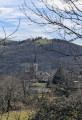
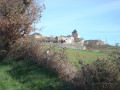
Enjoy a sweeping view over the northern slope of the Tarn valley: from Réquista, L’Hôpital-Bellegarde and Connac as far as the Bouloc telecommunications mast.
After crossing the plateau (farmland), the path enters the forest and begins the descent towards the Tarn, winding its way down in numerous hairpin bends (follow the signposts carefully). You’ll arrive at La Borie de Cazalou at the crossroads of five paths.

(2) Take the path that descends, veering slightly to the left (follow the signposts carefully). You’ll reach Saint-Dalmazi. Note the information board about the chapel.

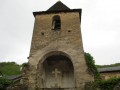
(3) Take a short round trip to visit the chapel (9th century): head right along the D902, cross the bridge over the stream coming from the Ravin de Senils, then turn left towards the chapel (the key is available from Brasc Town Hall, situated near the church, by the porch, very close to the start). Return to the junction.

(3) Continue along the D902 (westwards) for approximately 300 metres.

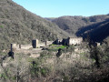
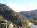
(4) Take the small road leading uphill to the left and follow it to Le Roc and then to Le Guiraldou. After this last hamlet, the road becomes a track and winds its way uphill through the forest in a series of hairpin bends. Reach the rocky outcrop (currently being developed and made safe): a magnificent view over Lincou and the Tarn Valley.

(5) Continue along the path for 200 m, paying close attention to the signposts.

(6) Leave the track and take a small path leading down to the right through the trees for 100 m.

(7) Join a track again and follow it to the right until you reach a junction of tracks.

(8) Take the track on the left. Head uphill along this very beautiful path (an old route that locals used to walk between Brasc and Réquista).

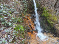
(9) Note the spring, which is probably ferruginous (iron oxide). Continue along this path until you reach the road.

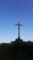
(10) Follow it to the left for 100 metres until you reach a junction. Take the road on the left (note the beautiful cross and the picnic tables). You’ll arrive in Brasc; walk past the cemetery and continue (note the cross known as the ‘square cross’ and the information board about the village’s various crosses).
At the end of Rue du Cimetière, turn left towards the church square and the car park (S/E).

Waypoints

  1. S/E : mi 0 - alt. 1,939 ft - Town Hall. Place de l' - Église Saint-Jean (Brasc)
  2. 1 : mi 0.28 - alt. 1,942 ft - Junction with the Senils road
  3. 2 : mi 2 - alt. 1,283 ft - Crossroads of five paths
  4. 3 : mi 2.57 - alt. 781 ft - St Dalmazy: Turn right on the return journey towards the chapel
  5. 4 : mi 2.96 - alt. 774 ft - A small road leading uphill to the left towards Le Guir - Tarn (rivère)
  6. 5 : mi 3.99 - alt. 1,499 ft - Viewpoint
  7. 6 : mi 4.1 - alt. 1,542 ft - Path leading down to the right
  8. 7 : mi 4.18 - alt. 1,467 ft - Track, on the right
  9. 8 : mi 4.32 - alt. 1,335 ft - Path on the left
  10. 9 : mi 5.08 - alt. 1,670 ft - Source likely to be ferruginous (iron oxide)
  11. 10 : mi 5.69 - alt. 1,867 ft - Road, on the left
  12. S/E : mi 6.09 - alt. 1,939 ft - Town Hall. Place de l’ - Église Saint-Jean (Brasc)

Notes

- Brasc Church Square: toilets and drinking water point.
- The entire route is signposted in yellow (PR®: Promenade et Randonnée).

Worth a visit

- There are numerous stone crosses along this route, particularly to the north-east of the Place de l’Église; note the very beautiful Croix de la Tourelle, the base of which is adorned with severed heads.
- Saint-Dalmas Chapel in Saint-Dalmazy (key available from Brasc Town Hall).

After the walk, head to Montclar (7 km) and climb to the top of the viewpoint (99 steps) to enjoy the magnificent and breathtaking view (orientation board).
https://www.youtube.com/watch?v=ohsv8sl9...

Always be cautious and plan ahead when you're outdoors. Visorando and the author of this route cannot be held responsible for any accidents occurring on this route.

The GR® and PR® markings are the intellectual property of the Fédération Française de Randonnée Pédestre.

Reviews and comments

4.2 / 5
Based on 2 reviews

Reliability of the description
4.5 / 5
Ease of following the route
4 / 5
Route interest
4 / 5
Sarra
Sarra

Overall rating : 4 / 5

Date of your route : Sep 09, 2025
Reliability of the description : ★★★★☆ Good
Ease of following the route : ★★★★☆ Good
Route interest : ★★★★☆ Good
Very busy route : No

I knew the route but in the other direction, starting from Saint Dalmazy. So I didn't have any difficulties. It's less tiring starting from Saint Dalmazy because you begin with the climb and finish with the descent
It took us three hours

Machine-translated

Jean-Luc Walker
Jean-Luc Walker

Overall rating : 4.3 / 5

Date of your route : Sep 03, 2023
Reliability of the description : ★★★★★ Very good
Ease of following the route : ★★★★☆ Good
Route interest : ★★★★☆ Good
Very busy route : No

A slightly challenging hike (with some elevation changes) but quite enjoyable. A great way to get out into nature for walkers who don’t have too much time.

Machine-translated

Other walks in the area

For more walks, use our search engine .

The GPS track and description are the property of this route's author. Please do not copy them without permission.